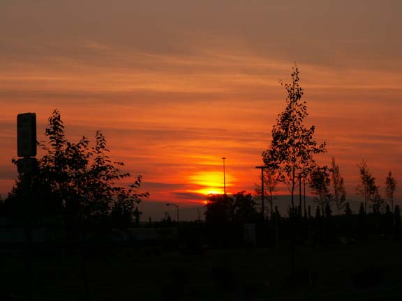
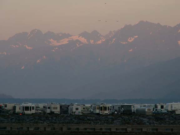
From our overnight spot before we left Anchorage.
Anchorage to Valdez - Alaska 2005
Updated: 11/30/08
From our overnight spot before we left Anchorage.
We had two destinations just north of Anchorage.
 The
first destination was the Alaska Native Heritage Center about ten miles out of Anchorage.
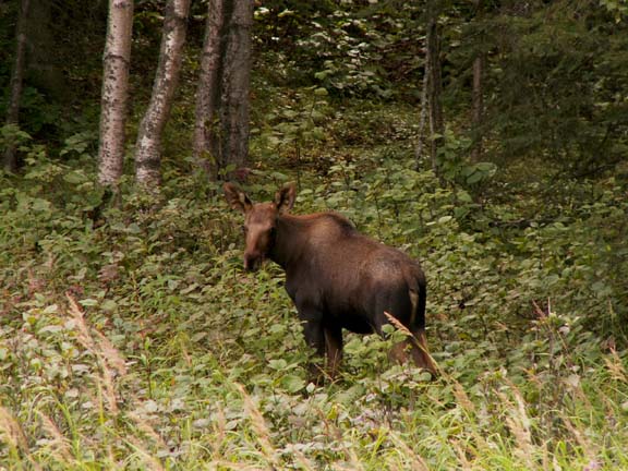
On the road leading to the entrance, this moose was enjoying lunch.
The
first destination was the Alaska Native Heritage Center about ten miles out of Anchorage.
On the road leading to the entrance, this moose was enjoying lunch.
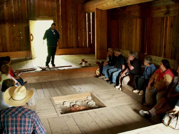
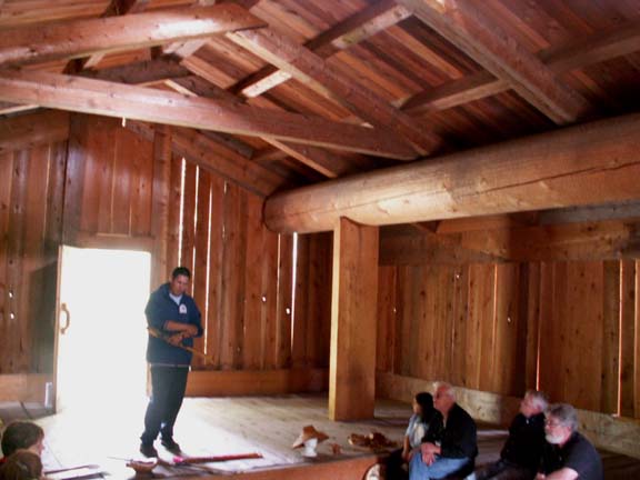
 The
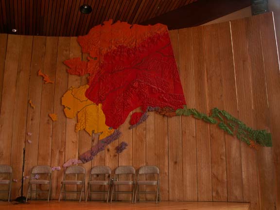
center provided exhibits and presentations on historical native living in the various
regions of Alaska. Admission is $17 per person - senior and AAA discounts
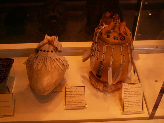
included. The snow goggles were carved from wood. The bags were made from parts
of the heart and a bladder from a moose. The background for the stage showed the
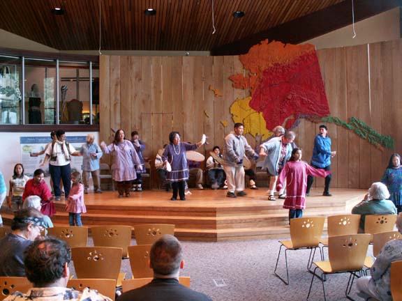
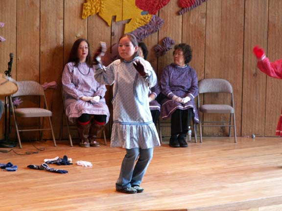
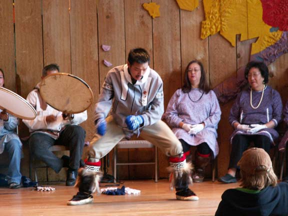
regions. The stage is also where they held the native dance performances of the
regions.
The
center provided exhibits and presentations on historical native living in the various
regions of Alaska. Admission is $17 per person - senior and AAA discounts
included. The snow goggles were carved from wood. The bags were made from parts
of the heart and a bladder from a moose. The background for the stage showed the
regions. The stage is also where they held the native dance performances of the
regions.
We watched a presentation of traditional dancing. The women just bend their knees and do hand motions, the men are more demonstrative in their dance.
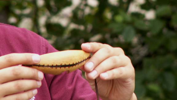
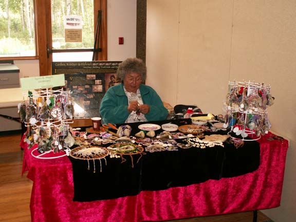
There was a Hall of Cultures where artists demonstrated their native crafts.
You could purchase items if you wished.
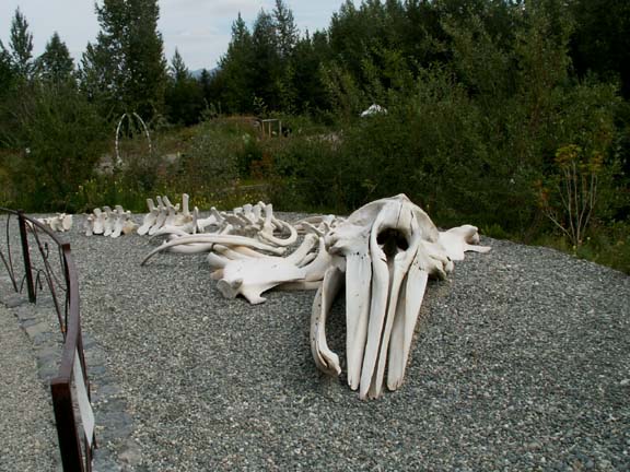 A
recent addition is the skeleton of a gray whale.
A
recent addition is the skeleton of a gray whale.
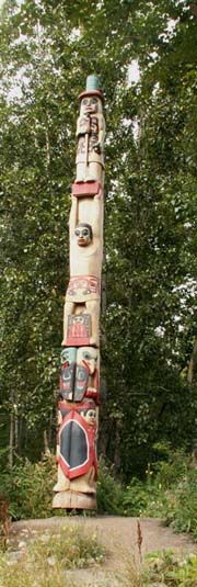 This
totem pole is unusual because it includes both the eagle and the raven. It was
carved for this exhibit, otherwise the eagle and raven do not appear on the same
totem pole. The top figure represents the elder, below him is the next
generation holding the top to the 'box of wisdom' standing with the 'box of
wisdom' between his feet, the eagle and raven, then the youth.
This
totem pole is unusual because it includes both the eagle and the raven. It was
carved for this exhibit, otherwise the eagle and raven do not appear on the same
totem pole. The top figure represents the elder, below him is the next
generation holding the top to the 'box of wisdom' standing with the 'box of
wisdom' between his feet, the eagle and raven, then the youth.
The eagle and raven clans existed together very well. As a matter of fact, if you are an eagle you had to marry a raven to keep the bloodline strong. Your mother's line determines what clan you belong to. This practice is followed today.
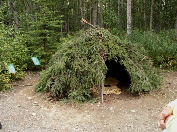
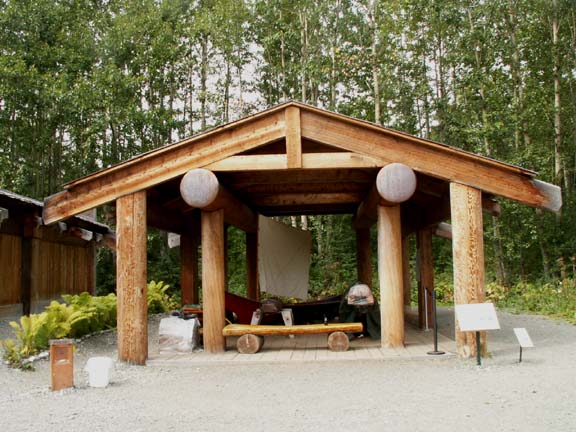
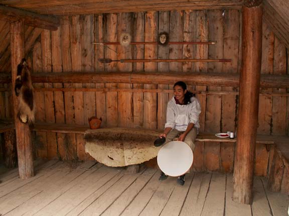
The guided tour of the grounds showed five traditional village settings including housing and other artifacts of the native people. There were people at each location to give you information and answer questions. These temporary housings were used while hunting.
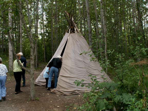
 This house was the men's house. The boys
moved in at the age of seven. Here the men passed on the skills and knowledge
the boys would need. The boys lived here until they married.
This house was the men's house. The boys
moved in at the age of seven. Here the men passed on the skills and knowledge
the boys would need. The boys lived here until they married.
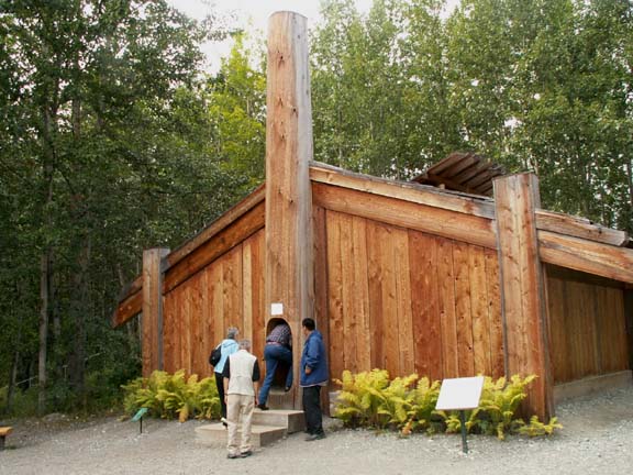
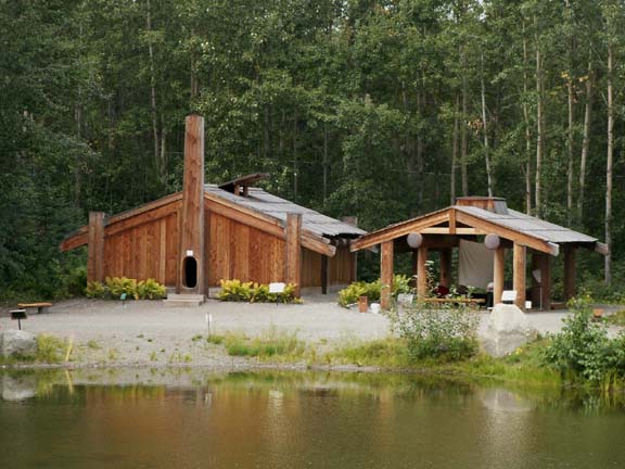 The
buildings of this tribes village were more permanent. The clan house on the left and the
carving shed are examples. They had us squeeze through the traditional entrance
to the clan house. Inside were massive timbers used for its construction.
Exiting we used the large door in the rear.
The
buildings of this tribes village were more permanent. The clan house on the left and the
carving shed are examples. They had us squeeze through the traditional entrance
to the clan house. Inside were massive timbers used for its construction.
Exiting we used the large door in the rear.
The carving shed was a protected area for the men to work.
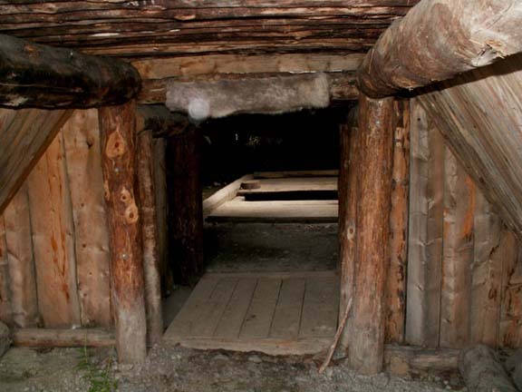
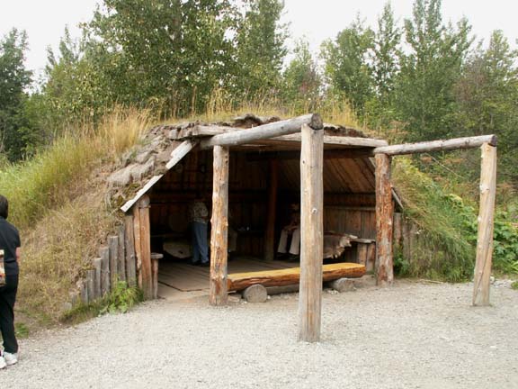
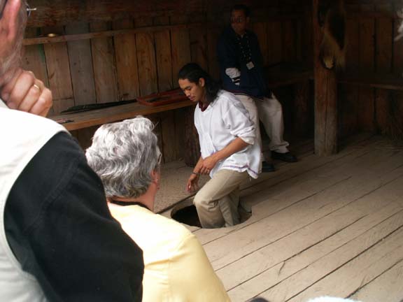
In some regions housing is partially underground. This half a house shows the interior and the hatch used for tunnel access.
It is an interesting stop on the way out of Anchorage. Allow about two hours for the visit.
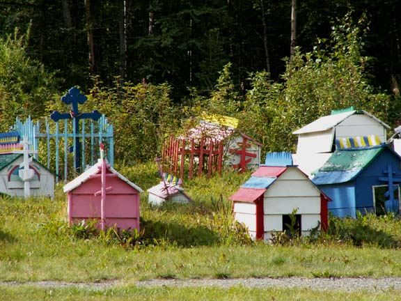
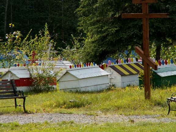
The Athabascan Cemetery in Eklutna, our second destination, was closed because it was Sunday. We saw some of the spirit houses over the fence. The styles shows the Russian Orthodox influence of the area.
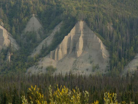
This view of the Matanuska River on the Glenn Highway was a little difficult to get to due to weeds and a fence. It sounded great in the Milepost book. This is one of those places the authors should revisit.
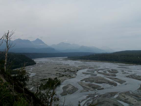
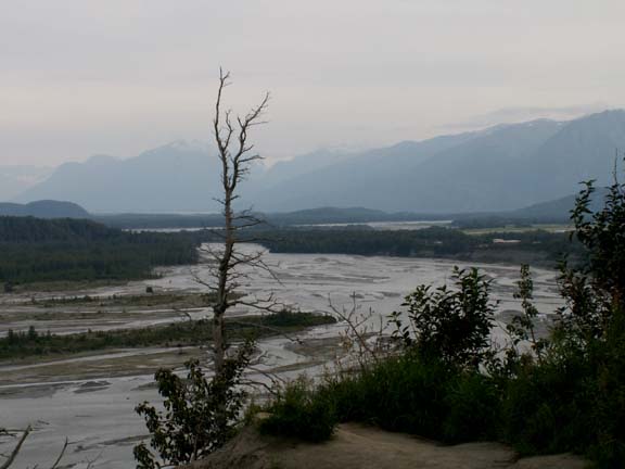
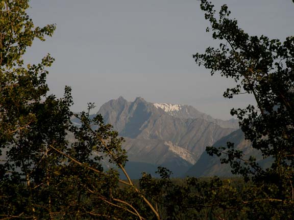
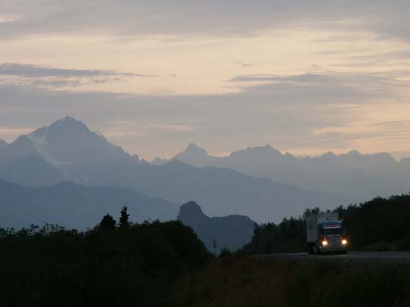
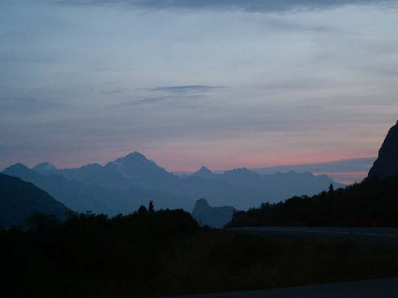
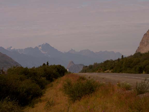
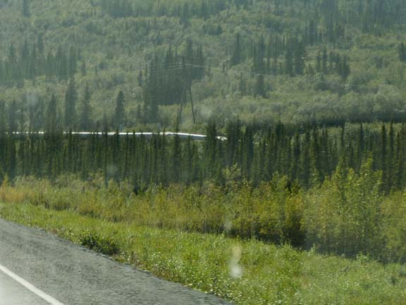
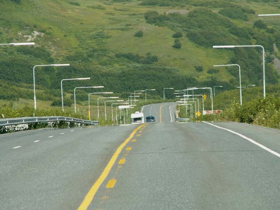
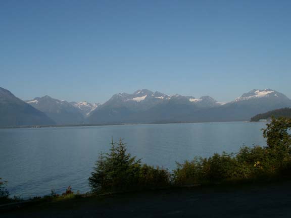
The scenery on the Glenn Highway is very nice. Here are a couple views we liked.
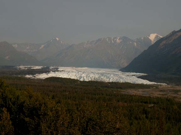
The Matanuska Glacier was a short walk from a very nice parking area. The moraine in front of the glacier was very evident. You could camp in the rest area, on asphalt, for $10.
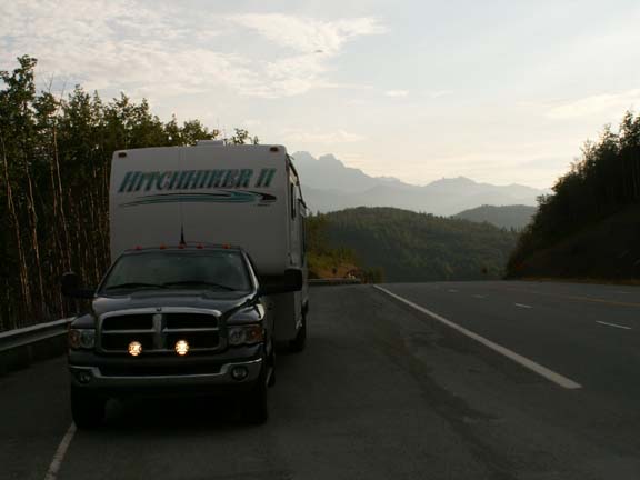
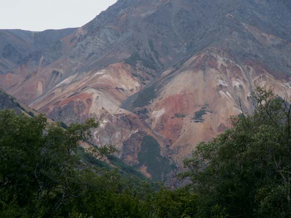
We drove later than usual because it was a nice evening - little traffic and we could stop whenever we wanted for the views. We spent the night in front of Sheep Mountain. The color is gypsum mixed with iron oxide. We scoured the mountain for Dall sheep but found none. On the other side of HHII were the Chugach Mountains.
These views from behind the fifth wheel were a little confusing at first. Fred thought there was a splotch on a photograph. The next morning, it was a mountain in front of a mountain.
The next morning was a nice sunny day. 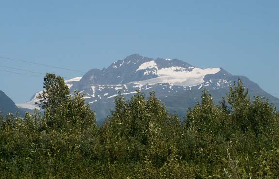
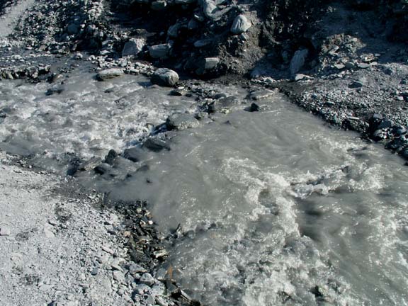
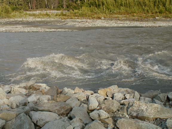 The water in the river was very silty.
 Many areas have 'Slide Area' signs.
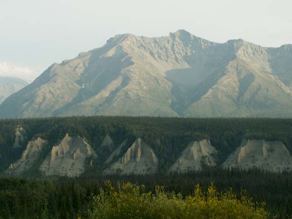
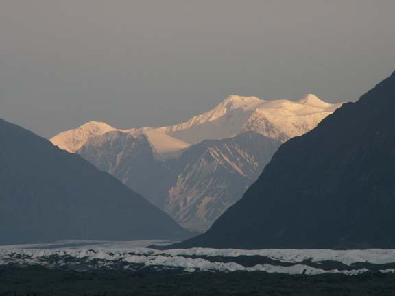
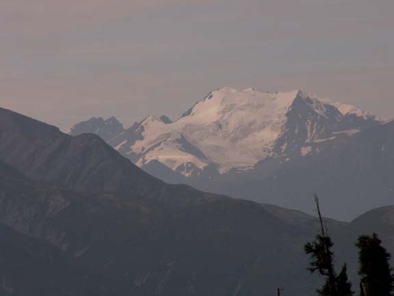
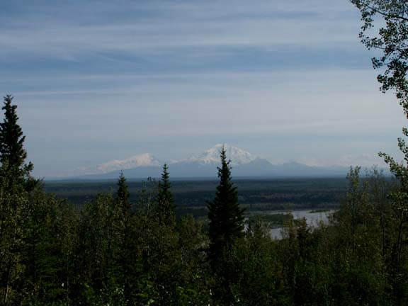
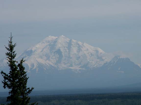
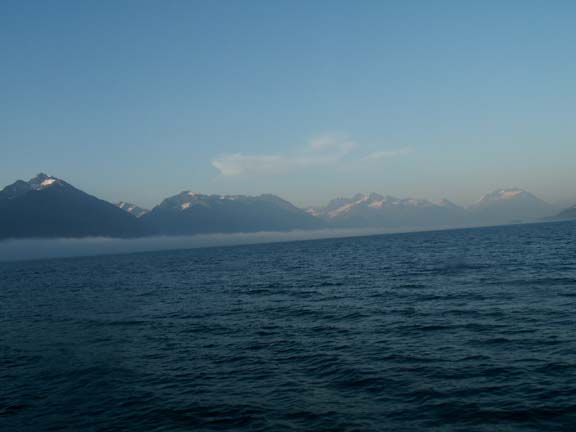
Approaching Glennallen, what we thought were clouds turned out to be snow covered mountains barely visible on the horizon. Later, we got close enough to enjoy them more. The largest one is Mount Drum. They are the Wrangell Mountains.
 Turning
on the Richardson Highway we head for Valdez. We have our first look at the
pipeline in a long time. It is mostly underground or behind mountains in this
area.
Turning
on the Richardson Highway we head for Valdez. We have our first look at the
pipeline in a long time. It is mostly underground or behind mountains in this
area.
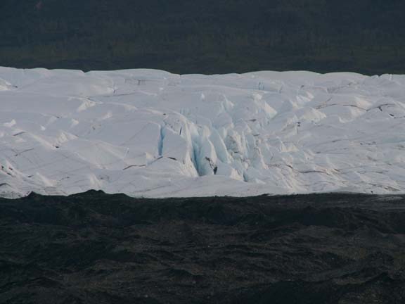
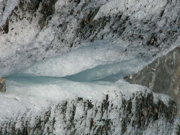
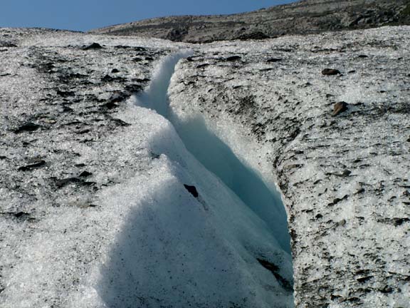
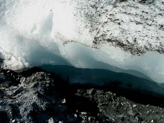
There are many, many glaciers in Alaska. These are a few along the Richardson Highway.
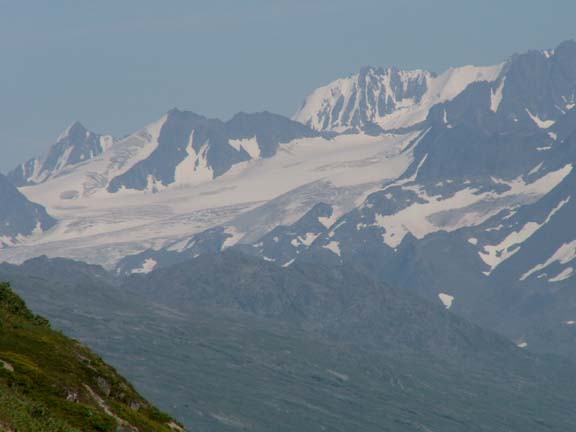
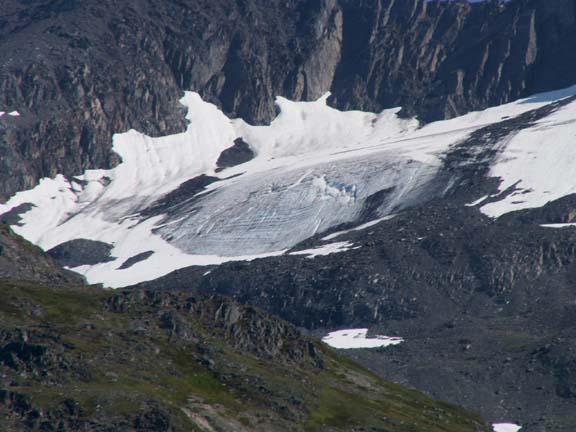
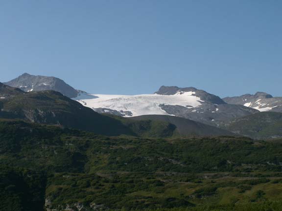
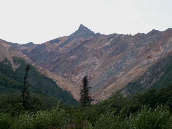
 Not
all glacier are as far away as these. We wonder about our camera sometimes due
to the quality of the photographs through the distance and haze. The Worthington
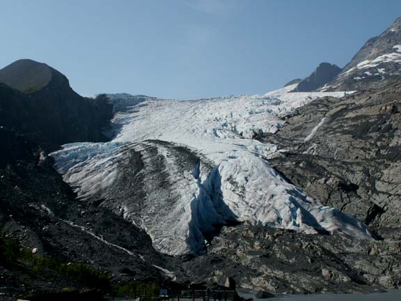
Glacier is one you can walk up to and/or on.
Not
all glacier are as far away as these. We wonder about our camera sometimes due
to the quality of the photographs through the distance and haze. The Worthington
Glacier is one you can walk up to and/or on.
It is the most visited site in the Copper River Basin.
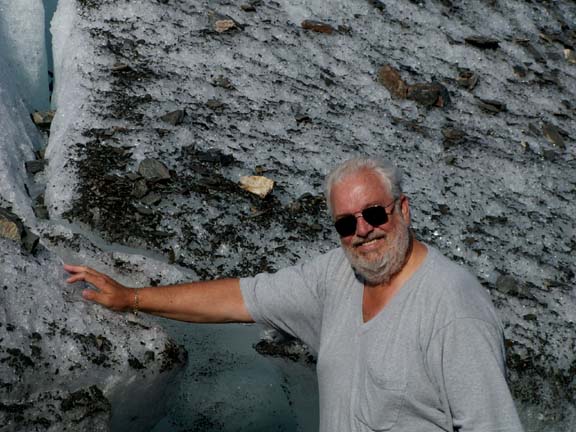
So, how could you be in Alaska and not touch a glacier. It was farther away than it looked as we traversed the paths. We say paths, because we back-tracked at a couple points. Especially, when you are looking for the easiest path for senior citizens. We have provided a red arrow to show where we ended our trek. And, for a size comparison, those are adult people down there in the photograph on the right.
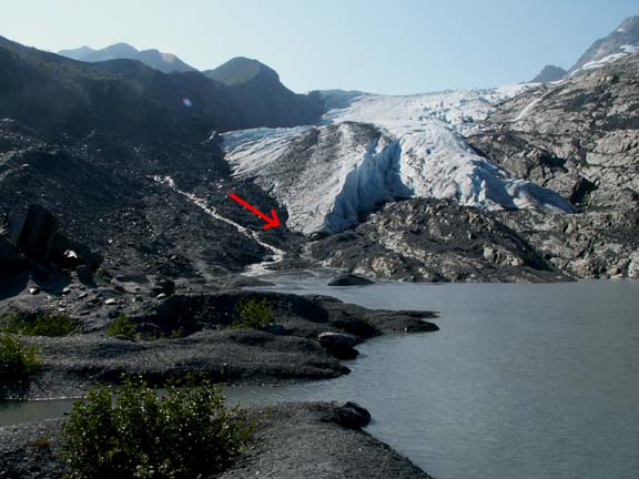
Proof that we made it . . . 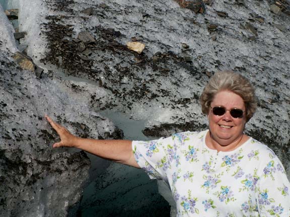
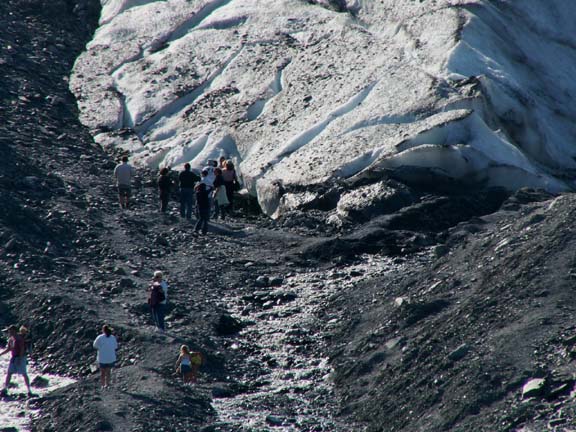
 While
we used this nice little rock bridge on the way down, we found a less risky way
back on the moraine. It was a little wetter, but safer - shoes will dry.
While
we used this nice little rock bridge on the way down, we found a less risky way
back on the moraine. It was a little wetter, but safer - shoes will dry.
 The
Thompson Pass section of the highway had heavy duty snow fences and these
snowplow guide posts. It was windy and probably not a nice place during the
winter. Elevation 2,678 feet.
The
Thompson Pass section of the highway had heavy duty snow fences and these
snowplow guide posts. It was windy and probably not a nice place during the
winter. Elevation 2,678 feet.
Then we started our descent to Valdez. All the way down, Fred was thinking about the climb out of Valdez in a few days - probably, second gear and 35 MPH. And ........., 4.2 MPG.
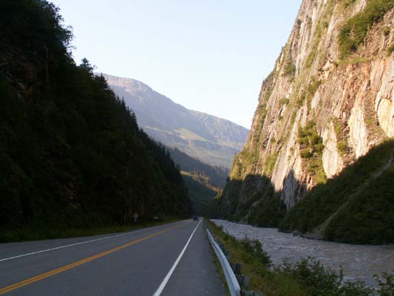
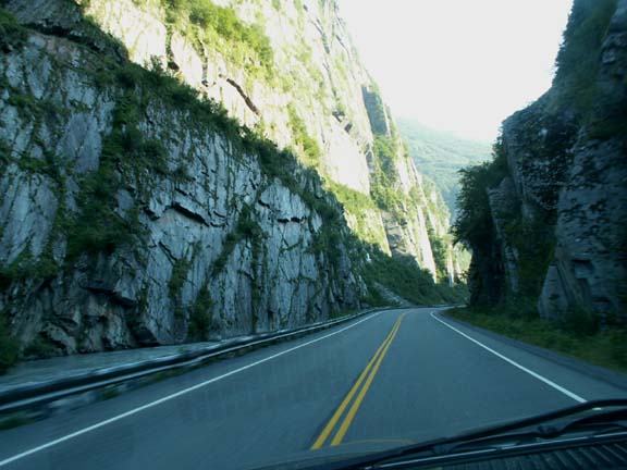
The highway passed through some rock passes.
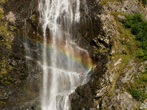
Two water falls are popular stops . . .
Bridal Veil falls even showed us a rainbow.
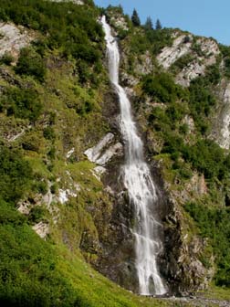
And, Horsetail Falls . . . 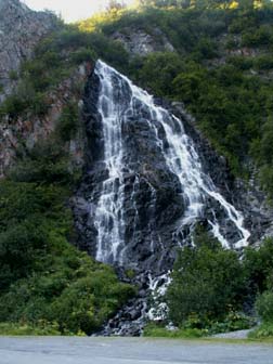
 Our
campsite in Valdez was on the channel to the small boat harbor. As soon as we
were set up, we washed the windows so we enjoy the boat traffic. This photograph
is from the public dock down the waterfront.
Our
campsite in Valdez was on the channel to the small boat harbor. As soon as we
were set up, we washed the windows so we enjoy the boat traffic. This photograph
is from the public dock down the waterfront.
This is the look down the channel. 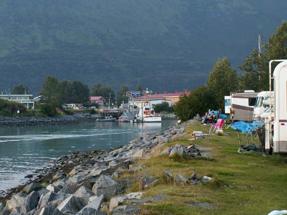
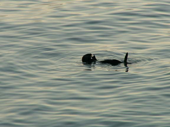
This sea otter plays behind our fifth wheel.
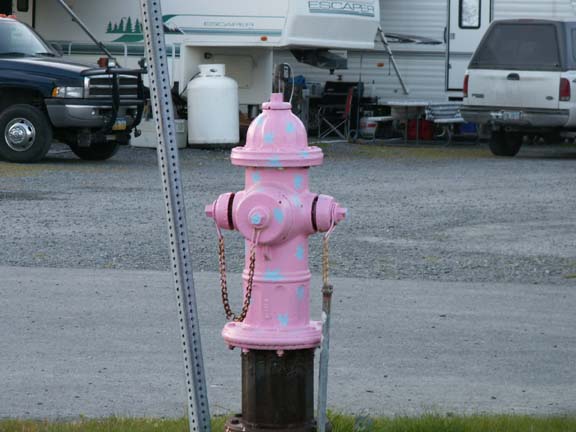
The fire hydrants in Valdez are decorated
in many different colors and designs.
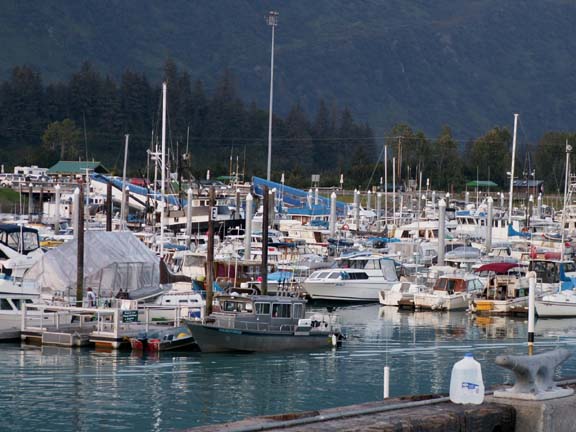
Small boat harbor ...
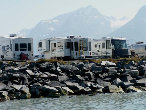
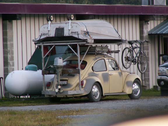 People
tow all kinds of 'toads' behind their motorhomes to use after they park the
motorhome. This one was especially interesting.
People
tow all kinds of 'toads' behind their motorhomes to use after they park the
motorhome. This one was especially interesting.
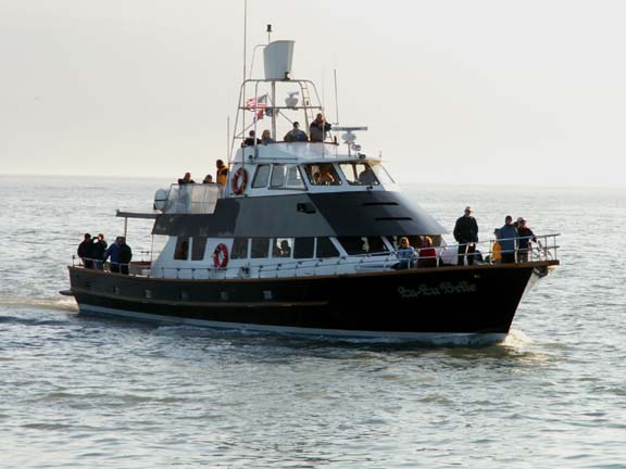
After some thought, and waking up to a beautiful day, we decided to take a boat tour of Prince William Sound and the Columbia Glacier. The 'cash' cost was $84 per person. It was $5 more to use a credit card. It was a six hour tour but she said if the captain stops too much for wildlife and scenery, it may be longer. He did, it was.
We choose of the Lu-Lu Belle based on the campground owners recommendation. It was a great 7 1/2 hour tour. Part of the reason it was a little longer - the captain heard a report of whales and away we went in that direction. We did see the tail of the whale and it was gone. He waited a long time for it to surface - it did not cooperate.
The Lu-Lu Belle is advertised as the "Limousine of Prince William Sound". On the gang plank, he had mounted two shoe brushes. The brochure says to wear rubber soled shoes and you can bring anything you want on board except red juice and red wine because it is hard to get the stain out of the carpet.
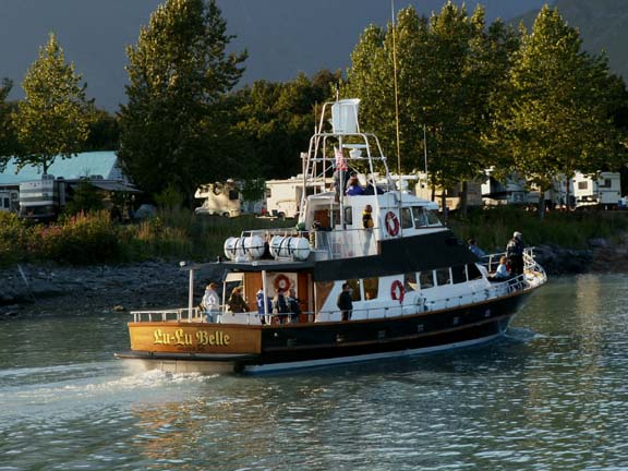
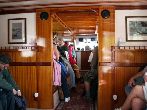
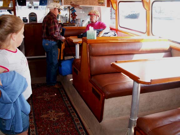
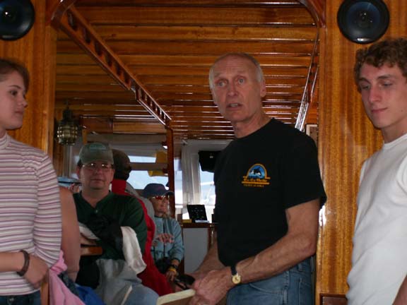 He gave more 'rules' as soon as everyone boarded - in a nice and
humorous way. You could tell he is proud of his boat. You had unrestricted
access to any part of the boat. It was licensed to carry 80 people - we had just
over 40.
He gave more 'rules' as soon as everyone boarded - in a nice and
humorous way. You could tell he is proud of his boat. You had unrestricted
access to any part of the boat. It was licensed to carry 80 people - we had just
over 40.
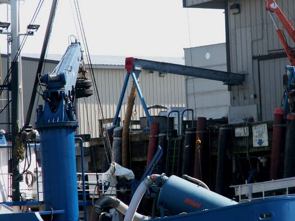 The
first point of interest was a fish tender. He explained how they go out to
the fishing boats and buy their fish for cash. That way the fishermen can
continue fishing without returning to the cannery when their hold is full early
in the day. The blue hose sucks the fish out of the fishing boats and separates
fish from the water and weighs them. The fisherman is paid, he goes back to
fishing. The fish tender make the trips to the cannery for the fisherman. The
yellow hose at the cannery sucks the fish out of the fish
tender.
The
first point of interest was a fish tender. He explained how they go out to
the fishing boats and buy their fish for cash. That way the fishermen can
continue fishing without returning to the cannery when their hold is full early
in the day. The blue hose sucks the fish out of the fishing boats and separates
fish from the water and weighs them. The fisherman is paid, he goes back to
fishing. The fish tender make the trips to the cannery for the fisherman. The
yellow hose at the cannery sucks the fish out of the fish
tender.
 The
second point of interest, at least to us, was the HHII parked on the edge of the
channel.
The
second point of interest, at least to us, was the HHII parked on the edge of the
channel.
We spent many hours watching the activity outside our windows. It was very interesting and relaxing.
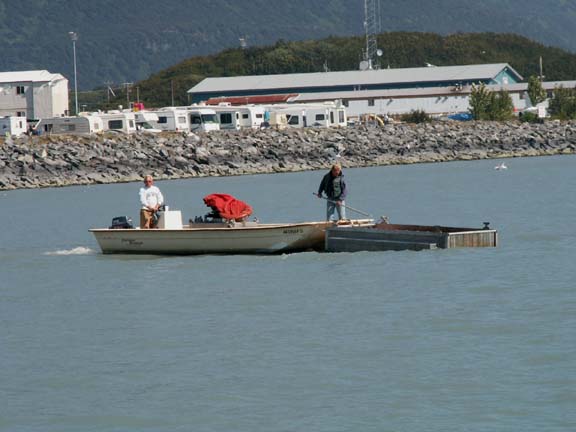
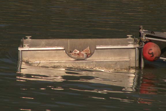
Next was this strange looking boat and bin combination. He explained that the fish cannery in the small boat harbor does not dump the leftover fish 'parts' in the harbor. They haul it a little ways into the bay and return them to their natural location, the bay. From that point on, we saw the bin pushed by our window regularly.
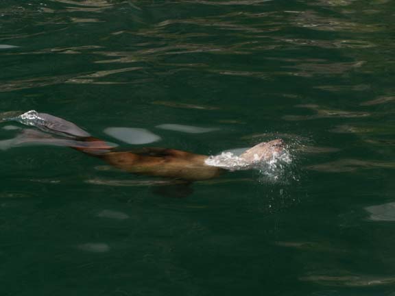
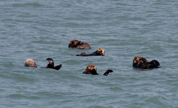 A
couple miles into Valdez Bay, we stopped to watch some sea otters play.
A
couple miles into Valdez Bay, we stopped to watch some sea otters play.
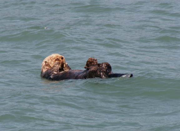 These
guys know how to relax.
These
guys know how to relax.
The next stop was at a bouy to see some more sea otters and sea lions.
They did not cooperate much. One waved as we left.
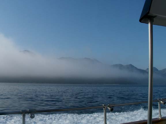
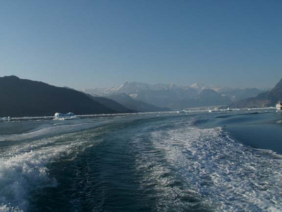
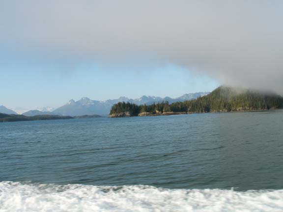
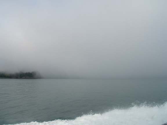
We headed out the Valdez Arm . We encountered fog so we did not see much and wondered what happed to our clear sunny day. Maybe this wasn't a good day for the tour. But, we eventually ran out of the fog. We were in the Bay of Alaska and into open water.
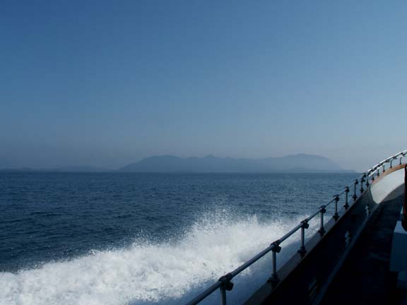
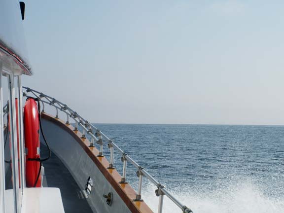
The tour covered a planned 110 mile so we ran at full throttle
often
to get where he wanted to take us.
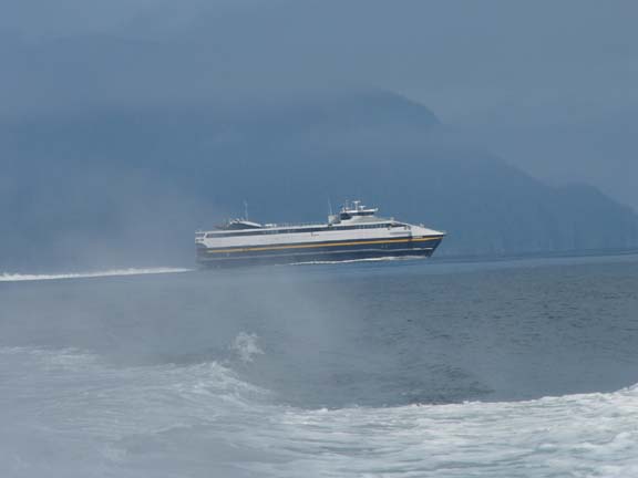 A
little ways into the Bay of Alaska, we saw their new ferry. It runs between
Valdez and other ports on the Alaska Marine Highway.
A
little ways into the Bay of Alaska, we saw their new ferry. It runs between
Valdez and other ports on the Alaska Marine Highway.
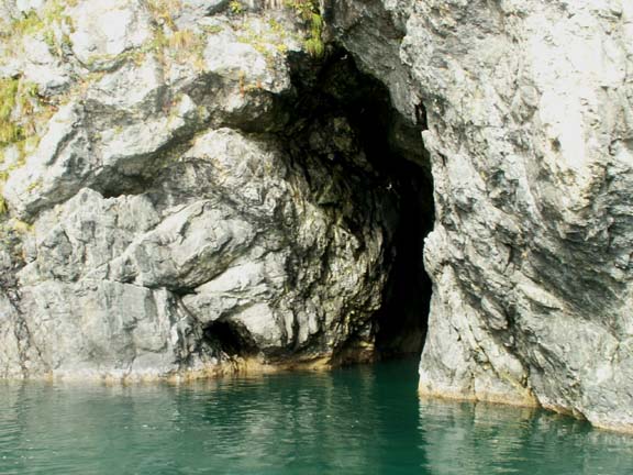
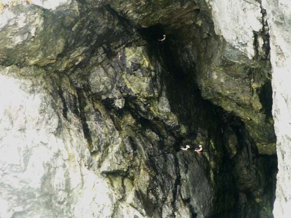
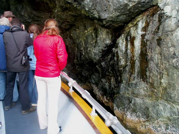
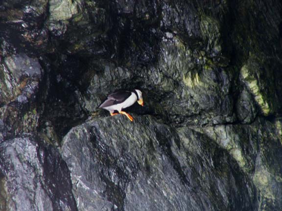
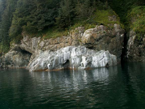
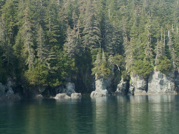 Along the shore were many opening in the rock. He knew which
ones to visit for viewing Puffins.
Along the shore were many opening in the rock. He knew which
ones to visit for viewing Puffins.
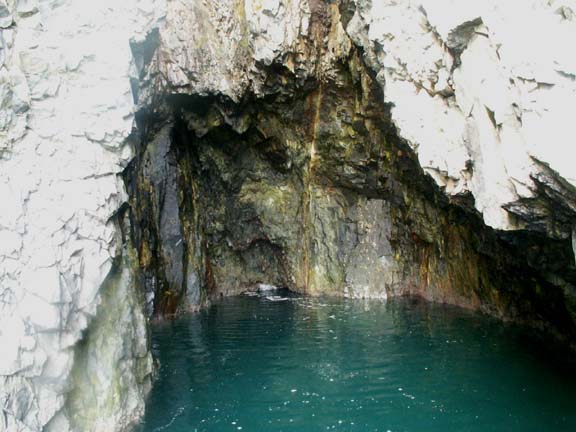
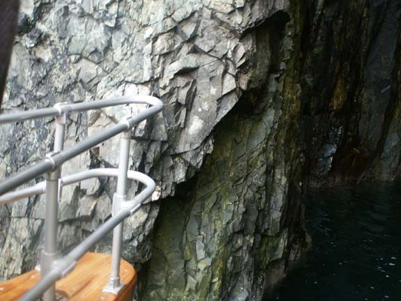 He put the bow of the boat into two openings.
He did it twice to show us Puffins. Obviously he has been at these locations before and knows the water so he doesn't damage his boat. The seas were calm so he got us close.
This is white rock, not a glacier.
After some time with the Puffins, we were underway again. These sea lions were very noisy. They liked the company or were warning others of our arrival. They were not to upset as they made no effort to avoid us. Other than this one, they ignored us.
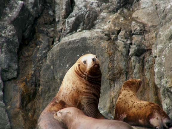
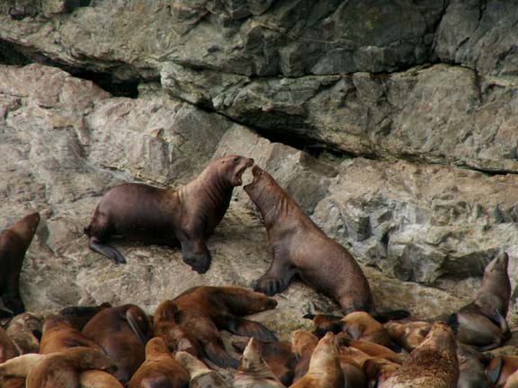
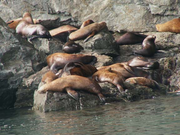
As we were slowly cruising the shoreline, some came out to entertain us.
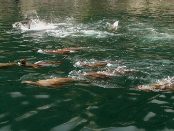
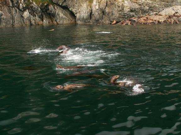
Sea lions are very polite. Again, one waved good-by to
us. 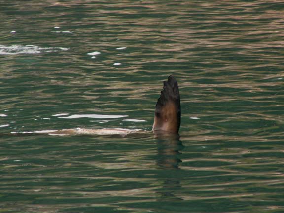
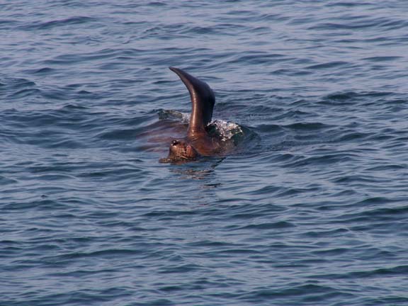
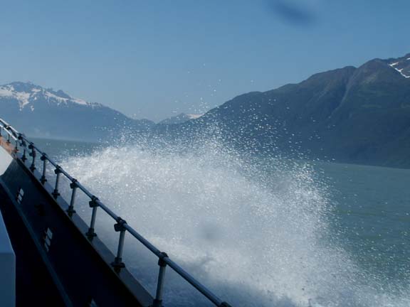
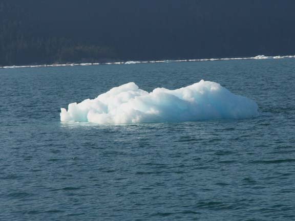
 Next, we were heading in the direction of Columbia Glacier. We
started seeing small icebergs floating in the water around us. His crew consisted of
four young women, one in the crows nest looking for whales. We changed direction
and headed out to sea farther. Not being successful except for the tail viewing,
we reversed course towards Columbia Glacier again.
Next, we were heading in the direction of Columbia Glacier. We
started seeing small icebergs floating in the water around us. His crew consisted of
four young women, one in the crows nest looking for whales. We changed direction
and headed out to sea farther. Not being successful except for the tail viewing,
we reversed course towards Columbia Glacier again.
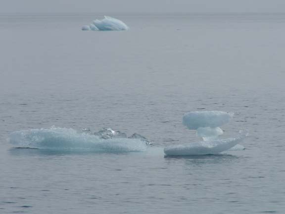
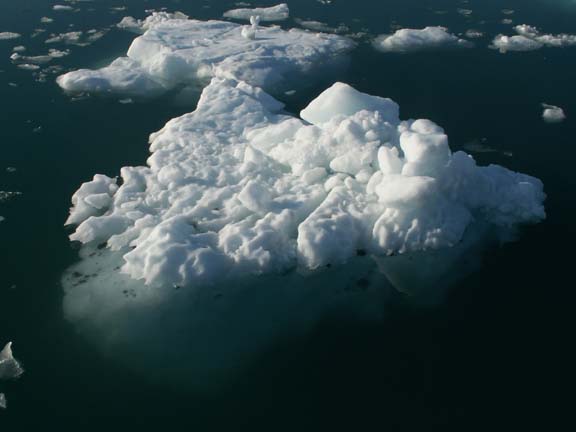
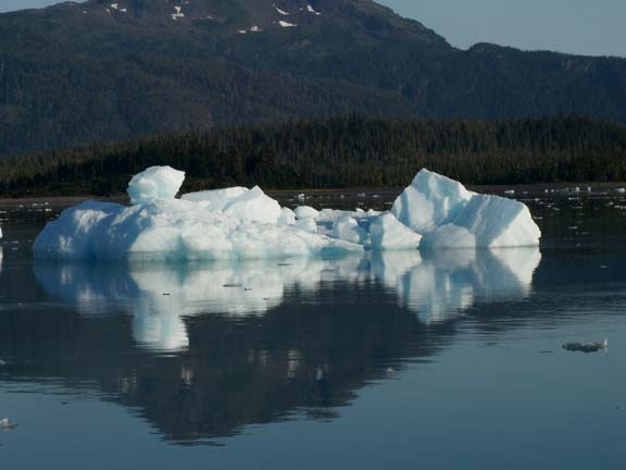
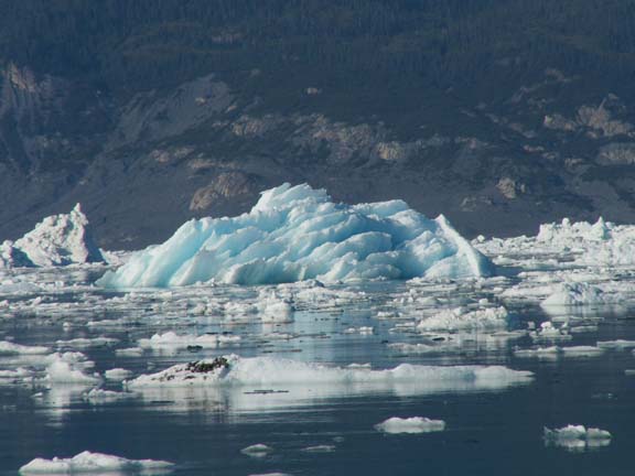
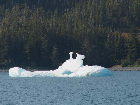 Help us name this animal iceberg.
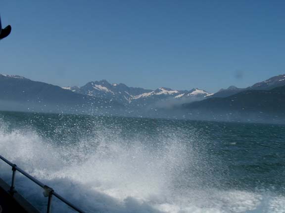
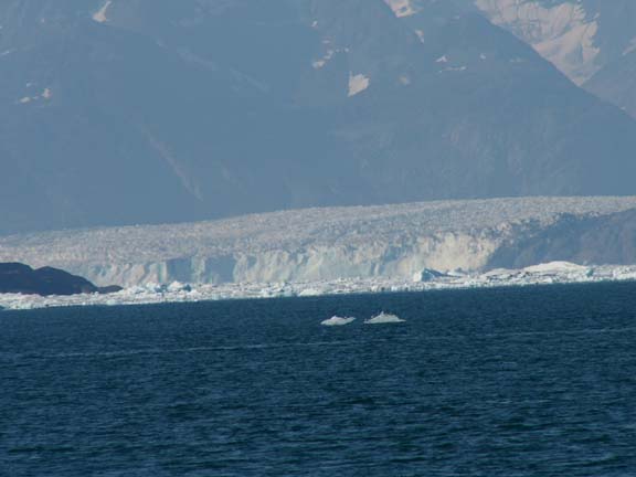
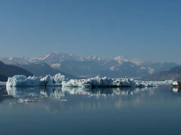
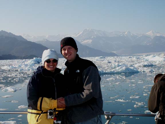
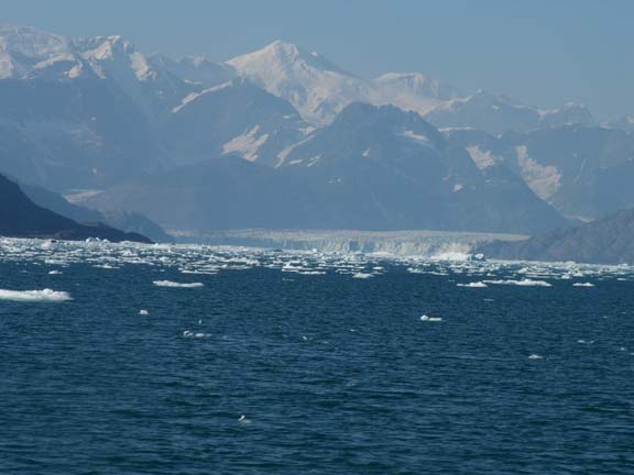 It
varies by the day how close boats can get to the Columbia Glacier. These views
are from
eleven miles away.
It
varies by the day how close boats can get to the Columbia Glacier. These views
are from
eleven miles away.
A large amount of calving since Sunday has clogged the front of the glacier with ice. The captain said he would get us in as close as possible.
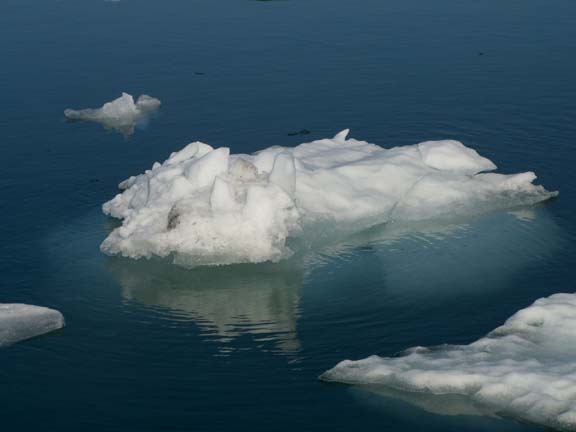
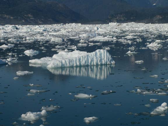
The ride towards the glacier through the iceberg was fun.
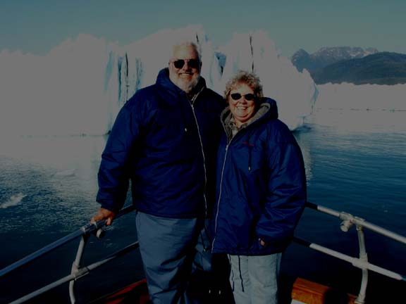
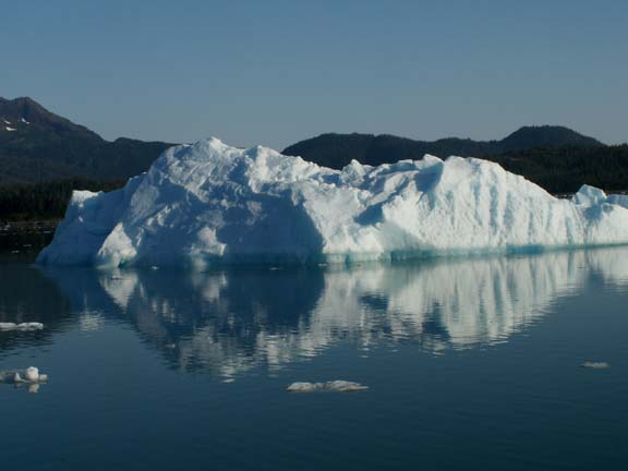
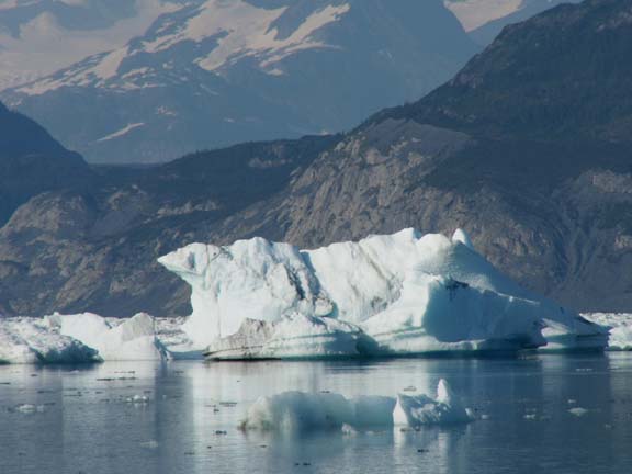 It
was in front of this large iceberg that he paused for photographs. He had a sign
for "Merry Christmas" and on the flip side "Happy Hanukkah".
Or, you could hold the boat's life ring. We choose to hold nothing.
It
was in front of this large iceberg that he paused for photographs. He had a sign
for "Merry Christmas" and on the flip side "Happy Hanukkah".
Or, you could hold the boat's life ring. We choose to hold nothing.
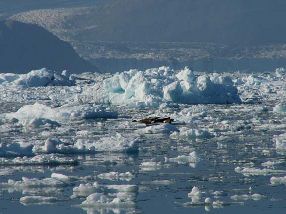
Harbor seals resting ...
 This
was as far as he could take us and his boat. The icebergs were getting to thick
to navigate through. All the way in to this point,
to young boys were so excited to see and hear the boat hitting small icebergs.
They had a lot of fun hanging over the bow and announcing the 'hits'.
This
was as far as he could take us and his boat. The icebergs were getting to thick
to navigate through. All the way in to this point,
to young boys were so excited to see and hear the boat hitting small icebergs.
They had a lot of fun hanging over the bow and announcing the 'hits'.
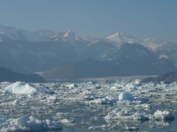
Columbia Glacier - seven miles away
Oh, before we leave the glacier area. We talked to a young
couple in line behind us at the dock.
They told us they were married on the Lu-Lu Belle on Sunday - two days earlier.
It was fun sharing their 'two day' anniversary.
Danielle and Geoff
He worked his way out and we were off for Port Valdez.
We were not underway long before we could see we were heading into fog. It was interesting watching us run into it. Because we could not see anything, we went inside. We stayed in dense fog until we were in Port Valdez.
It was a great trip. We were glad we did not listen to some previous advise that you did not get close enough to Columbia Glacier to make the trip worthwhile. The large number of icebergs made it a different tour.
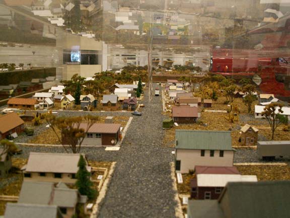
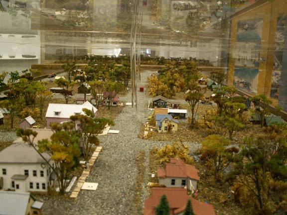
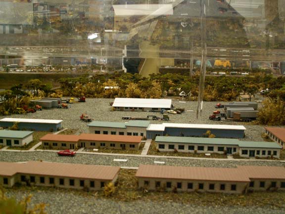
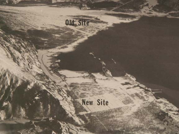 The
following day we visited the Valdez Museum. The annex had a scale model of
Old Valdez. It is called that because that as the town looked before the 1964 Earthquake. It was relocated to its present
location and rebuilt.
The
following day we visited the Valdez Museum. The annex had a scale model of
Old Valdez. It is called that because that as the town looked before the 1964 Earthquake. It was relocated to its present
location and rebuilt.
The model was laid out by streets. There are 60 city blocks and 400 buildings. It took the artist 2.5 years to complete.
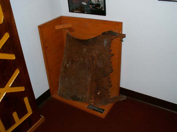
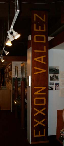 The
main museum housed many exhibits related to Valdez. Of course, oil is an
important industry to Valdez. One exhibit of the Exxon Valdez spill had a piece
of the tankers hull.
The
main museum housed many exhibits related to Valdez. Of course, oil is an
important industry to Valdez. One exhibit of the Exxon Valdez spill had a piece
of the tankers hull.
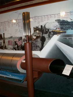 A
model of a section of the Trans-Alaska Pipeline showed a cut-away view.
A
model of a section of the Trans-Alaska Pipeline showed a cut-away view.
How did the first barrel of oil get to Valdez from the North
Slope/Prudhoe Bay?
> > > By dog sled, of course.
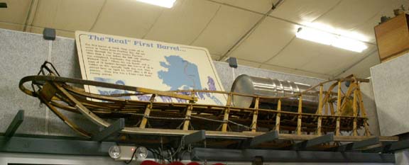 Photo not reduced.
It was a fund raiser for the Lions Club. A man and his son carried the oil on this sled.
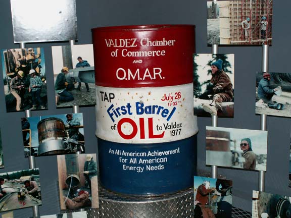 Then, there is the "first" barrel out of the pipeline.
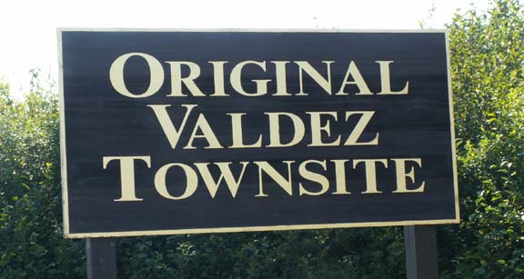
After our visit to the museum, we visited Old Valdez, nature has taken back the area over the last forty years. We could only find the foundation from the post office. It was too large for nature to hide.
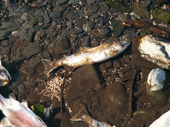
Heading down Dayville Road to locate the fish hatchery, we came across an interesting event at Salmon Gulch creek. Thousand of salmon trying to spawn. It was an amazing number of fish in a tight place, on top of each other - and, dying to get there. This boy was reaching into the water and picking up fish by their tail. A local resident told Mary Lou that in 30 years he has never seen this many fish.
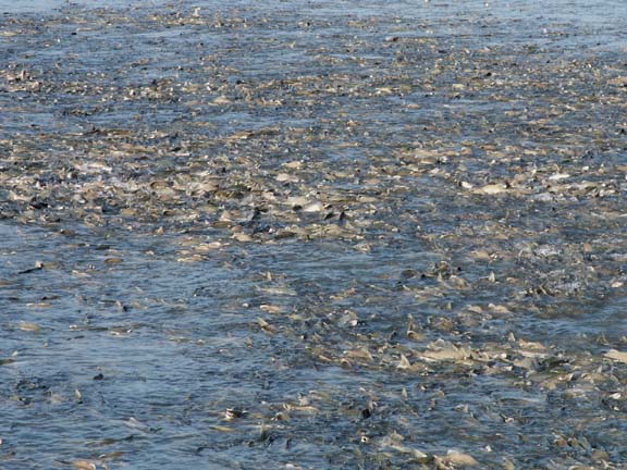
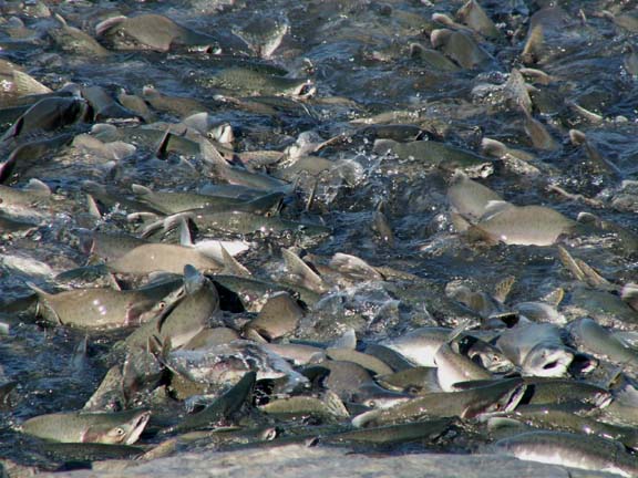
All the disturbed water is fish ... a closer look ... and closer yet.
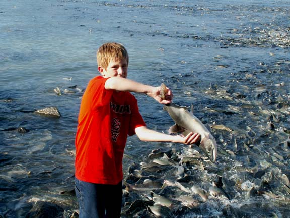 The
boy's father said he had been doing this for an hour.
The
boy's father said he had been doing this for an hour.
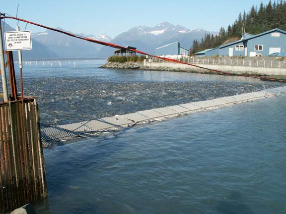 We are told this is a fish ladder. We thought fish ladders were supposed to help
the fish get upstream.
We are told this is a fish ladder. We thought fish ladders were supposed to help
the fish get upstream.
This is what it is all about. Salmon return from the ocean, lay their eggs and die.
We did find the hatchery. These are sunken cages and walkways in the salt water. The salmon are placed here to adjust to the salt water before being released to nature.
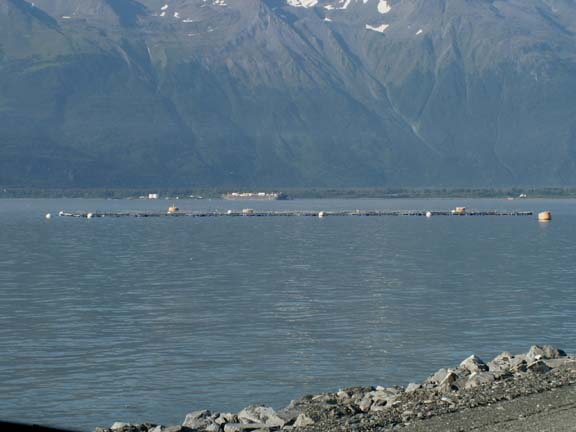
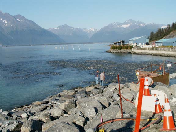
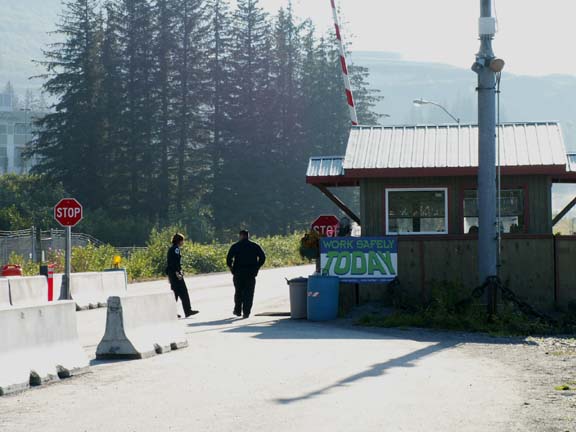
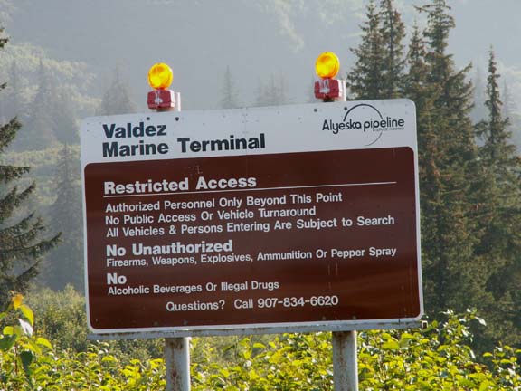
Our other goal on the Dayville Road was to find the end of the pipeline. We missed this sign and ended up a hundred feet from the gate to the Alyeska Marine Terminal where a guard suggested to Fred that he could see the pipeline in Fairbanks. He said the pipeline is underground in this area.
We didn't tell you earlier - the Alyeska Marine Terminal was directly across Port Valdez from our campground. It is a 24-hour operation and looks very attractive at night.
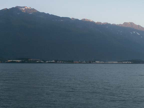
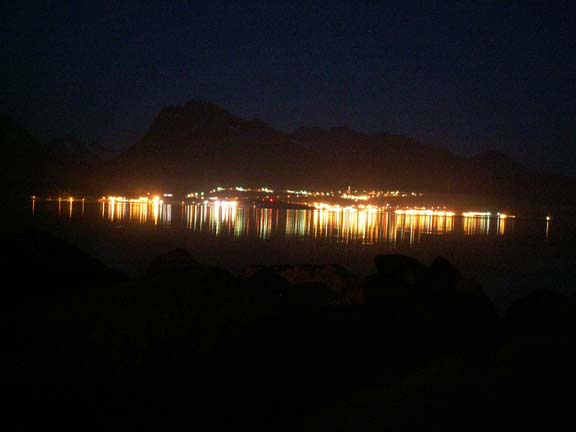
Things have changed at Port Valdez . . .
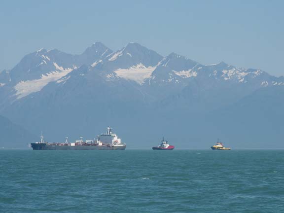 Since
the Exxon Valdez oil spill in 1989, oil tankers are escorted 62 miles out by two
containment vessels. Over 100 people and needed equipment are on stand-by in
the event of another oil spill. The Ship Escort Response Vessel System (SERVS)
equipment includes ten tugs, eight barges. On the eight barges are 48
mini-barges, five self-propelled skimming units, 34 workboats, three landing
craft and 42 miles of containment boom.
Since
the Exxon Valdez oil spill in 1989, oil tankers are escorted 62 miles out by two
containment vessels. Over 100 people and needed equipment are on stand-by in
the event of another oil spill. The Ship Escort Response Vessel System (SERVS)
equipment includes ten tugs, eight barges. On the eight barges are 48
mini-barges, five self-propelled skimming units, 34 workboats, three landing
craft and 42 miles of containment boom.
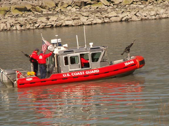 Tours of the terminal were
discontinued after 9-11 and this
Coast Guard boat with its 50-cal guns was added this year.
Tours of the terminal were
discontinued after 9-11 and this
Coast Guard boat with its 50-cal guns was added this year.
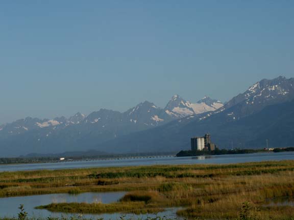
A couple more views are we drove around the water.
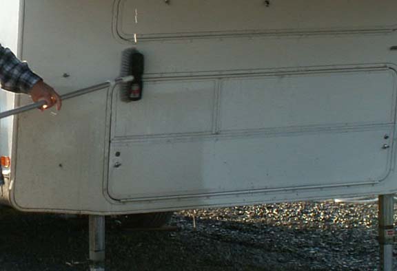
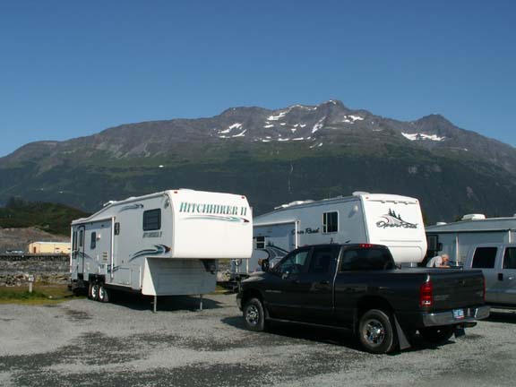
The campground we were in allowed you to wash your RV. Being able to use a brush and soap, showed that the HHII is really white and the truck dark charcoal. They are not both a brown color.
We enjoyed our time in Valdez and would go back in a heartbeat. Maybe a little earlier in the year. The smell of the dead salmon was starting to permeate the air.
Go back to Alaska Photo Album .