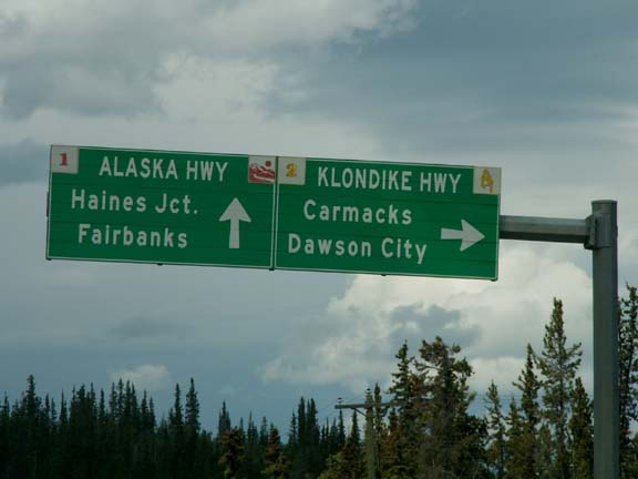
 When we left Whitehorse, we turned
off the Alaska Highway, and on to the Klondike Highway Loop towards
Dawson City. The road was not expected to be as good as the Alaska Highway.
When we left Whitehorse, we turned
off the Alaska Highway, and on to the Klondike Highway Loop towards
Dawson City. The road was not expected to be as good as the Alaska Highway.Whitehorse to Boundary - Alaska 2005
Updated: 11/30/08
When we left Whitehorse, we turned
off the Alaska Highway, and on to the Klondike Highway Loop towards
Dawson City. The road was not expected to be as good as the Alaska Highway.
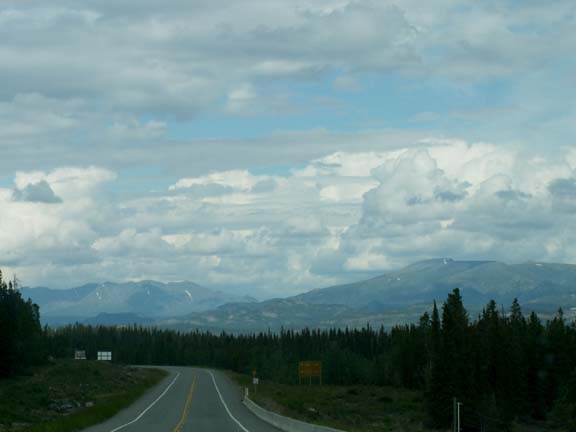
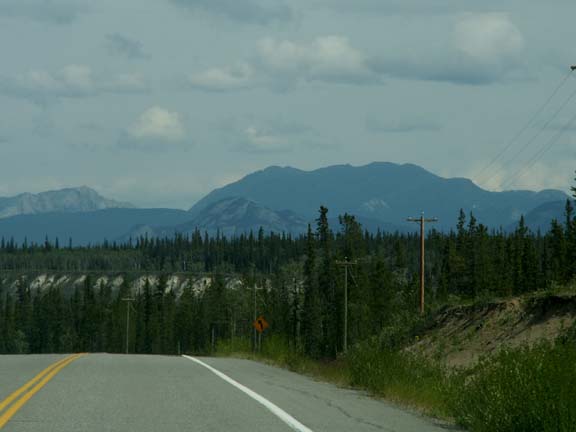
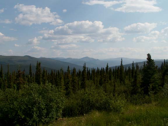
The following photographs were taken along this stretch of highway.
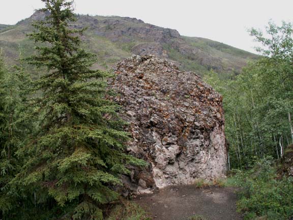 Conglomerate
rock formations ...
Conglomerate
rock formations ...

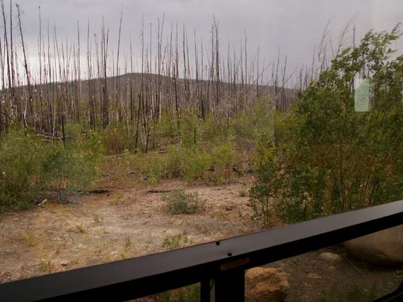 We
had lunch at the site of the Fox Lake forest fire in 1998. It is very common to
have signs designating the name and date of the forest fires.
We
had lunch at the site of the Fox Lake forest fire in 1998. It is very common to
have signs designating the name and date of the forest fires.
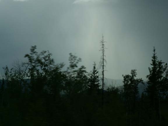
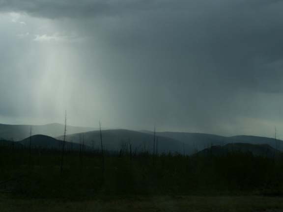
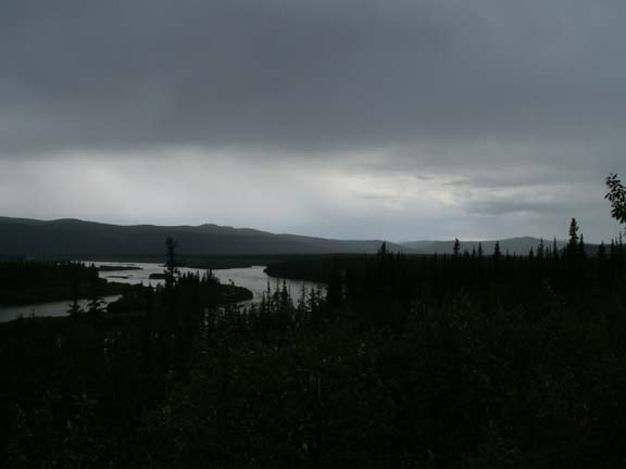
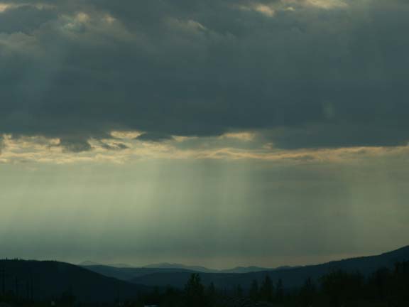 As
we were finishing lunch, it started to sprinkle. It turned out to be a rainy day
of driving. We had a stretch of heavy rain and several small showers.
As
we were finishing lunch, it started to sprinkle. It turned out to be a rainy day
of driving. We had a stretch of heavy rain and several small showers.
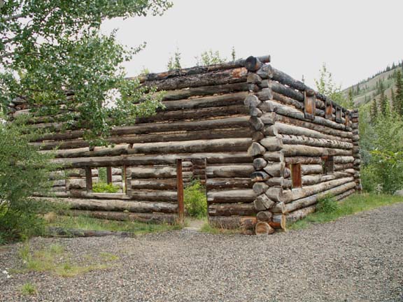
The Montague Roadhouse was in a rest area. It is no longer in use - the roof is missing and the doors long gone.
We planned to make the drive to Dawson City in two days. However, even leaving at noon and not seeing a lot to stop to investigate, we decided to make it in one. It turned out to be a good idea. We ran into several miles of construction - it was dry, we were almost alone and there were no workers in sight.
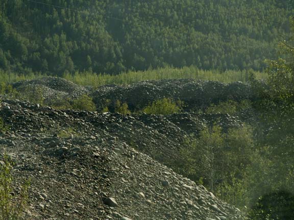
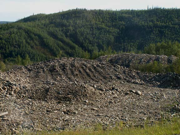
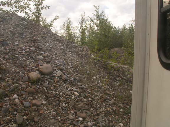
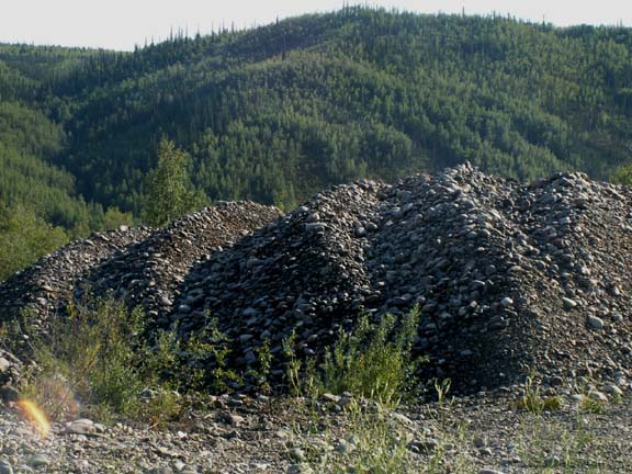
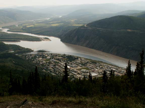
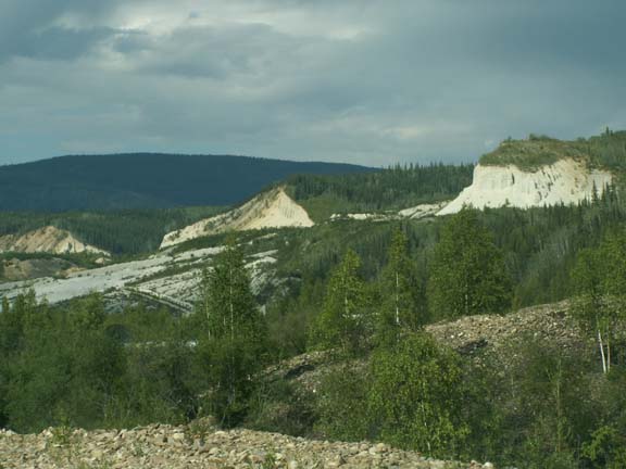
Approaching Dawson City was a little bit of a shock. There were rocks piled all along the highway. We learned fast that it was the result of the gold mining in the area.
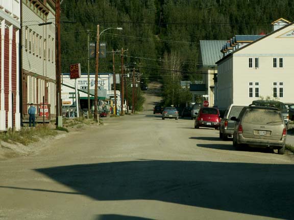
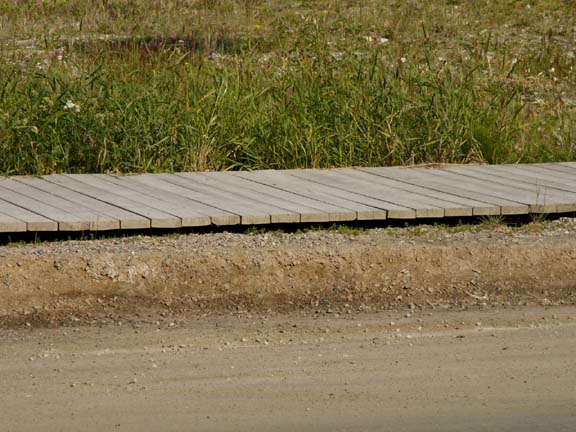
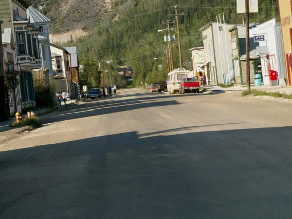
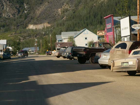
Dawson City was the hub of the Klondike Gold Rush. The Canadian government is spending a lot of time and money to restore the town to its heritage. The dirt streets and wood sidewalks remain as well.

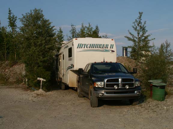
 The
campgrounds in the area are all on areas that have been previously mined. The
rocks are pushed aside and a level area established. You have a campground. This
is the view out the window next to Fred's recliner. We were wrapped in tailings.
The
campgrounds in the area are all on areas that have been previously mined. The
rocks are pushed aside and a level area established. You have a campground. This
is the view out the window next to Fred's recliner. We were wrapped in tailings.
While you are encouraged to spend three or more days in Dawson City to see the many attractions, we took in three. All that were not the touristy store attractions. (Oh - Mary Lou recommends the fish soup at Sourdough Joe's.)
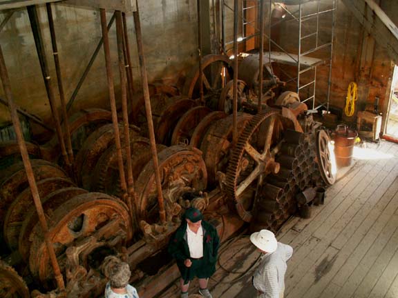
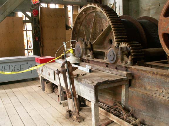
Don't miss Dredge No. 4. It is the largest wooded hull, bucket-line dredge in North America. Built in 1912 it is huge. The cost of the tour is $6.00 per person.
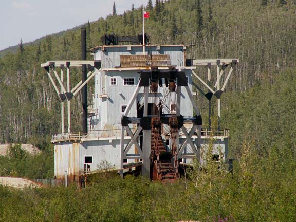
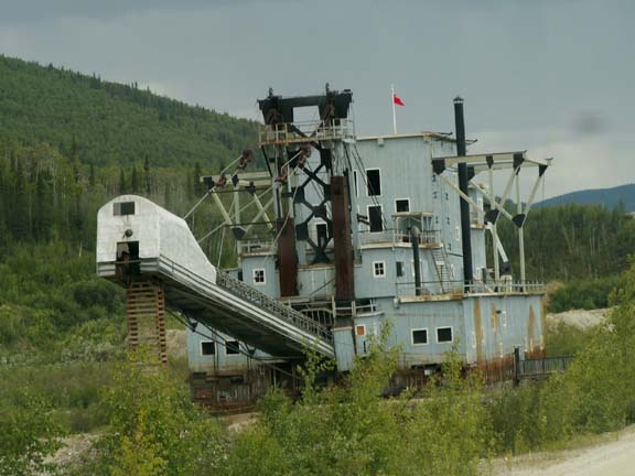
Rear - where rock is
piled
Front - the bucket-line
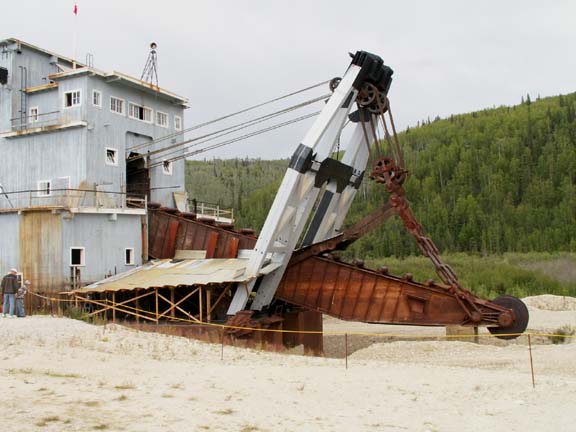
 It
is hard to believe this big box floated. They had to pump water from streams to
form the pond they needed. As the dredge moved forward, its pond moved forward
also by the rock being moved from the front to the rear of the pond.
It
is hard to believe this big box floated. They had to pump water from streams to
form the pond they needed. As the dredge moved forward, its pond moved forward
also by the rock being moved from the front to the rear of the pond.
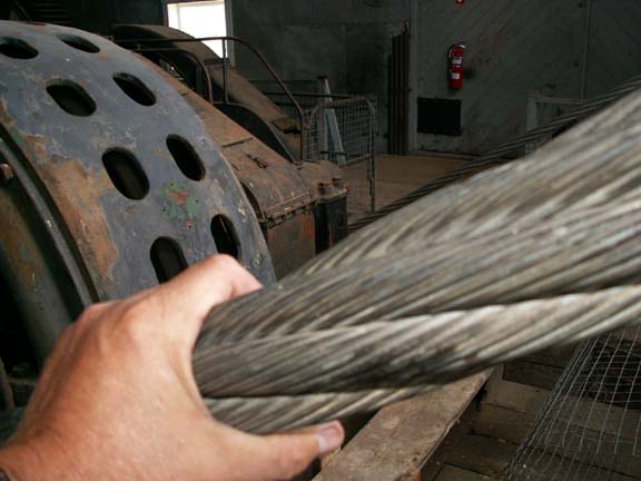
An idea as to the size of everything, this cable
runs all over the dredge and is contained on huge spools.
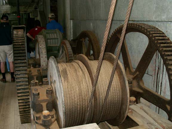
And, the size of the people compared to the gears.
The dredge was buried in ice and mud until rescued by the Canadian government. All the exposed items above the ice had disappeared but the items frozen in the ice remained intact. The machine shop and all the tools and many spare parts for the dredge were found after they removed the ice and mud.
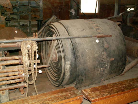
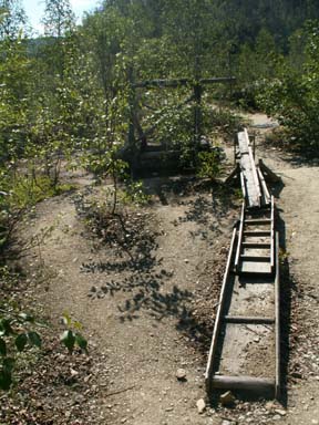
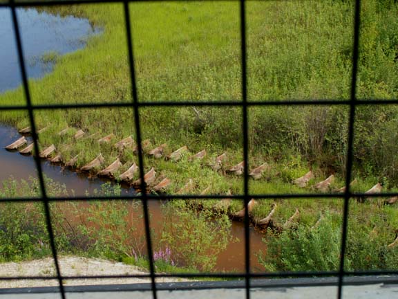 The
buckets were removed for maintenance each season. Due to flooding and the gold
prices falling the dredge was abandoned. The buckets lined up in the swamp next
to the dredge.
The
buckets were removed for maintenance each season. Due to flooding and the gold
prices falling the dredge was abandoned. The buckets lined up in the swamp next
to the dredge.
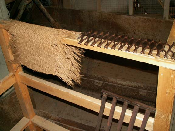
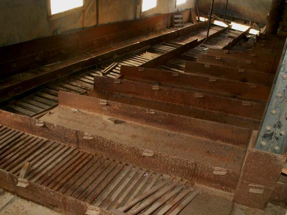
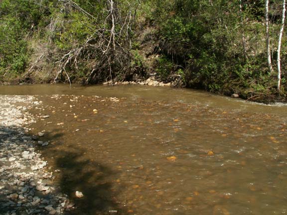
The gold is caught in the small grates, the large grates and the hemp mats. They were in the sloughs that sorted the 'heavy' gold from rock and water.
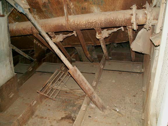
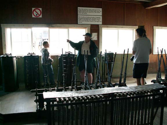 While
many men worked on the dredge, it could be operated by only four men. This
control room with its many levers rotated and moved the dredge forward.
While
many men worked on the dredge, it could be operated by only four men. This
control room with its many levers rotated and moved the dredge forward.
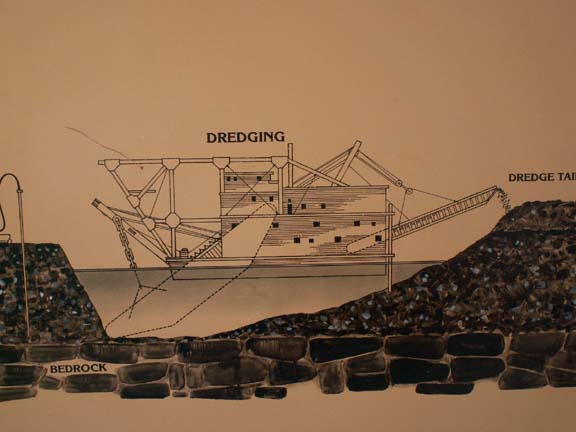
The entire dredge rotated to work the ground for gold. After it completed its swing, it moved forward about ten feet and worked some more. Thus, the 'tailing piles' all over town. And, that is why the discarded rock is piled in the shapes you see. The photograph down from Dome Drive really shows the pattern.
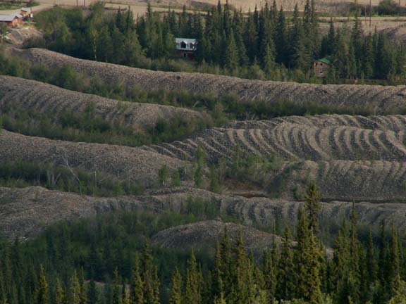
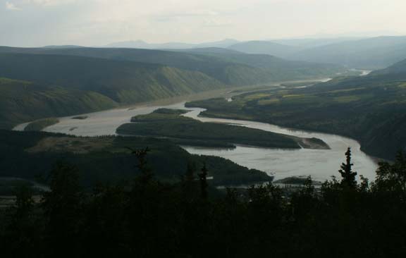
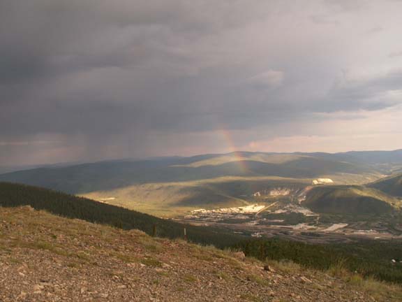
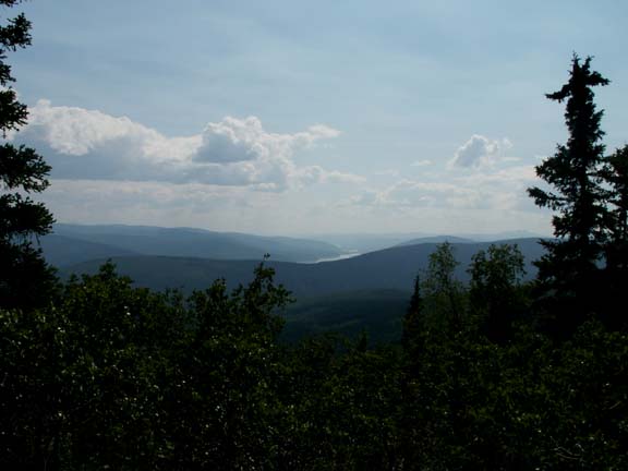
From Dome Drive you could also get a aerial view of Dawson City and where the Yukon and Klondike merged. While we were there a storm approached and dropped a few drops. And, showed us a rainbow.
 A
short distance down the road is where the original gold discovery was made -
Discovery Claim. It started the Klondike Gold Rush.
A
short distance down the road is where the original gold discovery was made -
Discovery Claim. It started the Klondike Gold Rush.
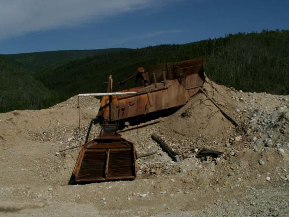
 It
was common to find gold when white channel gravel left by the glaciers was
present.
It
was common to find gold when white channel gravel left by the glaciers was
present.
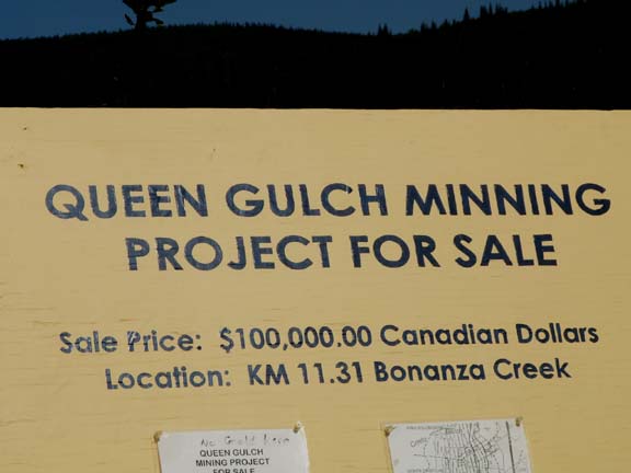
But don't despair. Opportunities are still available. This claim is for sale.
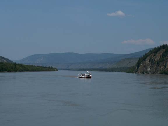
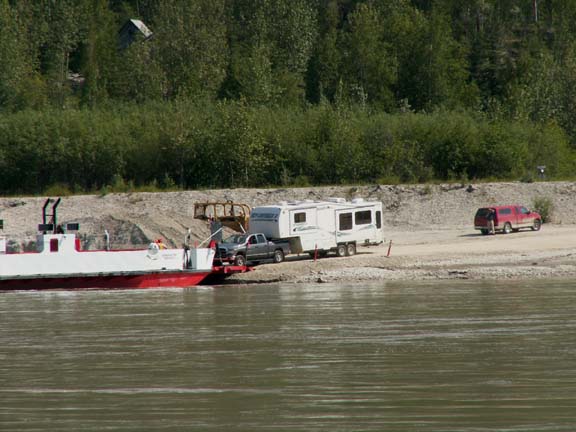
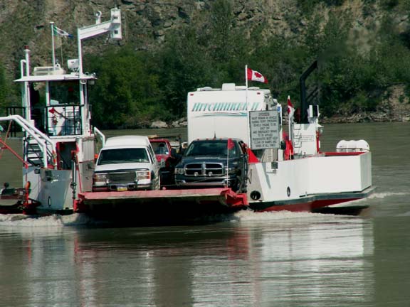
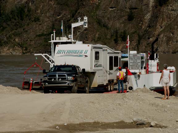
Leaving Dawson City was an experience. The only way across the
Yukon River is using the ferry. We were lucky enough to be behind several RVs
including a caravan group of 22 RVs. We had time to chat with a lot of other
people in line - no one was really in a hurry. It is part of the 'fun'. The
movement of the line was halted when a local vehicle arrived - locals had
priority. We were next in line when a tractor-trailer pulled up. We waited for
the next crossing. We waited three hours and fifty-five minutes for our eight
minute ride. 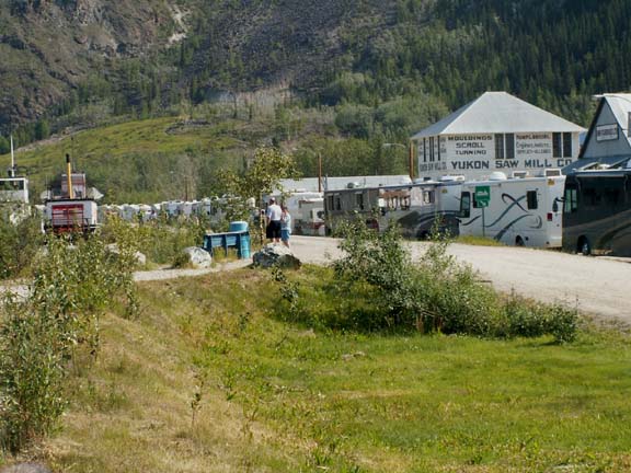
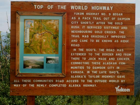
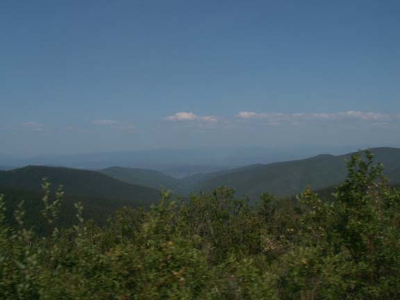
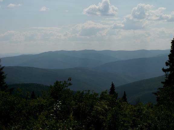
The Top of the World Highway
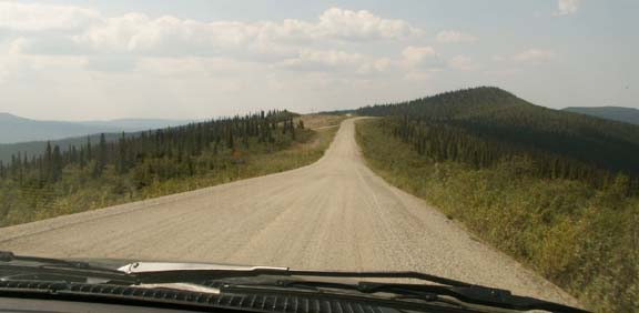 On
the Top of the World Highway when the asphalt deteriorated, they covered it with
gravel. It really wasn't too bad a road. You could safely travel 30 - 35 mph.
The scenery was again - fantastic.
On
the Top of the World Highway when the asphalt deteriorated, they covered it with
gravel. It really wasn't too bad a road. You could safely travel 30 - 35 mph.
The scenery was again - fantastic. 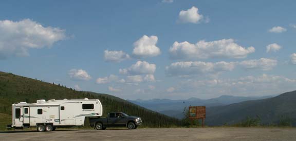
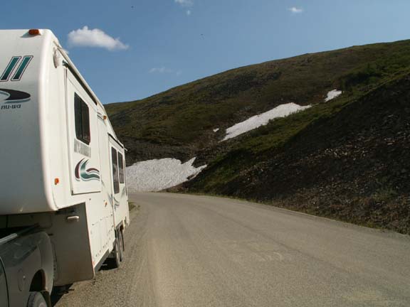
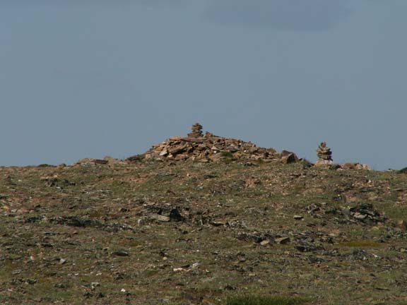
The marker for the highest elevation - 4,515 feet.
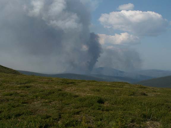 Our first view of a forest fire.
The USA customs building was not too impressive. But then, it was in a desolate area.

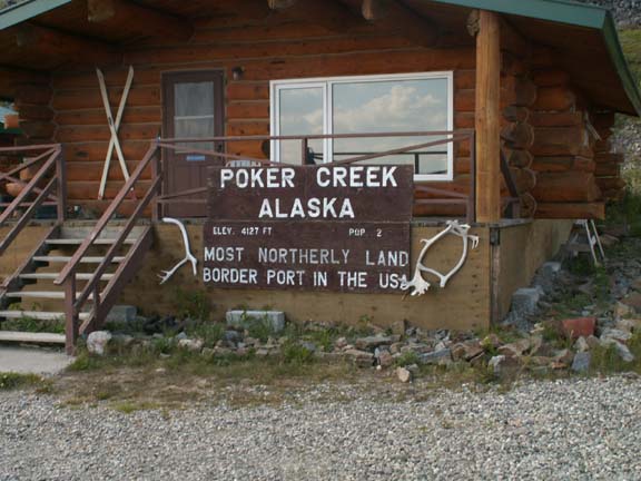
Poker Creek, Alaska is the most northerly land border port in
the USA.
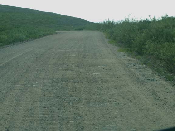
Immediately after crossing into Alaska, the road was rock and stone with a little dirt. Our speed dropped to 20-25mph. We had stopped so many times for photographs, almost everyone was ahead of us. We could drive slow and not hold anyone up.
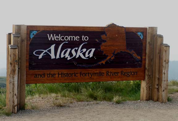
We realized, this is the second time we have been to Alaska.
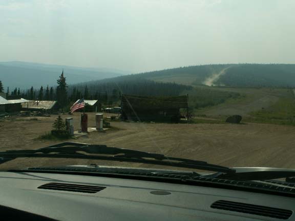 We
were through Boundary, Alaska so 'fast' we only had time to photograph the gas
station.
We
were through Boundary, Alaska so 'fast' we only had time to photograph the gas
station.
Or, maybe that's all there was. No, there was an air strip.
Go pack to Alaska Photo Album .