Seward - Alaska 2005
Updated: 11/30/08
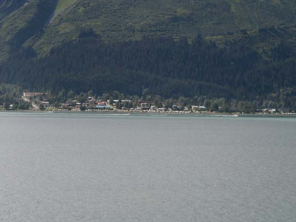
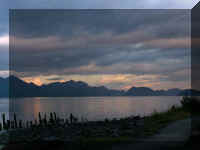
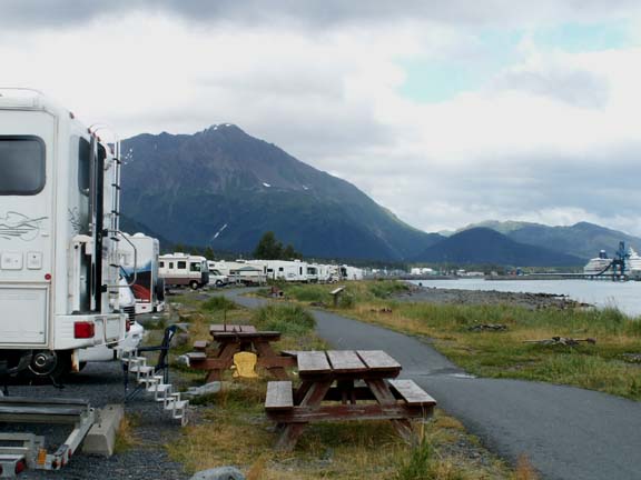
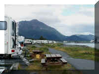 We arrived in Seward on a cloudy
day. The rain had ended and we had no trouble finding a campsite in the city
campground next to Resurrection Bay. The city turned the unstable land along the
shore of the bay that did not fall into the bay during the 1964 earthquake into
camping for visitors to the city.
We arrived in Seward on a cloudy
day. The rain had ended and we had no trouble finding a campsite in the city
campground next to Resurrection Bay. The city turned the unstable land along the
shore of the bay that did not fall into the bay during the 1964 earthquake into
camping for visitors to the city.
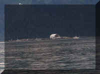
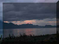
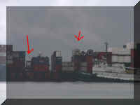
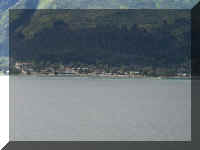 From
across the bay, the RVs parked along the shore look like little white dots.
From
across the bay, the RVs parked along the shore look like little white dots.
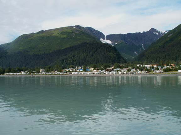
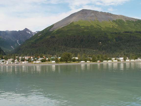
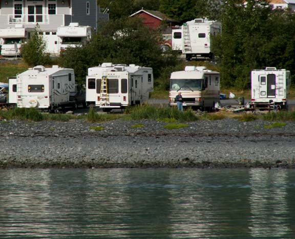
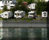
From the middle of the bay (in a boat), the RVs look bigger.
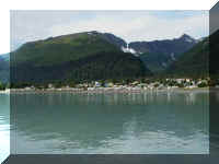
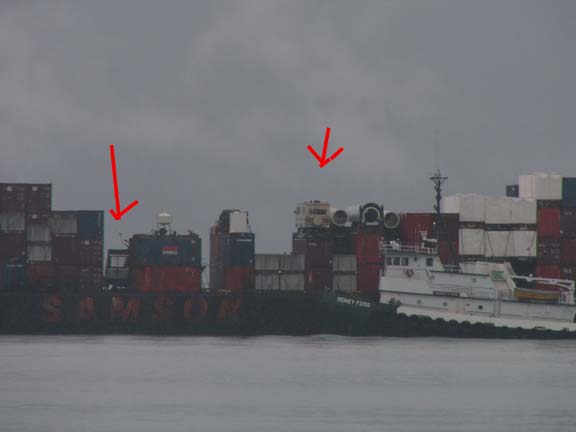
If it is blown up a little, you can see the HHII.
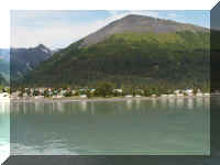
As you can see the land is not far above sea level.
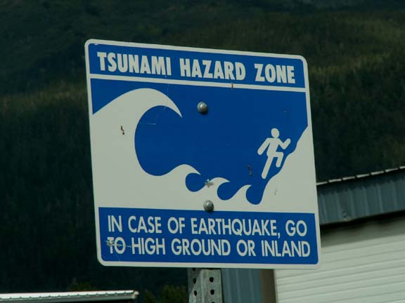
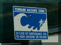
The is another town where Tsunami signs abound.
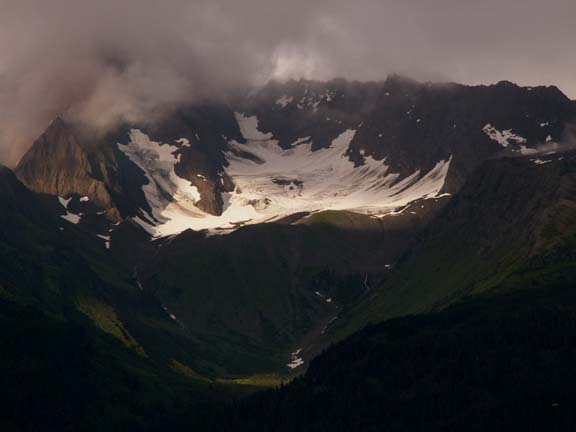
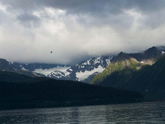
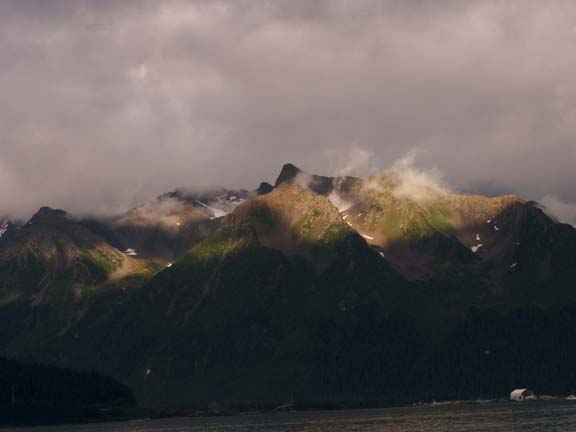
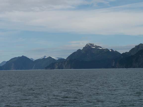
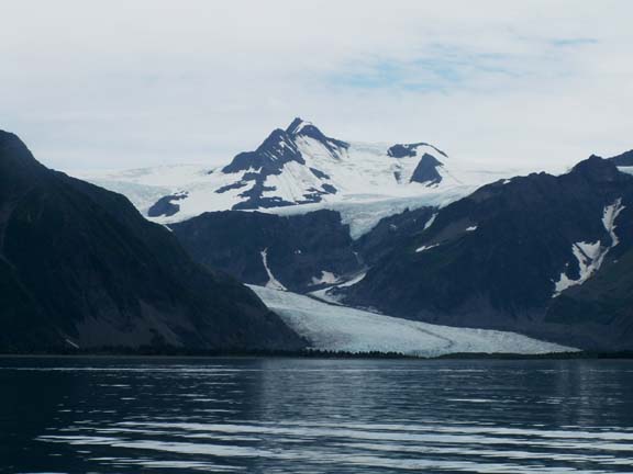
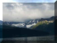
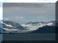
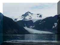
Our view across Resurrection Bay is great - mountains and
glaciers.
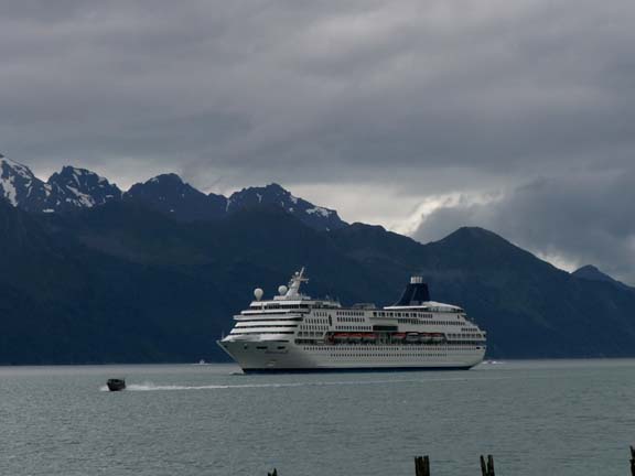
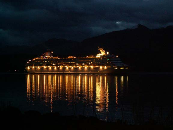
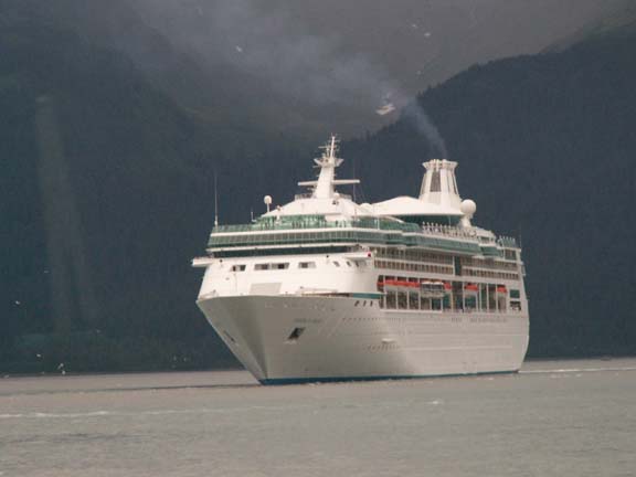
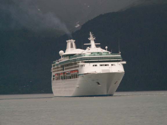
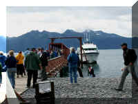
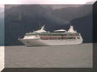
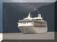
We had just finished setting up about noon when we saw a cruise
ship coming into the bay. Later, we talked to a couple from the cruise ship as
they walked behind our fifth wheel. They told us they have a class 'C' motorhome
and asked a lot of questions about our experiences. During our conversation,
they told us the ship was leaving at midnight. They must not have been on 'Alaska
Time'
- the ship left at 11:00pm.
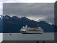

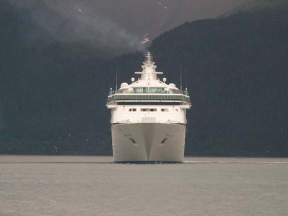
As the ship floated by, we talked again about how happy we are
to be traveling without structure and moving at our own pace.
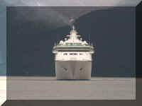
Do you notice how dark it is as the ship is departing? There has
been such heavy cloud cover the last few nights, it has been dark.
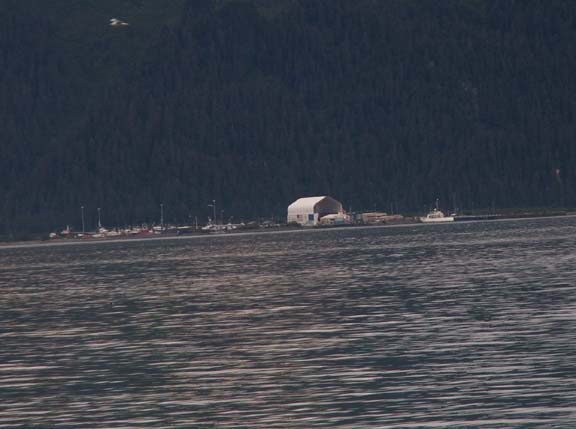
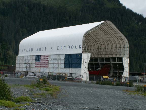
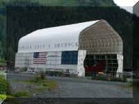
We drove to the other side of the bay to see what we were
looking at. It is a ship yard with a dry dock. There is also another city
campground - if you say it fast. It is a level gravel area that seems to be
popular with fisherman.
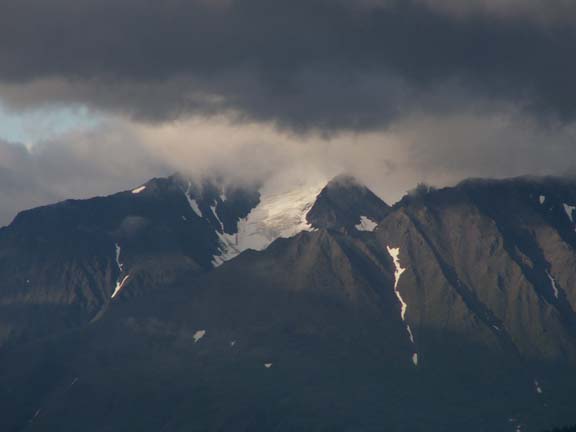
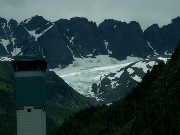
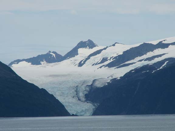
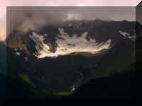
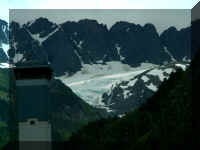
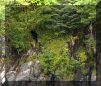
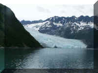
On the other side of the bay we found another glacier. The tower
in the foreground of the guard tower for the local maximum
security prison.
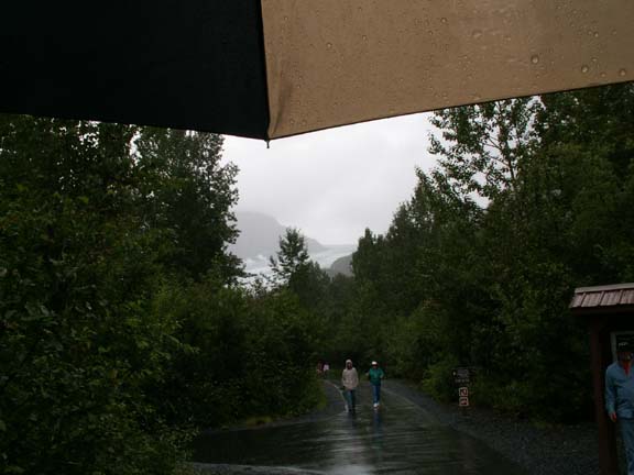
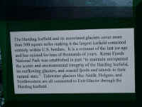
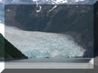
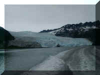
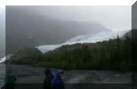
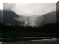 Even
though it looked like rain, we drove to Exit Glacier - the most accessible
glacier in the Kenai Fjords National Park. We got our first look at it along the
road as we drove the nine miles to the park. Exit Glacier is three miles long and
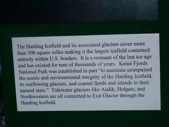
it is one of over 35 named glaciers flowing from the Harding Icefield. It is the
only road accessible area in the Kenai Fjords National Park.
Even
though it looked like rain, we drove to Exit Glacier - the most accessible
glacier in the Kenai Fjords National Park. We got our first look at it along the
road as we drove the nine miles to the park. Exit Glacier is three miles long and
it is one of over 35 named glaciers flowing from the Harding Icefield. It is the
only road accessible area in the Kenai Fjords National Park.
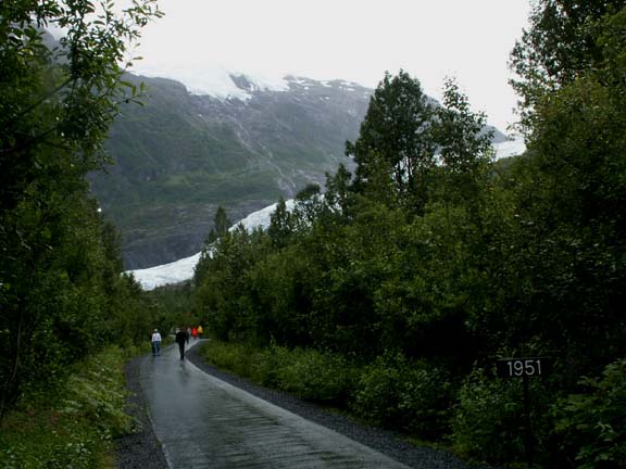
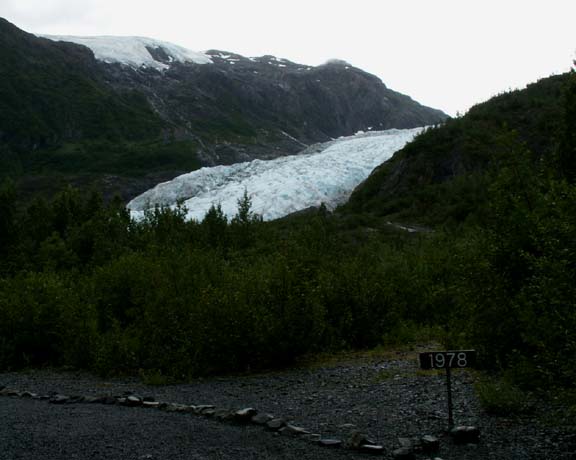
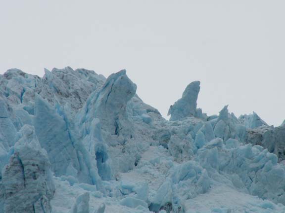
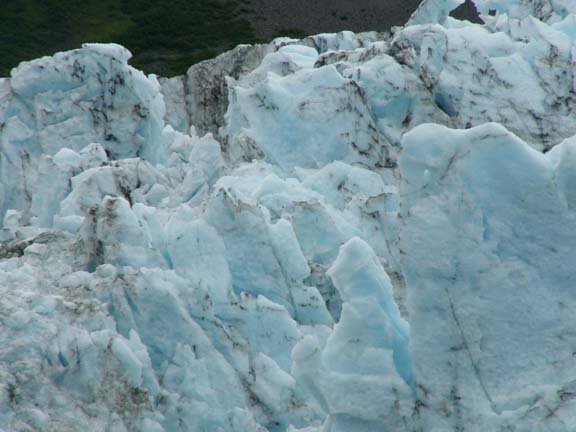
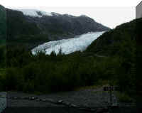
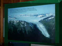
As you walked the trail, signs showed you where Exit Glacier was
in 1927, 1951 and 1978. You can see the Harding Icefield on the left ridge.
Because everything in Alaska is so massive,
we thought this information was worth posting.
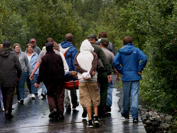
 They
say that glacier ice is unstable, unpredictable and very dangerous. Fred heard
or read that you can not go on it without a guide. As we were walking towards
Exit Glacier, this guy was being carried out due to an injury of some
kind.
They
say that glacier ice is unstable, unpredictable and very dangerous. Fred heard
or read that you can not go on it without a guide. As we were walking towards
Exit Glacier, this guy was being carried out due to an injury of some
kind.
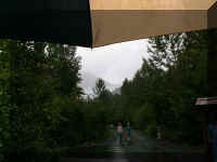
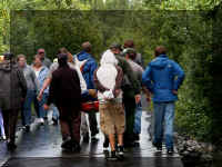
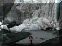
It was a misting rain when we arrived and raining hard as we approached
the glacier. The last half of the mile walk was muddy so we did not complete the
entire walk on our first visit.
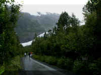
We went back to Exit Glacier and finish the walk to the
base on a day when it was just raining lightly.
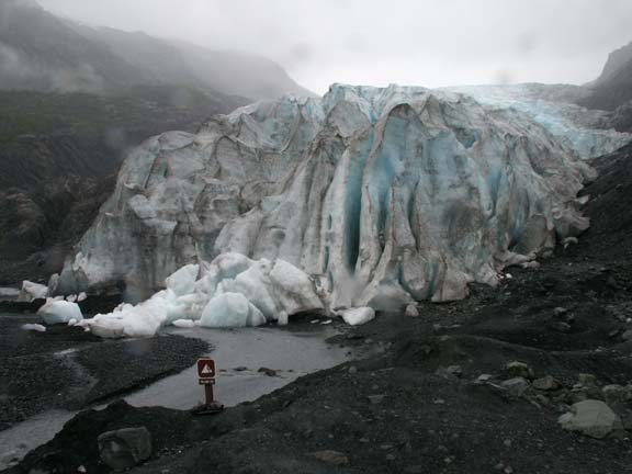
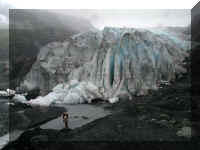
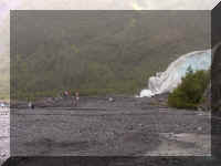 This
photograph lets you compare the front part of the glacier and the people for
size. Most of the time there is no size comparison to determine how massive
things are.
This
photograph lets you compare the front part of the glacier and the people for
size. Most of the time there is no size comparison to determine how massive
things are.
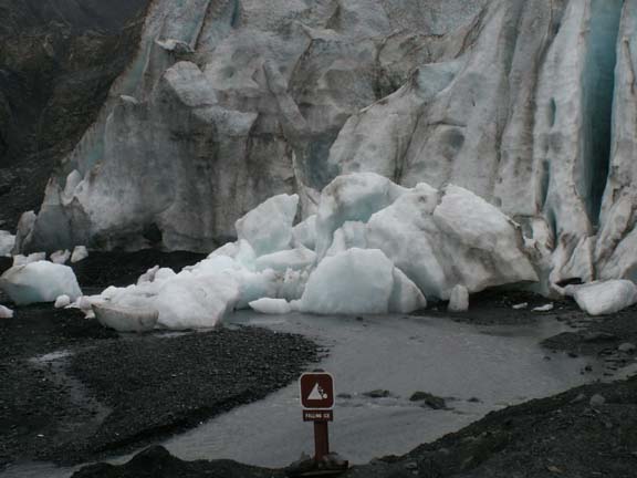
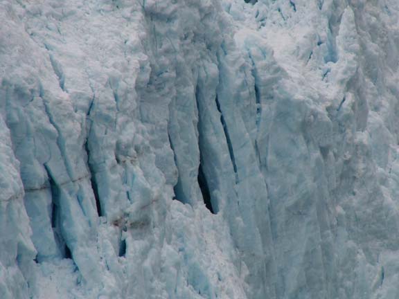
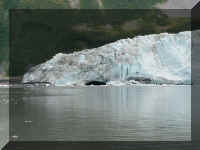
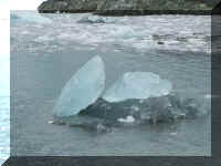
 The
story is that you used to be able to walk up to Exit Glacier and touch it or
walk on it. When someone was killed by chunks like these, people were no longer
allowed passed posted warnings signs.
The
story is that you used to be able to walk up to Exit Glacier and touch it or
walk on it. When someone was killed by chunks like these, people were no longer
allowed passed posted warnings signs.
This glacier did not make sounds like Aialik Glacier but is just
as dangerous.
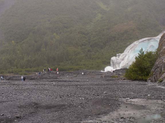
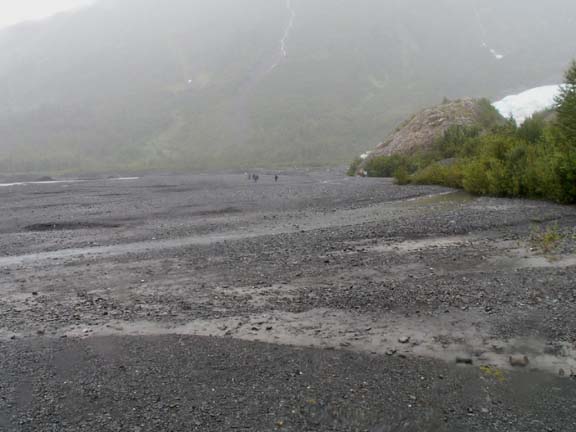
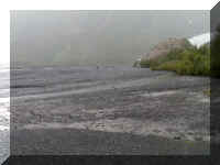 This
outwash plain results from the receding glacier. Water flows through, changing
its course and creating what is then called a braided river.
This
outwash plain results from the receding glacier. Water flows through, changing
its course and creating what is then called a braided river.
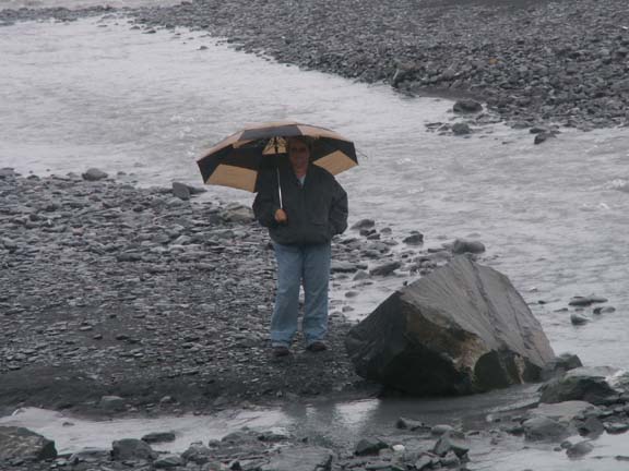
 Mary Lou waited for Fred back a ways from the glacier.
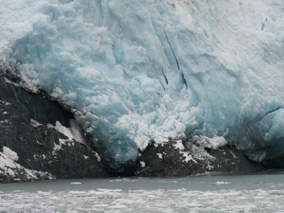
This what we came back to see. Exit Glacier from its base. The
face had deep grooves in it and it is not as clean looking as we expected.
If you got to these Exit
Glacier photographs using the link at the end of this page, you are finished
with this page.
If you are a new visitor to
this page, please continue.
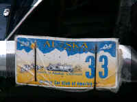
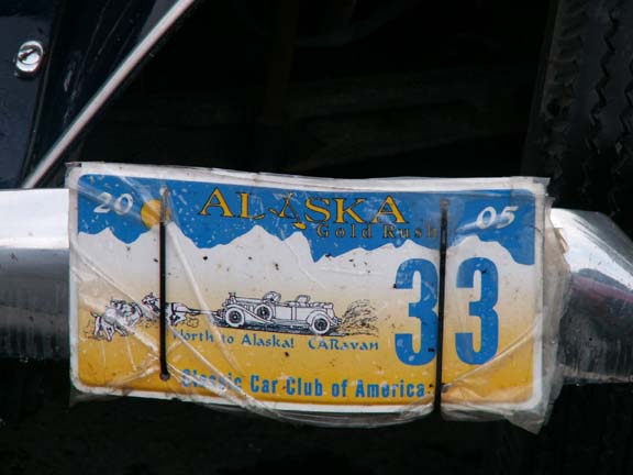
We had been seeing vintage cars around Seward.
This license plate explains that the Classic Car Club of America
was on a North to Alaska CARavan.
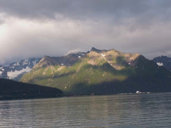
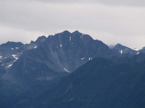
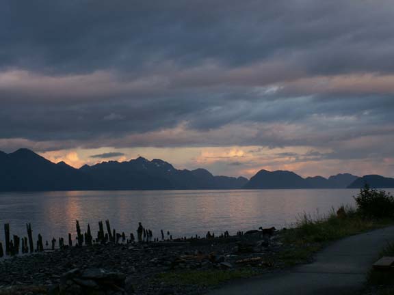
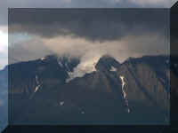
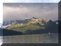
As the sun sets, the shadows make the mountain across from us
look even more interesting.
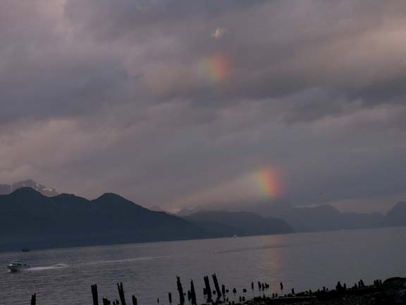
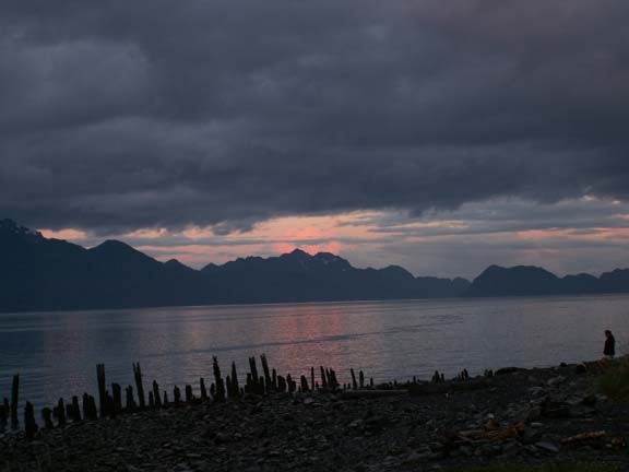
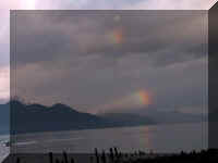 Looking
down the bay towards the ocean, we spotted a broken rainbow.
Looking
down the bay towards the ocean, we spotted a broken rainbow.
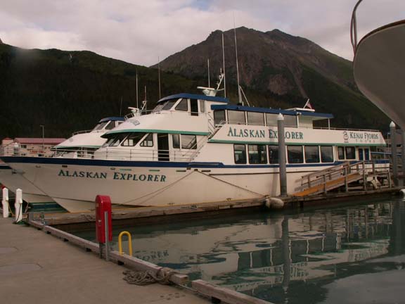
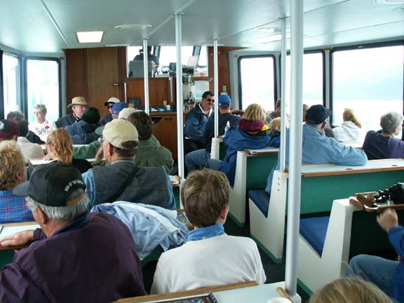
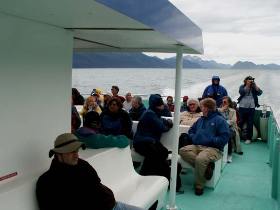
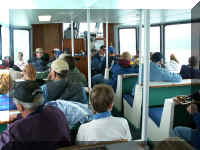
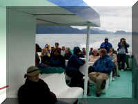
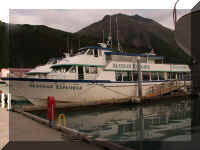 Our
big adventure in Seward was our 8.5 hour Kenai Fjords National Park Tour on a
tour boat. We were on the top deck so Fred could move around to make
photographs. We sat outside behind the cabin with a roof over our heads in case
it rained - great seats.
Our
big adventure in Seward was our 8.5 hour Kenai Fjords National Park Tour on a
tour boat. We were on the top deck so Fred could move around to make
photographs. We sat outside behind the cabin with a roof over our heads in case
it rained - great seats.
 The
boat has two Caterpillar diesel engines developing over 3,500 horsepower. It was
big enough to carry 150 people and could cruise at 25 MPH.
The
boat has two Caterpillar diesel engines developing over 3,500 horsepower. It was
big enough to carry 150 people and could cruise at 25 MPH.
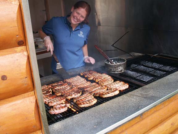
Our cruise included a halibut or chicken lunch on the boat and
an
all-you-can-eat salmon dinner on Fox Island on the way back to Seward
The cost for our tour was $145 per person. They offered shorter
tour and there are several tour companies. Our was with Kenai Fjords Tours. It
was great.
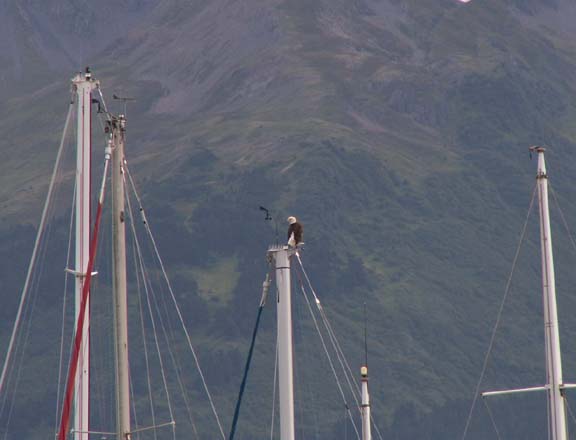
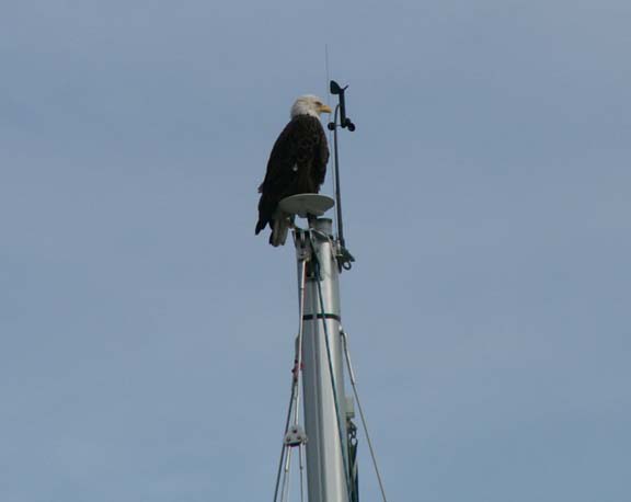
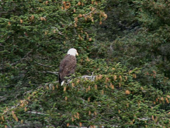
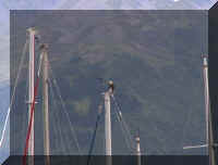
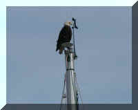
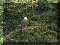
Before we left the dock, everyone rushed to the left (port) side
of the boat. An eagle was sitting on a boat mast. No matter how many eagles you
see, they are spectacular.
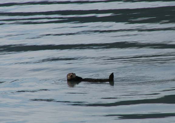
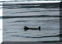 We
were barely underway when the boat stopped. This little guy was leisurely
swimming along. We have noticed that on the bus tour in Denali and this tour
that the operators are very respectful of the wildlife. Providing you a look at
them but not interfering with the habitat more than necessary.
We
were barely underway when the boat stopped. This little guy was leisurely
swimming along. We have noticed that on the bus tour in Denali and this tour
that the operators are very respectful of the wildlife. Providing you a look at
them but not interfering with the habitat more than necessary.
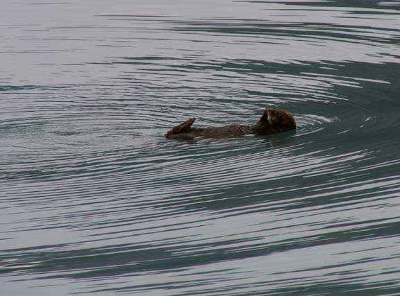
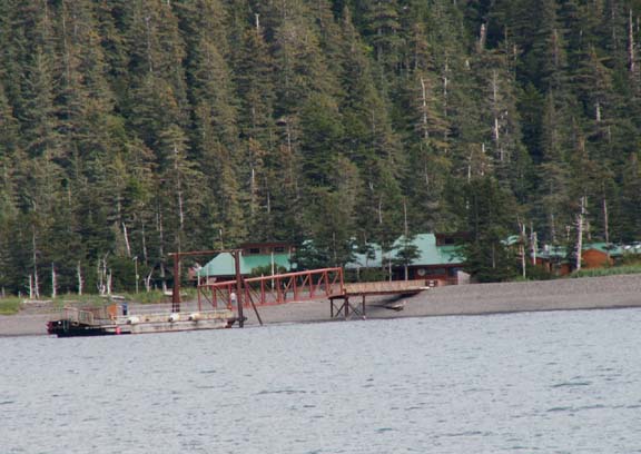
Later in the trip, we stopped for another. 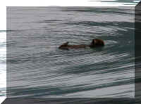
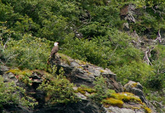
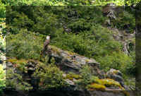
 Just
another short time under power from the first sea otter, we stopped again. There were two eagles in
the trees along shore. They allow time in the tour for several stop at
predetermined locations and at impromptu location for wildlife viewing.
Just
another short time under power from the first sea otter, we stopped again. There were two eagles in
the trees along shore. They allow time in the tour for several stop at
predetermined locations and at impromptu location for wildlife viewing.
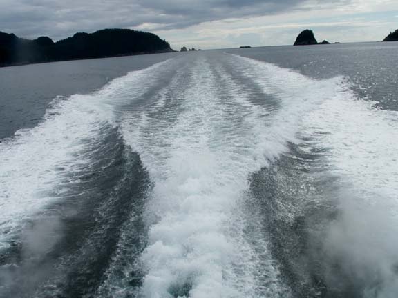
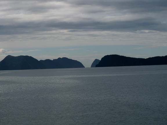
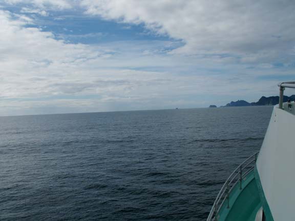
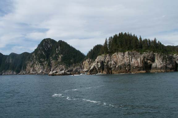
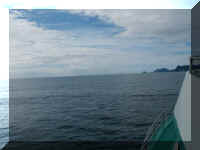
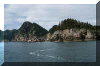
Then we headed for open water. Looking ahead at the various
islands, you could see the openings to the Bay of Alaska.
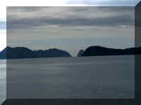
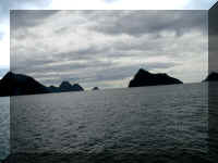
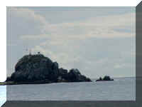 Pilot Rock is the home of
several navigation aids. Weather and sea
conditions are transmitted to a satellite, the information can then be accessed
via the internet at any time.
Pilot Rock is the home of
several navigation aids. Weather and sea
conditions are transmitted to a satellite, the information can then be accessed
via the internet at any time.
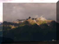
While it was a cloudy day, some glimpses of blue sky were
visible.
 After
we reached open water the captain announced that in front of us was the longest
stretch of open ocean heading to Hawaii and beyond.
After
we reached open water the captain announced that in front of us was the longest
stretch of open ocean heading to Hawaii and beyond.
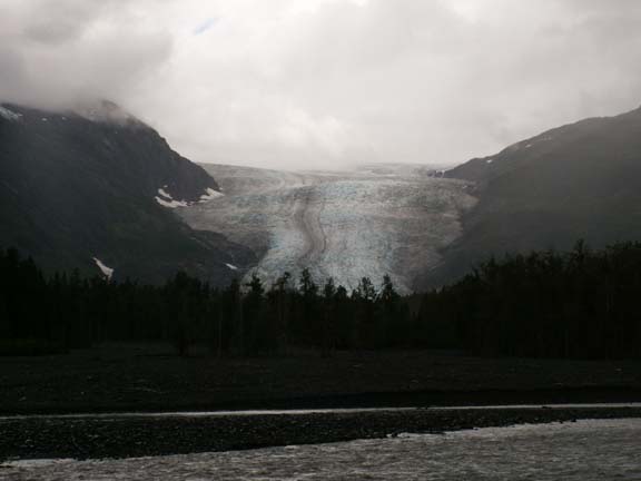
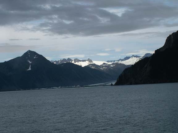
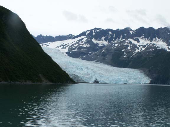
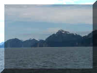
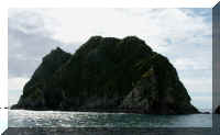
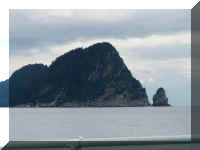
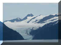
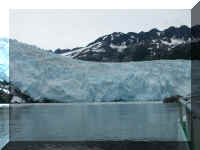
 Bear
Glacier is on the outside edge of the park just before reaching the Aialik
Peninsula.
Bear
Glacier is on the outside edge of the park just before reaching the Aialik
Peninsula.
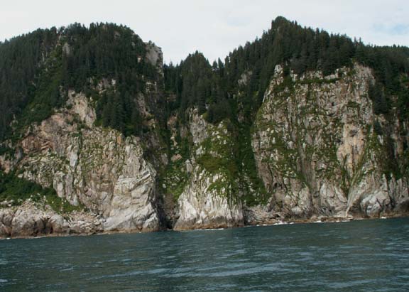
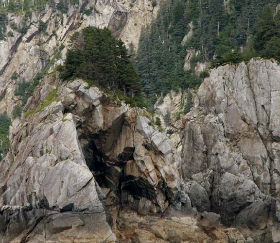
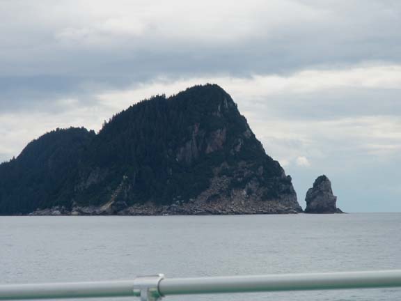
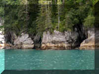
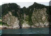
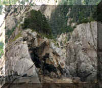
The shore along the Aialik Peninsula of Kenai Fjords National
Park provided some beautiful
views. The jagged rocks ... and ... how do those trees grow in rock?
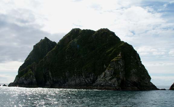
Use your imagination . . . this ridge looks like a sea
shell or fan.
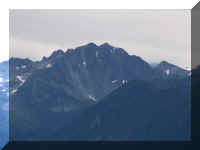
We will call these 'big' and 'little' mountains. How big is the
little one?
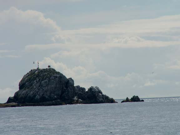
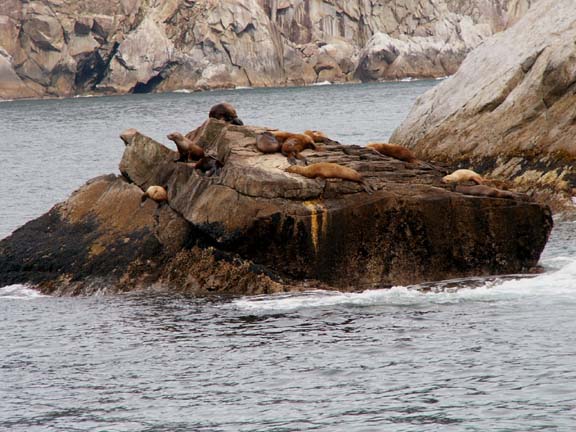
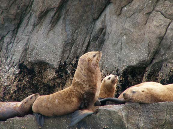
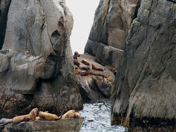
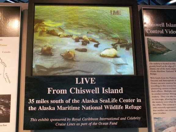
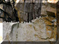
Sea lions were numerous, we saw big groups of them on two
occasions. This is the group at Chiswell Island.
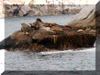
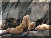
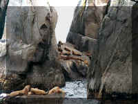
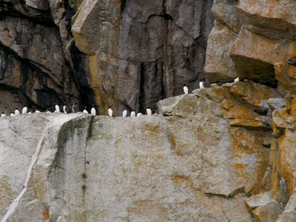
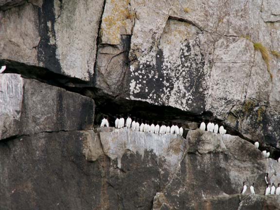
These sea lions had to share their rocks with a whole bunch of
sea birds. Every rock ledge was filled with birds and hundreds were flying
around. Too many to count!
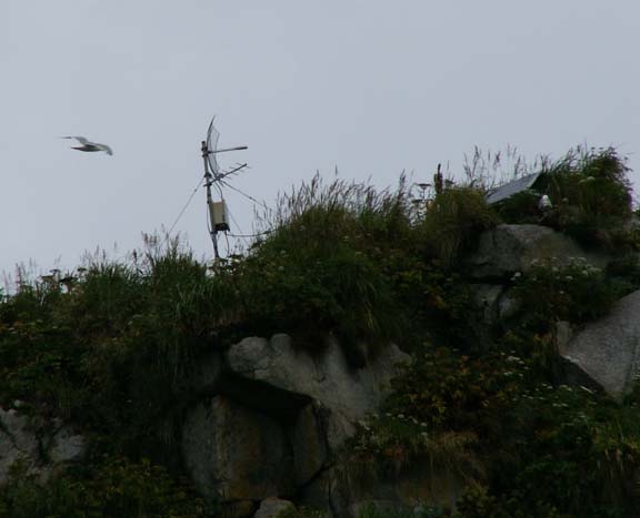
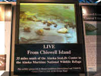
The Alaska Sealife Center has a remote video cam installed on
Chiswell Island to observe the rookery. The next day, we watched a live broadcast from
Chiswell Island at the center.
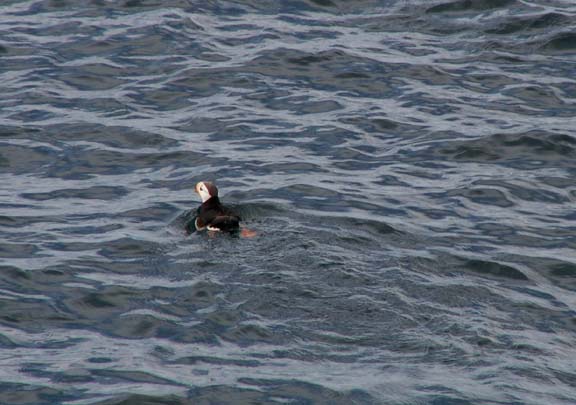
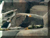
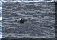 The
little Puffins are everywhere.
The
little Puffins are everywhere.
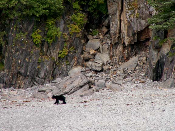
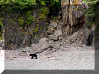 This
bear was at the beach. It was probably fishing before we arrived. It wandered
the beach for quite a while then decided to go up the mountain and into the
trees.
This
bear was at the beach. It was probably fishing before we arrived. It wandered
the beach for quite a while then decided to go up the mountain and into the
trees.
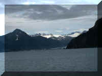
As we turned and headed into Kenai Fjords National Park, we
could see glaciers in front of us. As you travel the views of the glaciers
change as mountains in front of them obstruct part of the view.
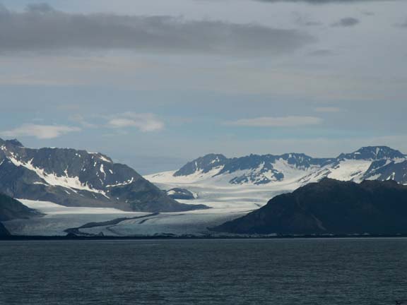
Holgate Glacier
Pederson Glacier
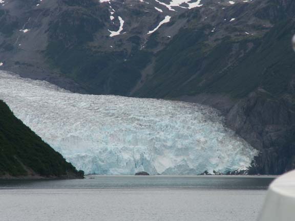
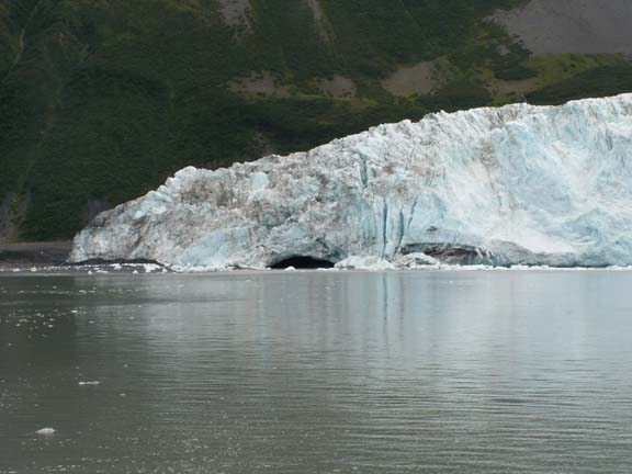
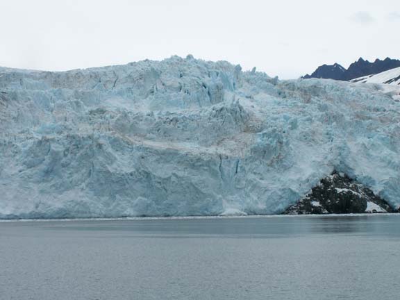
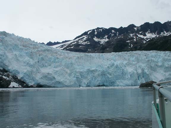
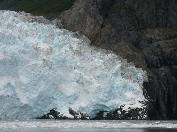
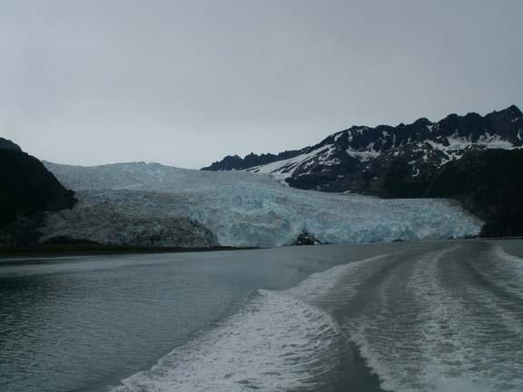
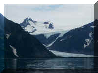
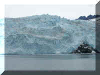
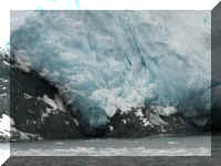
Continuing deeper into the park, we approached Aialik Glacier.
As you got closer, you realized how large this glacier was.
The boat could get no closer than a quarter mile and drifted away quickly.
At its face, the Aialik Glacier is about 1.5 miles wide and 500 feet high.
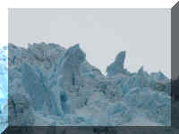
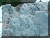
This is the glacier closer ...
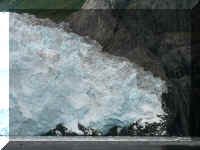
And some random views ...
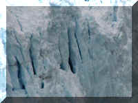
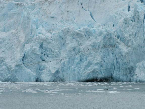
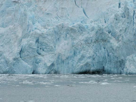
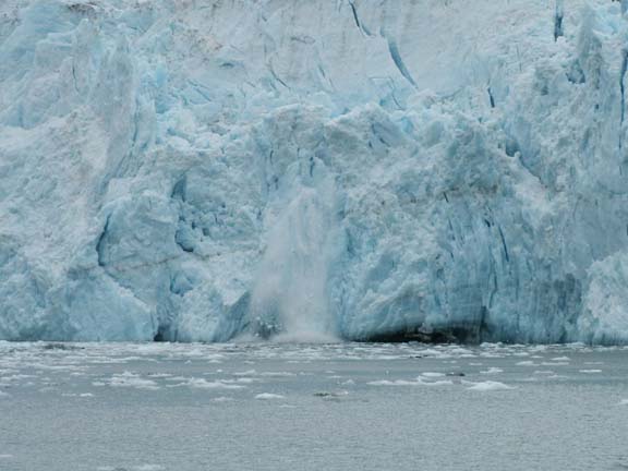
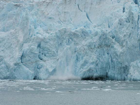
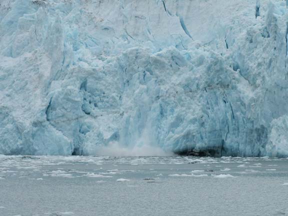
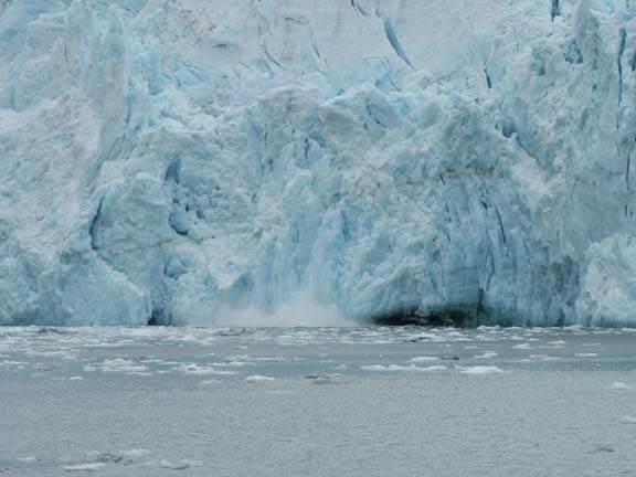
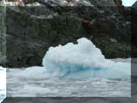
We parked at Aialik Glacier for a half hour and heard the
thunderous sounds a tide water glacier makes. The captain said we were fortunate
to see so much calving - the pieces falling off the glacier seemed small to us
due to the fact that the boat was always at least a quarter mile from the
glacier. The following photographs of one of the calvings are not thumbnailed so
you can see it. (For 'low-tech' animated - click on the first photograph,
use your down arrow key fast, you can see the change.)
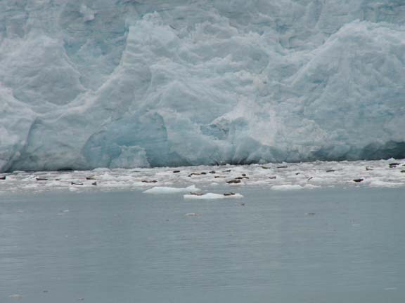
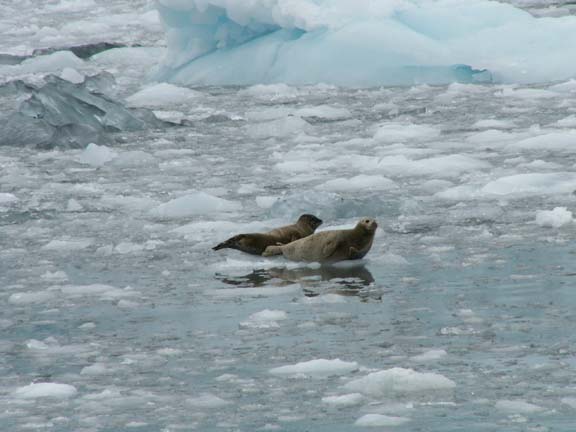
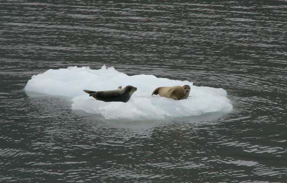
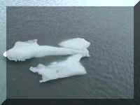
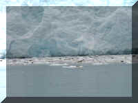 Mary
Lou wanted Fred to take a photograph of the harbor seals in the slush. It
appeared that way to us because of the distance - they were really laying in
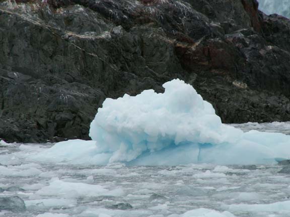
chunks of ice. Some of the harbor seals floated near the boat.
Mary
Lou wanted Fred to take a photograph of the harbor seals in the slush. It
appeared that way to us because of the distance - they were really laying in
chunks of ice. Some of the harbor seals floated near the boat.
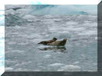
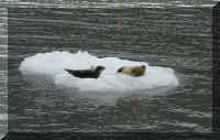
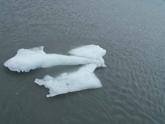
You just know it is fantastic viewing when Fred thinks the ice
is beautiful.
We had to leave another
tour boat was approaching.
The captain took us by some of the remaining sights as we
turned for Seward.
Cascade Falls
Elephant Rock
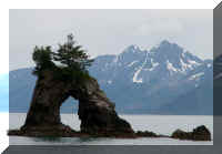
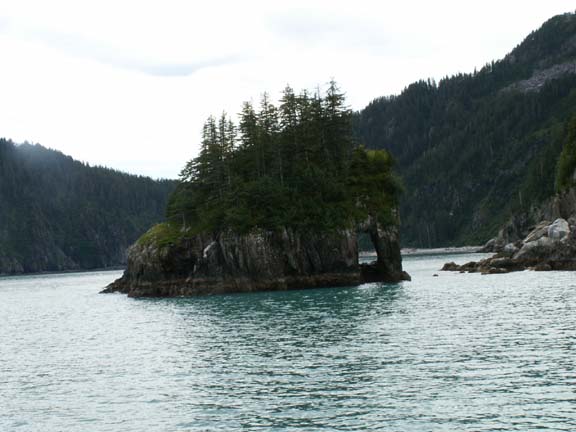
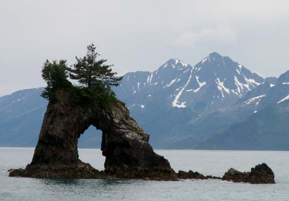
Sea
Arch
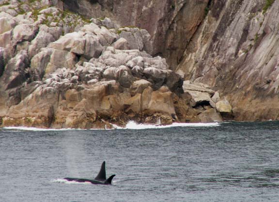
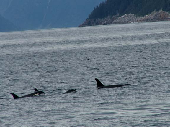
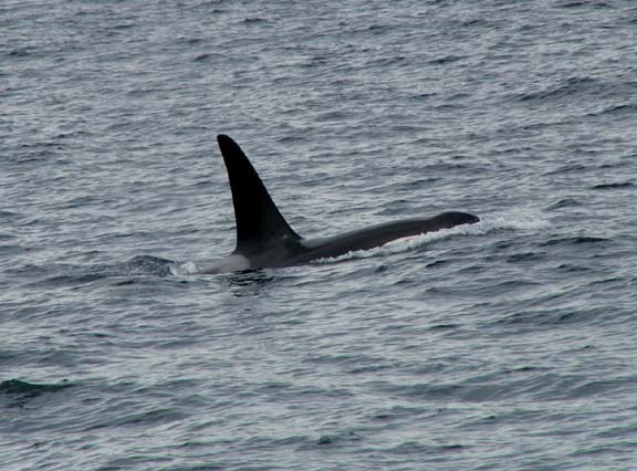
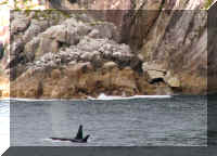
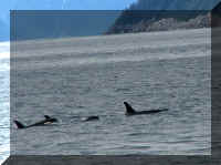
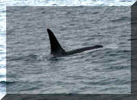
The captain had shown everything on the tour and was heading for
Fox Island when had received a radio communication from another boat that they
had spotted Orca Whales (Killer Whales). He told us we were changing direction
to see them.
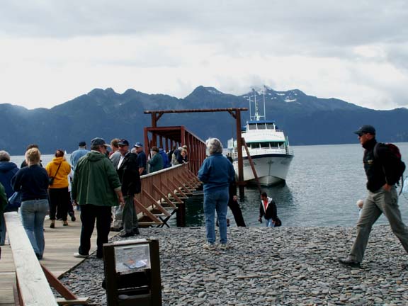
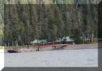
Lunch was served on the boat and the all-you-can-eat salmon
dinner was served on Fox Island. We had an hour on shore for dinner and two toots
of the horn told us it was time to board the boat again.

 It was a great day that
ended at 6:30pm. It was a pleasant weather day with some sunshine and,
importantly, no
rain.
It was a great day that
ended at 6:30pm. It was a pleasant weather day with some sunshine and,
importantly, no
rain.
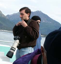
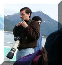
At the end of the day, Fred was glad he did not lug around a camera
setup like this around the boat all day.
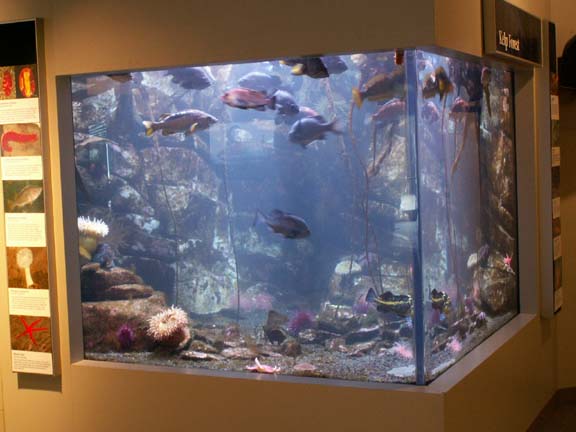
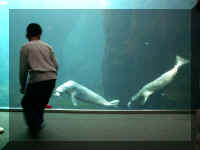
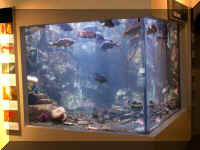 The
next day we visited the Alaska SeaLife Center in Seward. It is relatively new
(1998) and small in size. It promotes public and ecological understanding.
Admission is $14 per person.
The
next day we visited the Alaska SeaLife Center in Seward. It is relatively new
(1998) and small in size. It promotes public and ecological understanding.
Admission is $14 per person.
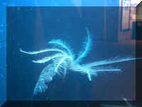
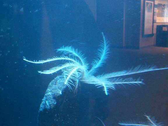
Feather Stars
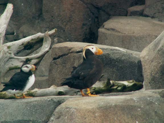
Puffin
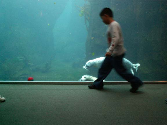
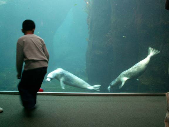
This boy was playing with the harbor seals. He was rolling a
ball in front of the tank. they were trying to get it.

If you are going as a casual visitor, you may be disappointed.
The focus of this facility is research and wildlife rehabilitation. There is a
strong element of public education, including excellent hands-on exhibits for
children and adults. They offer Behind-the-Scenes Tours, and frequent
presentations through the day.
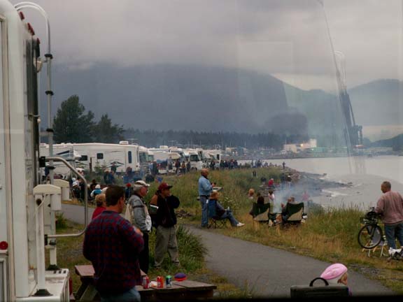
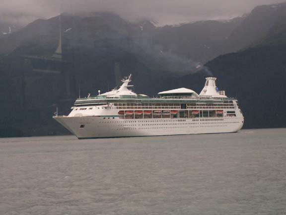
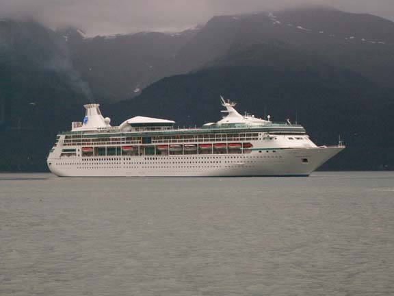
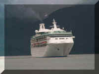
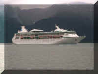
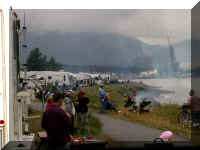 We
are not saying that the activity level is low in Seward ... but ... all the
people came outside to watch a cruise ship turn around in the bay.
We
are not saying that the activity level is low in Seward ... but ... all the
people came outside to watch a cruise ship turn around in the bay.
We found time in our busy schedule to photograph the
event.
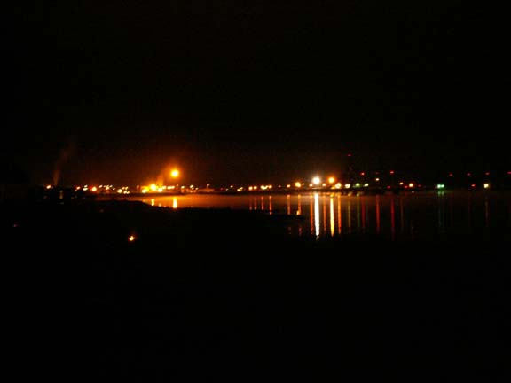
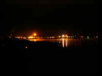
Later that night ... looking out the bay towards the Bay of
Alaska.
And even later that night, the small boat harbor
... 
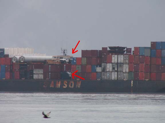
The next day, even in the rain, camping at the edge of the bay
was interesting. A barge loaded with cargo, including a motorhome, a truck with
a snow plow and a boat, passed our window.
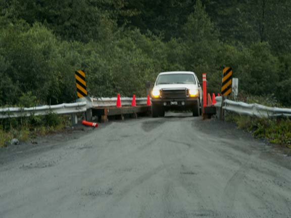
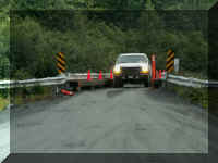 After
hiding in the HHII from the rain all day, we headed out to the Miller's Landing
campground on Lowell Point about 7:30pm. It was three miles of narrow winding road
between the bay and the mountain. We were amazed how much traffic we
encountered. Believe it or not, people take their RVs over this bridge.
After
hiding in the HHII from the rain all day, we headed out to the Miller's Landing
campground on Lowell Point about 7:30pm. It was three miles of narrow winding road
between the bay and the mountain. We were amazed how much traffic we
encountered. Believe it or not, people take their RVs over this bridge.
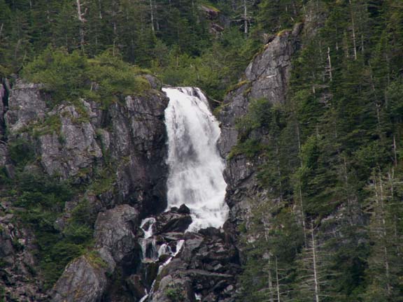
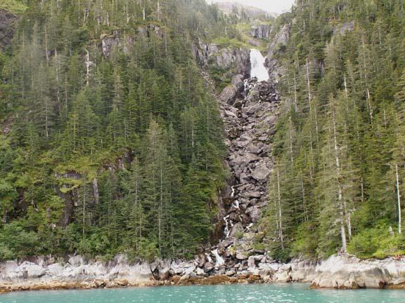
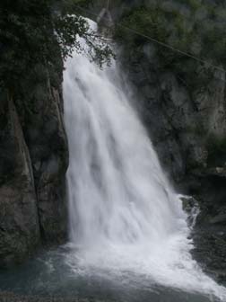
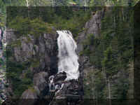
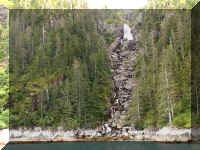
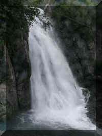 We
found this waterfalls along the road. Because it had no name, we named it
Surprise Falls. It was in a very old and commercial area and a waterfall was a
pleasant sight.
We
found this waterfalls along the road. Because it had no name, we named it
Surprise Falls. It was in a very old and commercial area and a waterfall was a
pleasant sight.
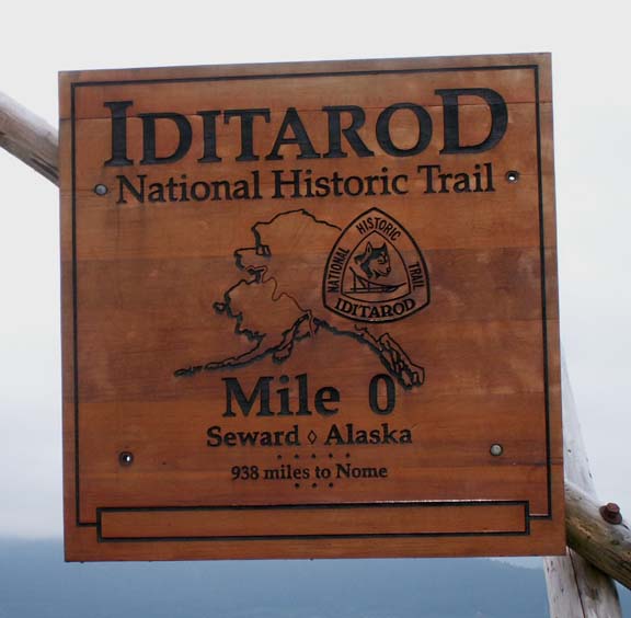
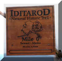 The
marker for Mile "0" of the Idiarod National Historic Trail is in one
of the city's campgrounds. The trail was originally. a mail route between Seward
and Nome. The sled dogs were replaced by an airplane in 1924.
The
marker for Mile "0" of the Idiarod National Historic Trail is in one
of the city's campgrounds. The trail was originally. a mail route between Seward
and Nome. The sled dogs were replaced by an airplane in 1924.
The Iditarod race we hear about now, runs from Anchorage to Nome
each March.
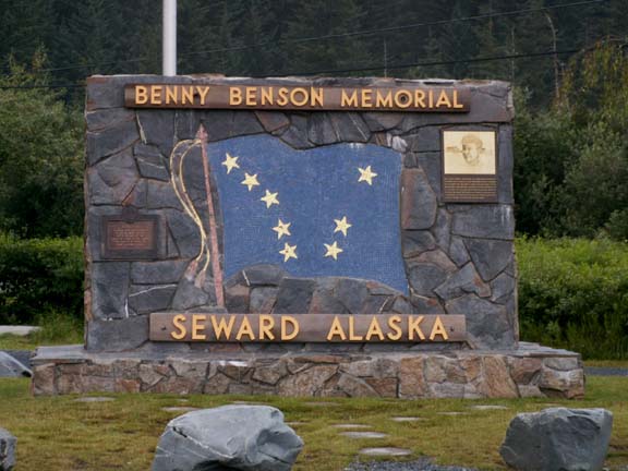
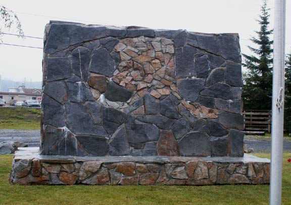
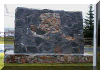
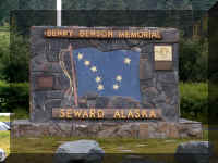 The 13 year old,
Alaska Native boy from Chignik, who designed the Alaska flag in 1927 is
memorialized here. Mary Lou noticed, that they used stones to form the shape of
Alaska on the rear of the marker.
The 13 year old,
Alaska Native boy from Chignik, who designed the Alaska flag in 1927 is
memorialized here. Mary Lou noticed, that they used stones to form the shape of
Alaska on the rear of the marker.
Benson explained the design of the flag: The blue field is for
the Alaska sky and the forget-me-not, an Alaska flower (now the official state
flower). The North Star is the future state of Alaska, the most northerly of the
union. The Big Dipper is for the Great Bear, symbolizing strength.
The first unfurling of the Alaska flag took place at the
dedication of the Jesse Lee Home in Seward on July 9, 1927.
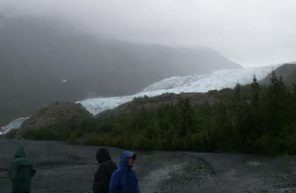
 In
spite of the continuing light rain, we went to Exit Glacier about 2:30pm. It was
raining there also but just the light variety, nothing like it was the first
time we were there. This time, we finished the walk and got to the base of the
glacier. As you can see from the attire of the people in the foreground, it was
not a great day.
In
spite of the continuing light rain, we went to Exit Glacier about 2:30pm. It was
raining there also but just the light variety, nothing like it was the first
time we were there. This time, we finished the walk and got to the base of the
glacier. As you can see from the attire of the people in the foreground, it was
not a great day.
If you are revisiting
this page and passed by Exit Glacier , this link
will return you there to view additional photographs from our second visit.
We enjoyed our time in Seward. Watching the watercraft on
Resurrection Bay helped filled some rainy days. We realize now, after four days of rain, how fortunate we were
to have a dry day for the boat tour.
Return to Kenai
Peninsula, a few days
Go back to Alaska Photo Album
.
Top of Page

 We arrived in Seward on a cloudy
day. The rain had ended and we had no trouble finding a campsite in the city
campground next to Resurrection Bay. The city turned the unstable land along the
shore of the bay that did not fall into the bay during the 1964 earthquake into
camping for visitors to the city.
We arrived in Seward on a cloudy
day. The rain had ended and we had no trouble finding a campsite in the city
campground next to Resurrection Bay. The city turned the unstable land along the
shore of the bay that did not fall into the bay during the 1964 earthquake into
camping for visitors to the city.