Kenai Peninsula, a few days - Alaska 2005
Updated: 11/30/08
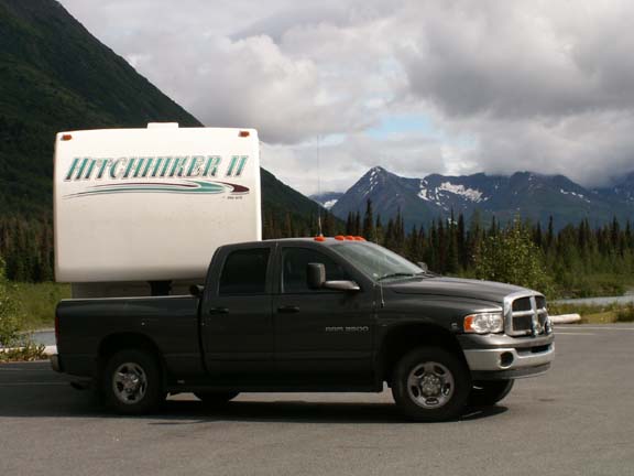
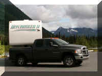
 We
had an interesting experience when we got up in the morning to go to the Kenai
Peninsula. Fred parked the truck behind the HHII when we returned from dinner so
we could keep our eye on it during the night. Early in the morning, someone
parked in front of the HHII so we could not hitch up to leave. With the help of
a very cooperative police officer, the owner was located and the vehicle moved.
We were on our way.
We
had an interesting experience when we got up in the morning to go to the Kenai
Peninsula. Fred parked the truck behind the HHII when we returned from dinner so
we could keep our eye on it during the night. Early in the morning, someone
parked in front of the HHII so we could not hitch up to leave. With the help of
a very cooperative police officer, the owner was located and the vehicle moved.
We were on our way.
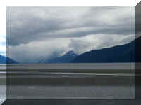
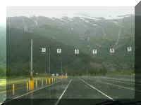
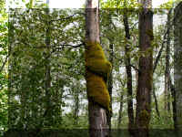
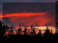
We are told Anchorage has milder summers and winters than Michigan. They
also are only a short drive from very beautiful scenery. The road into the Kenai
Peninsula carries a lot of traffic and they post signs that if more than five
vehicles are following you to use the pull-offs and let them pass. It is old
views for locals but we wondered why the speed was 55 and 65 on a two-lane road
in such a beautiful area.
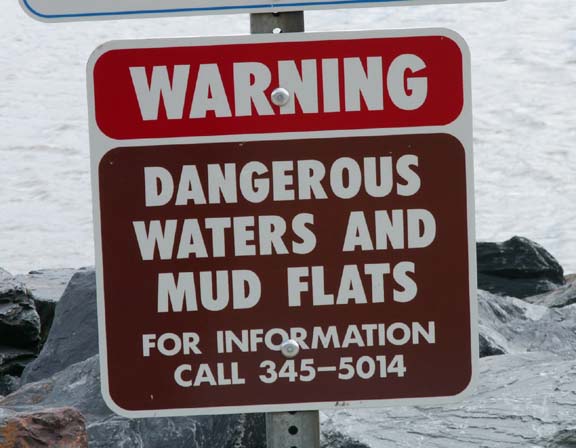
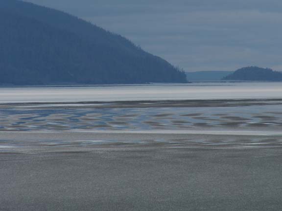
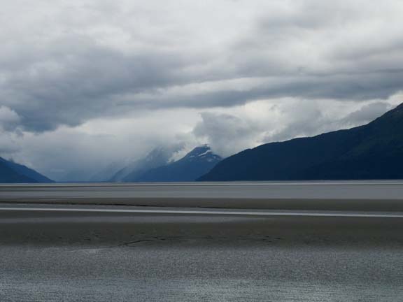
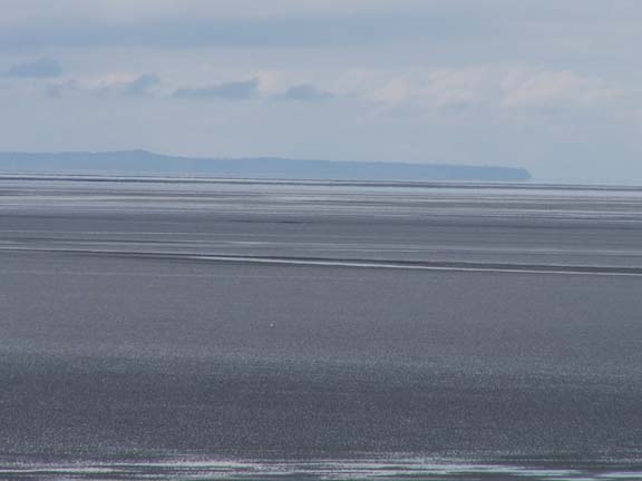
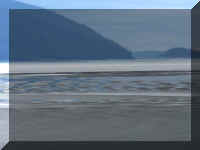
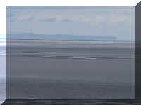
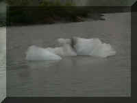
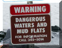 The
mud flats are very dangerous. If you stand on them and wiggle a little, you will
sink - almost like quicksand.
The
mud flats are very dangerous. If you stand on them and wiggle a little, you will
sink - almost like quicksand.
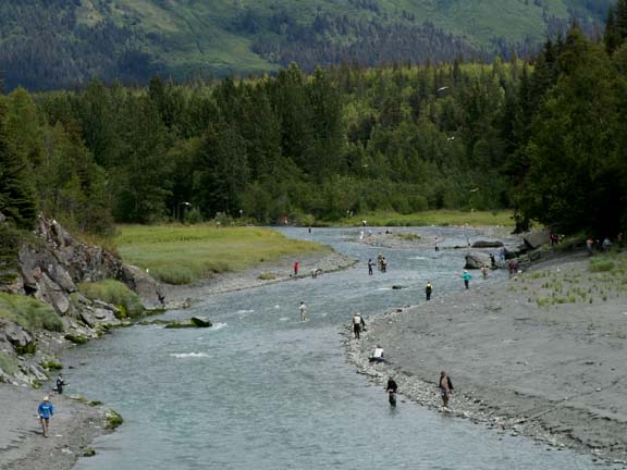
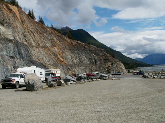
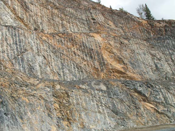
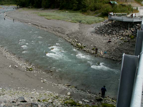
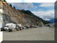
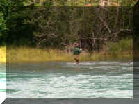
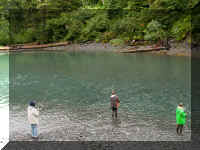
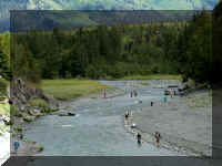 Bird
Creek was our first look at fishermen in action. Judging from the parking area
it is a very popular location. The state had to blast away a lot of rock for
this relatively new parking area. Again, so close to Anchorage, it would be an
evening, after work, event. The water is fast moving and very picturesque.
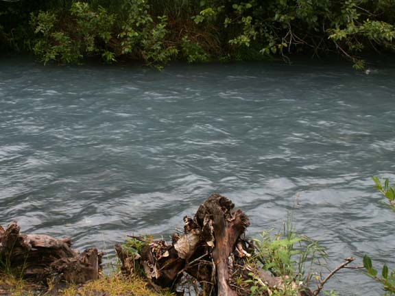
Bird
Creek was our first look at fishermen in action. Judging from the parking area
it is a very popular location. The state had to blast away a lot of rock for
this relatively new parking area. Again, so close to Anchorage, it would be an
evening, after work, event. The water is fast moving and very picturesque.

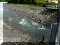
Fast moving water ...
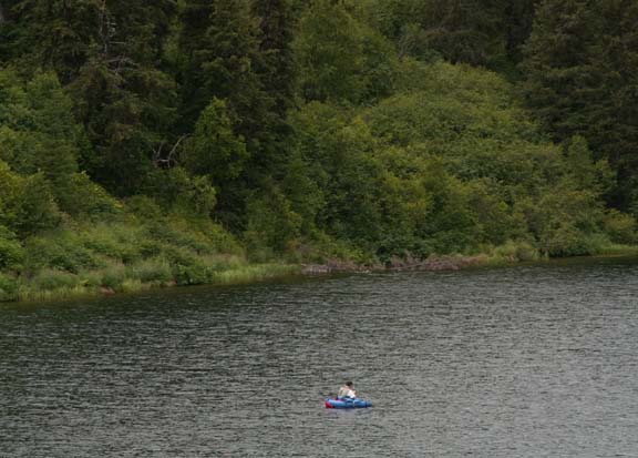
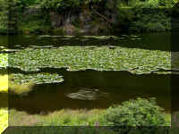
A little farther down the road in Jerome Lake the fishing was
more leisurely.
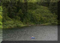
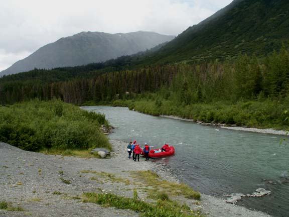
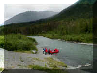
When we turn into a pull-off, we have to make sure we can get
out. While most have entrance/exits at each end some do not. This did not - so
we pointed the truck at the only access. Below
rafters were leaving for a trip down the river.
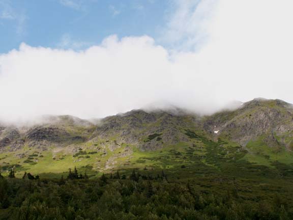
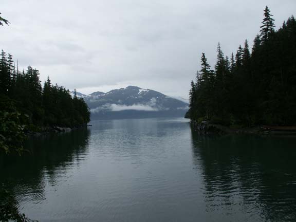
The scenery was a mix of blue sky, clouds, rock mountains and
forested hills.
These are not your usual snow covered mountains.
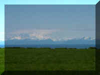
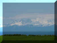
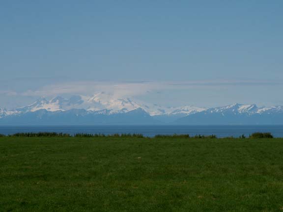
Liamna Volcano
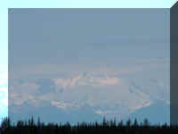
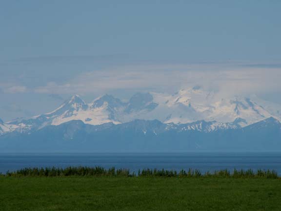
Redoubt Volcano
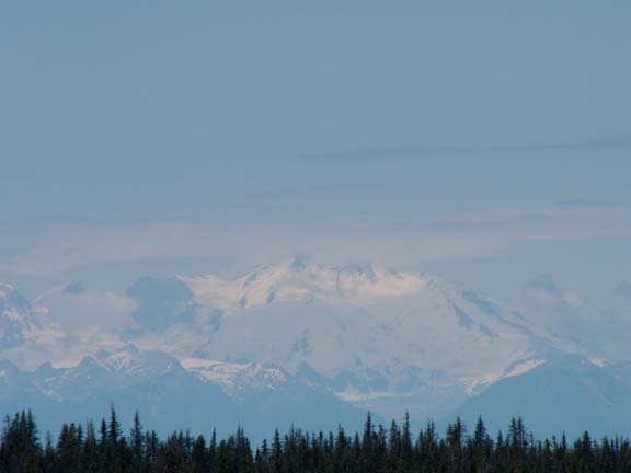
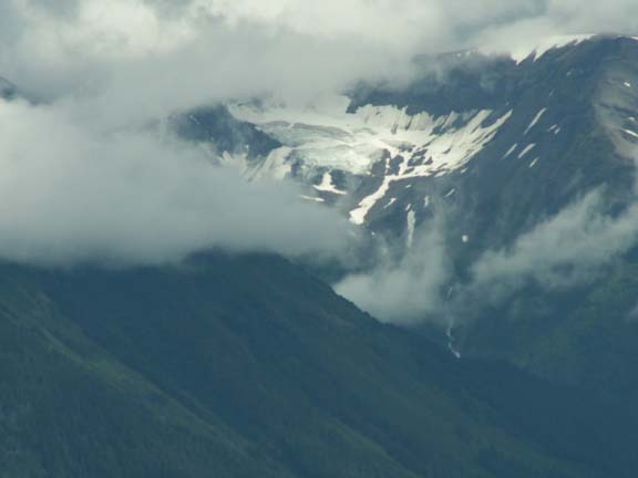
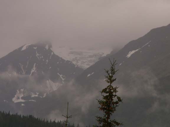
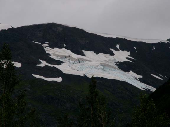
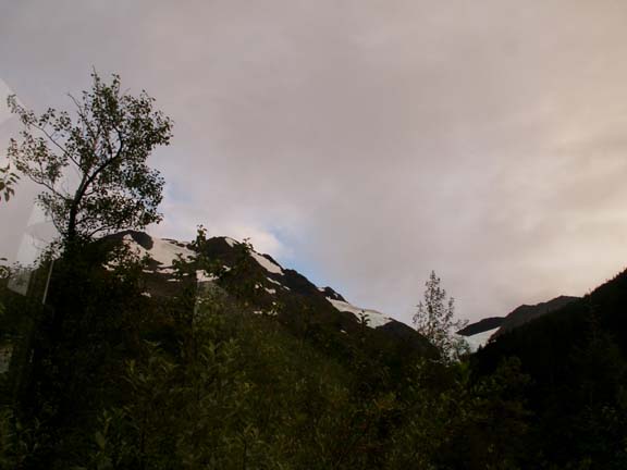
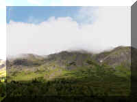
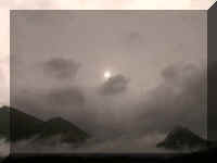
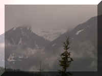
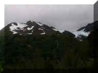
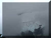
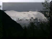
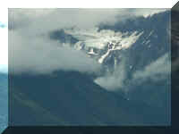 Sometimes
more clouds than blue sky but a glacier would be in view.
Sometimes
more clouds than blue sky but a glacier would be in view.
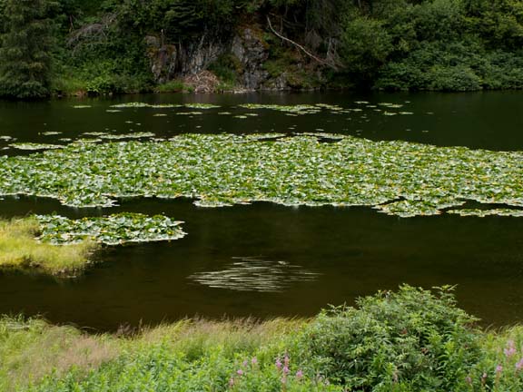
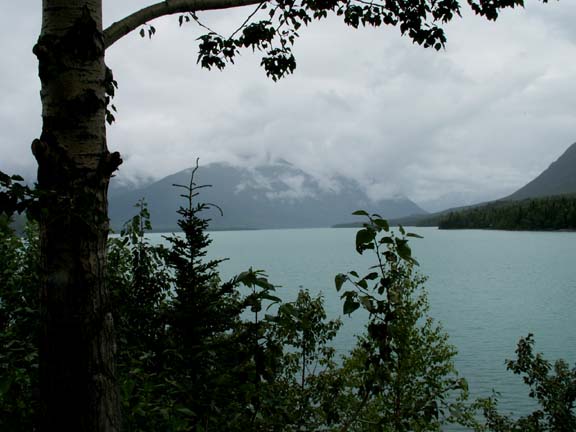
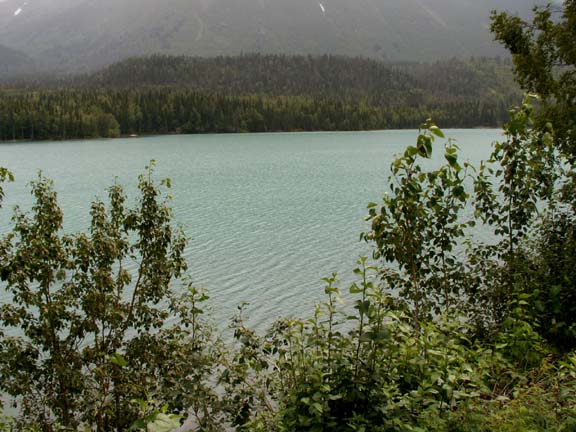
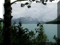
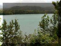
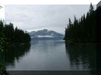
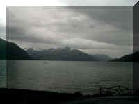
Lake Kenai is a beautiful green color.
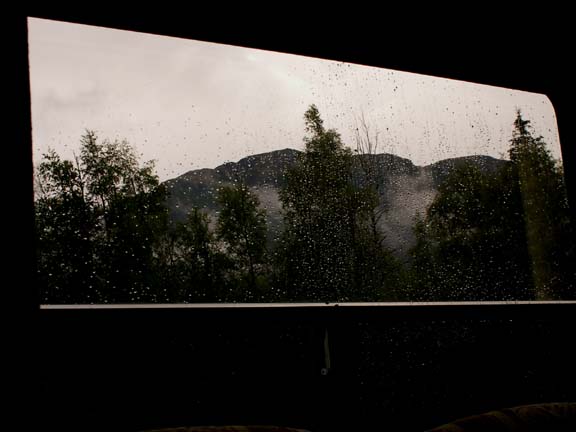
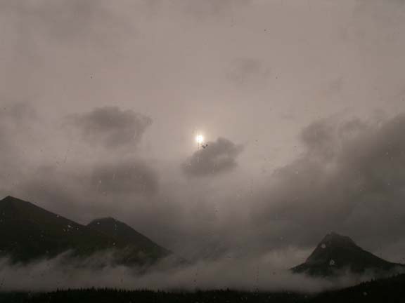
 It
started to rain and looked like it would last the rest of the day so we spent
the night in a pull-off in the mountains. Even on the rain the views are
pleasant.
It
started to rain and looked like it would last the rest of the day so we spent
the night in a pull-off in the mountains. Even on the rain the views are
pleasant.
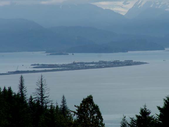
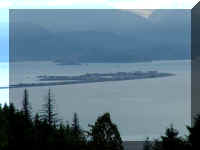
The next day we saw our destination off in the distance - the
Homer Spit.
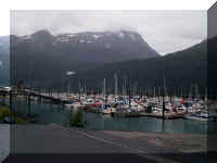
We stayed on the Homer Spit for six days.
Our photographs of Homer, Alaska
are on a separate page.
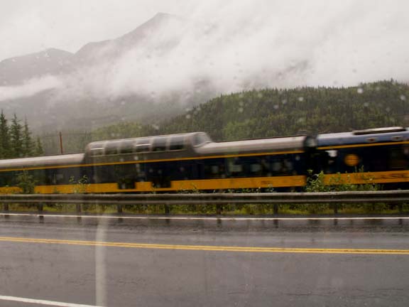
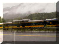
We left Homer and headed for Seward late in the day. Because we
did not know if we should pull into Seward late in the day, we stopped
after driving 154 miles, leaving only 21 miles for the next day. It is a gamble
as you decide where to stop for the night - this stop was too close to the road
so we did not have a restful night. There was too much traffic on this mountain
road. It rained most of the night but still
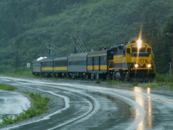
provided a pretty view. In the morning, the Alaska Railroad train passed our
spot while we had breakfast.
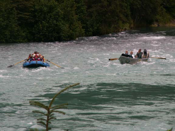
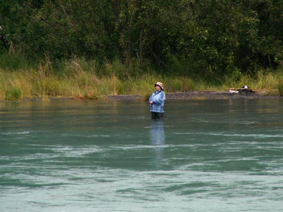
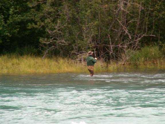
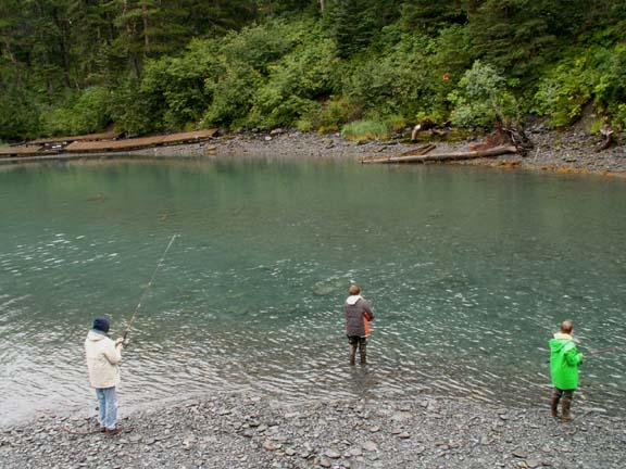
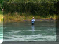
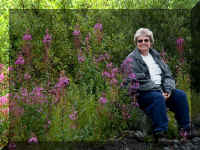
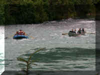 Just by chance we stopped at a pull-off at the right time. Fred
jumped out of the truck and photographed these rafters between the trees. While
he was there the fisherwoman and fisherman were subjects as well.
Just by chance we stopped at a pull-off at the right time. Fred
jumped out of the truck and photographed these rafters between the trees. While
he was there the fisherwoman and fisherman were subjects as well.
Our photographs of Seward, Alaska
are on a separate page.
We stayed in Steward for six days.
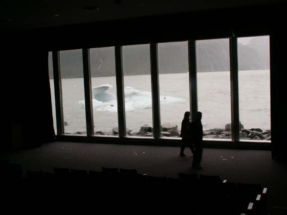
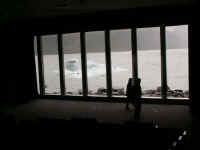
We visited the Begich, Boggs Visitor Center at Portage Glacier. The visitor
center is built on the terminal moraine left behind by Portage Glacier in 1914.
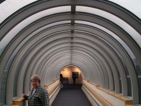
It is a very impressive building. The front of the movie theatre is windows. You can
look at the
beautiful view until the show starts. The video we saw was "Voices from the
Ice" - it was great, we bought the DVD. Leaving the theatre you walk
through a glass walkway.
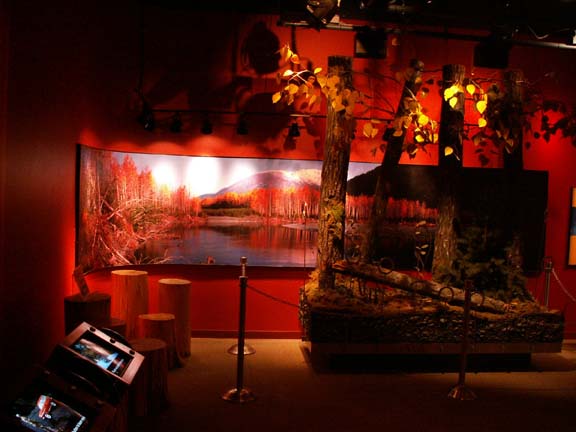
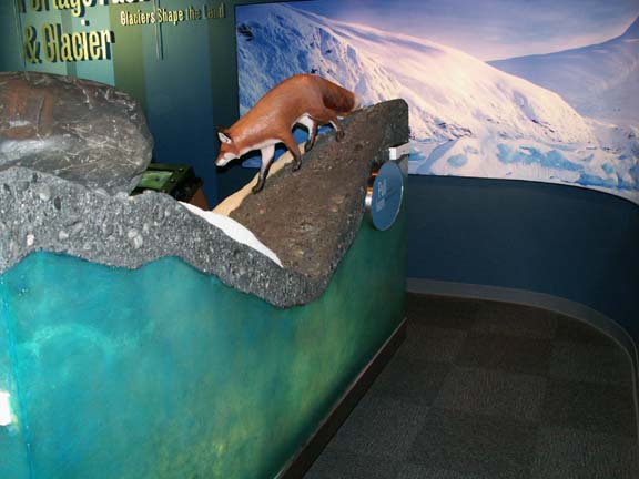
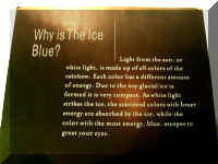
They have many displays and exhibits. This one discussed the
Chugach National Forest and the other the way rocks are trapped on top of
glaciers as it moved.
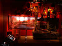
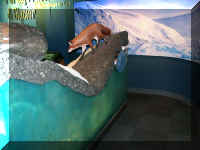
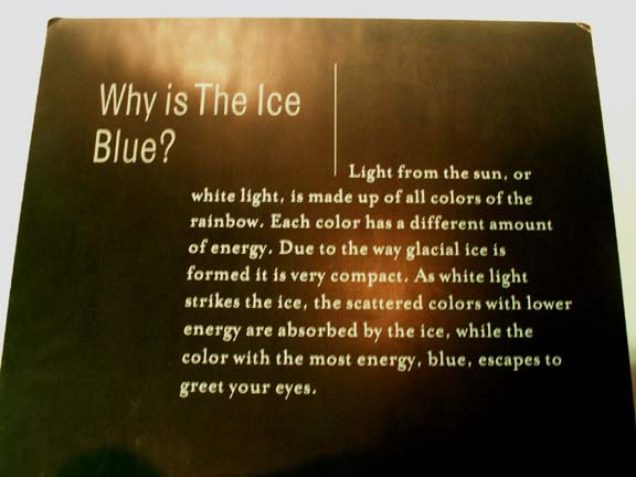
This explained why glacier ice is blue.
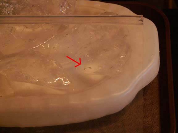
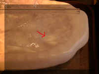 This
ice worm is related to the earthworm. They can reach lengths of one
inch and 1/32 in diameter. This one was about a half-inch long. Heat is their
greatest enemy. If a human finger touches an ice worm, it may die instantly for
the heat.
This
ice worm is related to the earthworm. They can reach lengths of one
inch and 1/32 in diameter. This one was about a half-inch long. Heat is their
greatest enemy. If a human finger touches an ice worm, it may die instantly for
the heat.
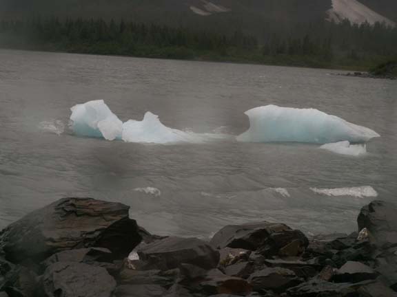
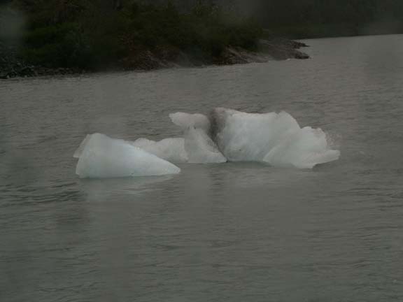
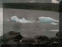
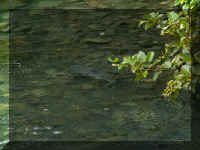
Outside the visitor center, the water had ice chunks for our
enjoyment. It was rainy, cold and windy - they were enjoyed through the
windows.
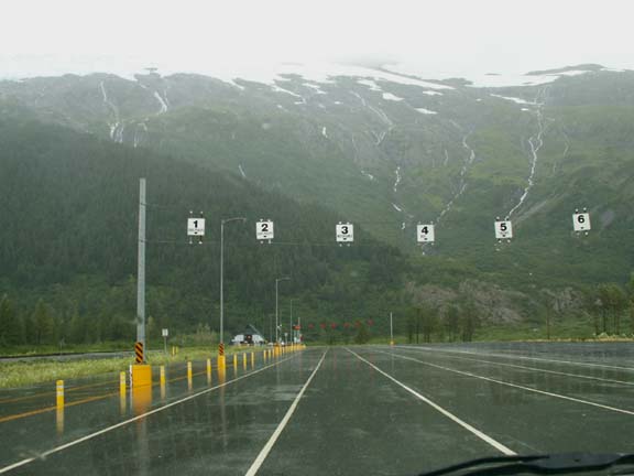
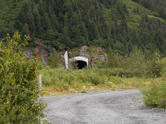
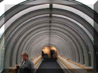
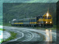
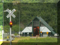
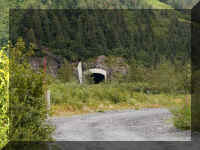
This visitor center was not our destination for the day. We were
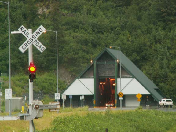
heading to Whittier for the night. Until the year 2000, the only way to get
there was by train, plane or boat. In 2000, the train tunnel was opened to motor
vehicles, they share the space. The tunnel was built by the US military in 1943 to get fuel and
supplies to the Alaska Command. The Whittier Tunnel (Anton Anderson Memorial
Tunnel chief engineer of the project) is 14,140 feet long (2.5 miles). It is the longest
highway tunnel in North America. It sounded like an interesting experience when
we read about it.
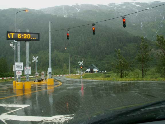
The train traffic has priority. Motor vehicle traffic goes to
Whittier on the half-hour and comes from Whittier on the hour - unless at train
is on the tracks. You pay a toll ($12 - $300) going to Whittier, leaving
Whittier is free. For our RV, it was $20. Traffic is controlled by lights. When
you pay your toll, you are assigned a lane. After the appointed time, the lane
light indicate you can move to the next light where that light spaces out the
traffic.
 Our release time was 6:30pm.
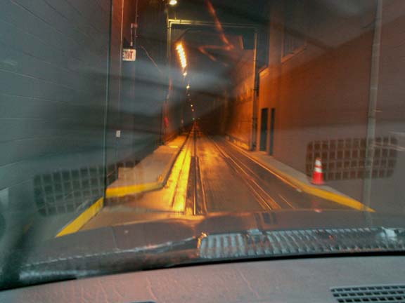
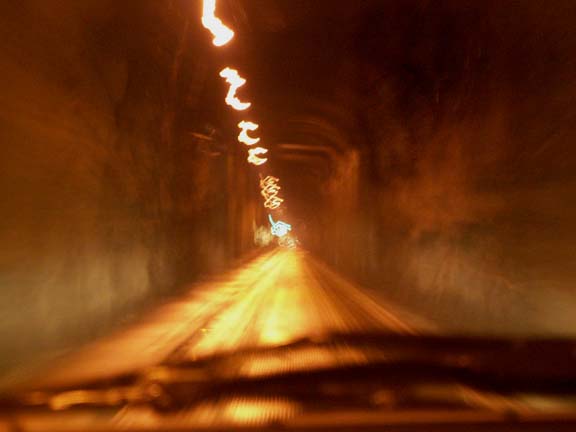
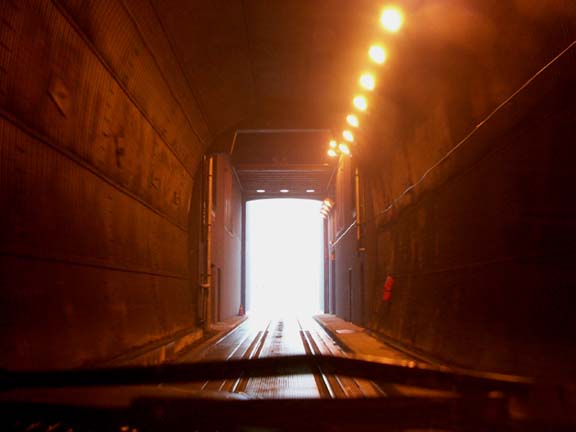
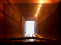
This was a neat experience. It is difficult to make a
'time-exposed' photograph in a vehicle driven partially on train rails. But ...
we are going to post the photographs anyway. We want to share or experience in
this long, dark, wet tunnel through a rock mountain.
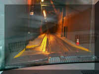
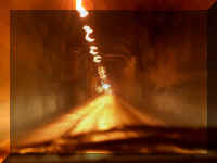
Riding the
rails
Rock
walls and ceiling
Concrete entrance
 As
we drove into Whittier, a train was heading for the tunnel. instead of a train
we only saw cars, pickup trucks, RVs, busses and 18-wheelers coming out.
As
we drove into Whittier, a train was heading for the tunnel. instead of a train
we only saw cars, pickup trucks, RVs, busses and 18-wheelers coming out.
Our first introduction to Whittier was the city campground. It
was the roughest ride we'd had since Chicken due to the deep potholes.
However, the other side of the HHII had so much water flowing for the glaciers
that you could here it inside with the windows closed.
Are asking why we wanted to go to Whittier? Because, it was
there.
It really had nothing to offer except some interesting
history. Whittier was a strategic military location as a ice free, deep-water
port until 1960. However, the Alaska railroad took over tunnel operations in
1945. The military left two buildings -
Hodge Building used for Army bachelor quarters and the Buckner Building used for family
housing and civilian bachelor quarters.
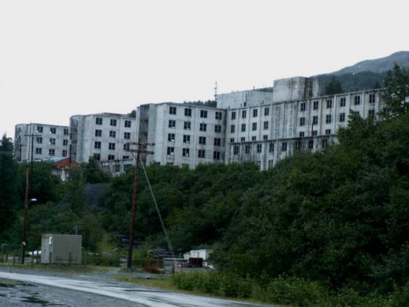
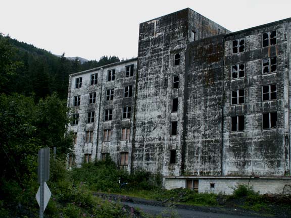
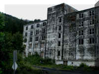
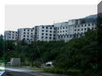 The
Buckner Building was once the largest building in Alaska and called the 'city
under one roof'. After receiving considerable damage from the 1964 earthquake,
the Buckner Building was not repaired and remains unused.
The
Buckner Building was once the largest building in Alaska and called the 'city
under one roof'. After receiving considerable damage from the 1964 earthquake,
the Buckner Building was not repaired and remains unused.
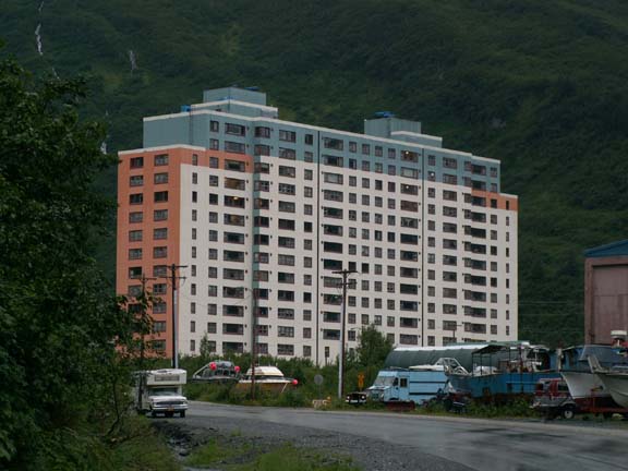
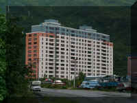 Today,
the Hodge Building is called the Begich Towers condominiums. It houses virtually
all of Whittier's residents. It also houses the city hall, post office and
medical clinic.
Today,
the Hodge Building is called the Begich Towers condominiums. It houses virtually
all of Whittier's residents. It also houses the city hall, post office and
medical clinic.
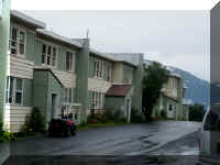
There is also Whittier Manor Condos that houses some residents.
 Begich
Towers is connected by a tunnel to the local school just across the road so the
children do not have to go outside in the cold weather to school.
Begich
Towers is connected by a tunnel to the local school just across the road so the
children do not have to go outside in the cold weather to school.
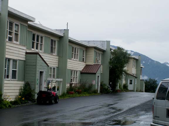
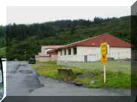
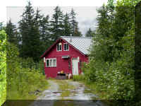
Taking Salmon Run Road to the end, the only road out of town,
we found three houses.
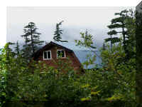
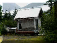
At the end of the road was this fishing location with a
beautiful view.
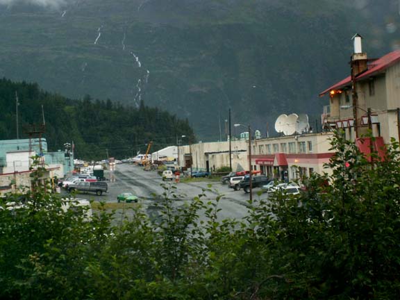
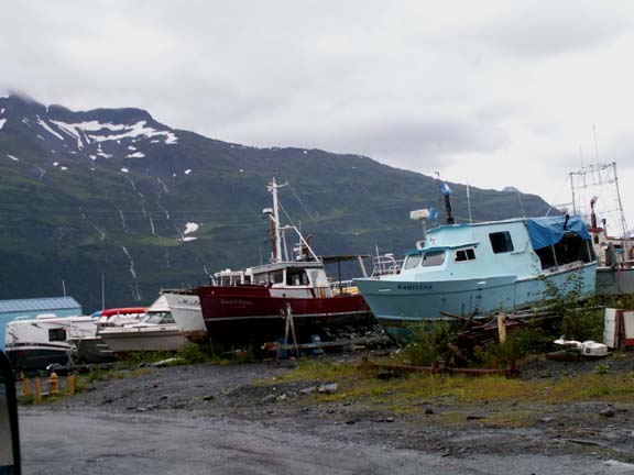
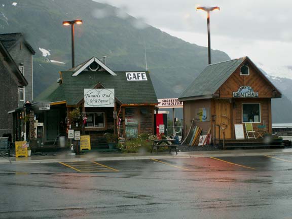
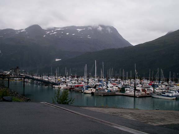
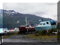
The remainder of the town is made up of boat yards, fish
processors, dockage and some other commercial establishments.
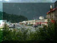
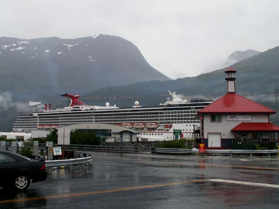
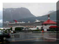 When
we go up in the morning, a cruise ship was in port. It was flying International
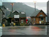
flags. The water front where the tourist go has a marina, several offices for fishing,
kayaking and boat tours of Prince William Sound, only a couple gift shop, a few
restaurants and an inn.
When
we go up in the morning, a cruise ship was in port. It was flying International
flags. The water front where the tourist go has a marina, several offices for fishing,
kayaking and boat tours of Prince William Sound, only a couple gift shop, a few
restaurants and an inn.
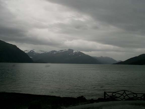
 Near
Harbor Triangle a bench offered a nice view - on a dry day. It rained the entire
time we were in Whittier. We walked Harbor Triangle with our umbrellas over our
heads.
Near
Harbor Triangle a bench offered a nice view - on a dry day. It rained the entire
time we were in Whittier. We walked Harbor Triangle with our umbrellas over our
heads.
We made the 1:00pm release and enjoyed our return trip through
the tunnel just as much as the first.
A lot of people do not go to Whittier because it is still a
little difficult. Judging from the brochure and what is said in various
books, we were a little ahead of Whittier's planned improvement as a tourist
destination. We hope you have enjoyed your ride through the tunnel and on-line visit to
Whittier with us.
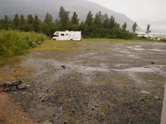
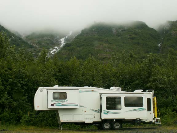
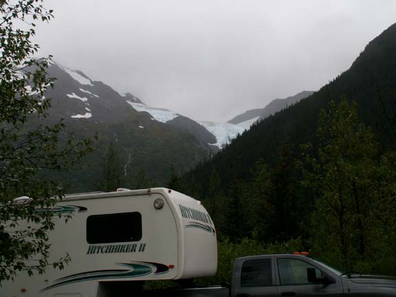
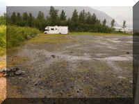
Our drive of only nine miles put us at Williwaw Campground (USFS)
for a couple nights. The campground sits below overhanging Middle Glacier and right next to the
salmon
viewing area. We had to charge some batteries, update the Web site and work on
travel plans out of Anchorage.
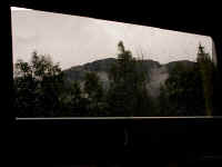
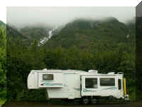
 The view out our window.
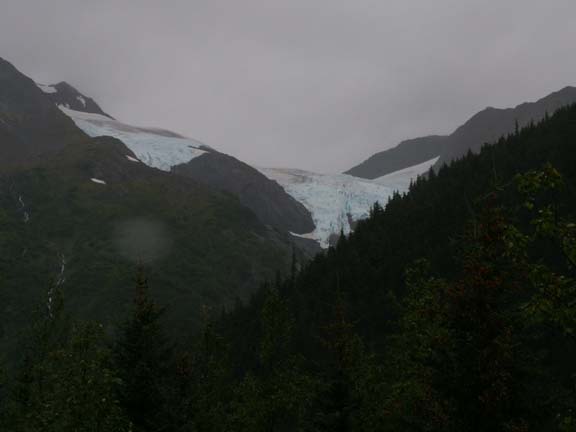
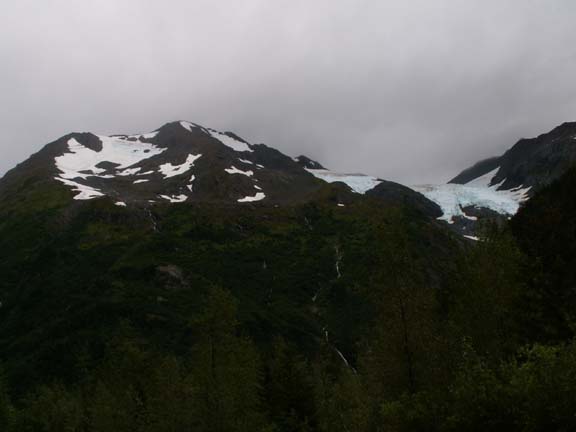
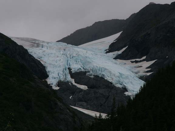
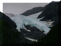
This is a full view of the overhanging Middle Glacier and a zoom
in on the largest visible part.
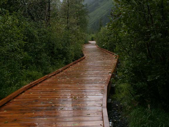
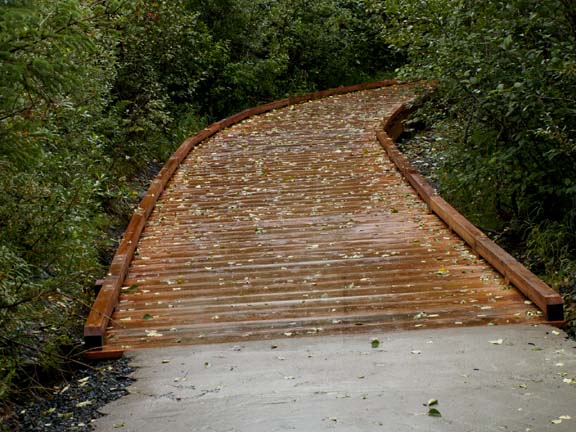
 Our
second day here we followed the path to the salmon viewing platform. Well, not
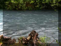
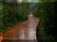
really. It was the wrong path. But, it was a pretty two mile walk along a stream of
glacier blue water. We found out later that the path was the under construction
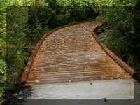
"Trail of Blue Ice". It was a combination of gravel, asphalt and wood.
Our
second day here we followed the path to the salmon viewing platform. Well, not
really. It was the wrong path. But, it was a pretty two mile walk along a stream of
glacier blue water. We found out later that the path was the under construction
"Trail of Blue Ice". It was a combination of gravel, asphalt and wood.
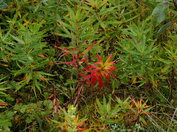
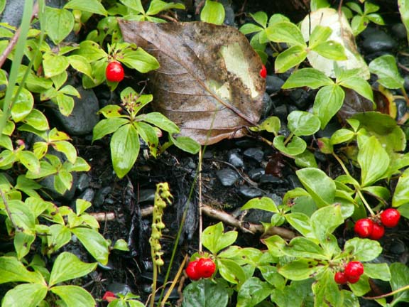
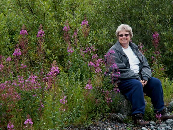
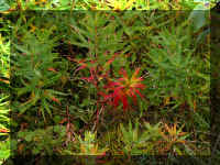
The leaves on the ground and red leaves on some plants reminded
us of fall in Michigan. Could it be fall in Alaska on August 4?
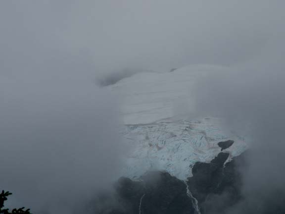
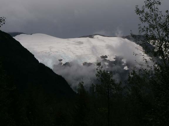
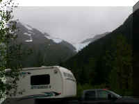
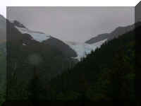
We saw Byron Glacier and other things along the way.
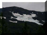
Glacier in clouds
When we saw the Portage Tunnel which is next to the visitor
center, it confirmed we were on the wrong path. Mary Lou thought it was time for
a break.
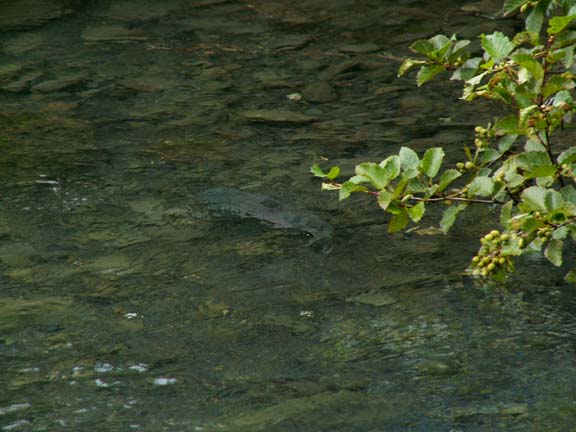
After a rest period in the HHII, we set out with map in hand to
find the salmon viewing platform. We found it 'to the left' an eighth of a mile
from our campsite.
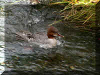
It was a little early for the salmon run.
We did see one fish.
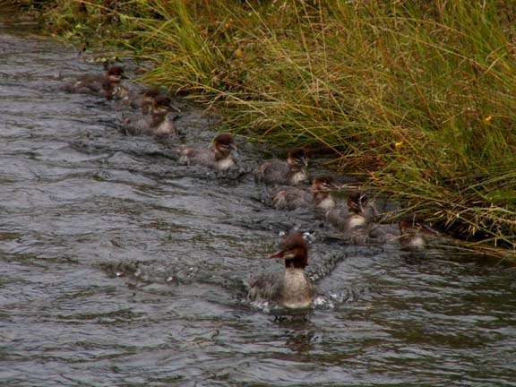
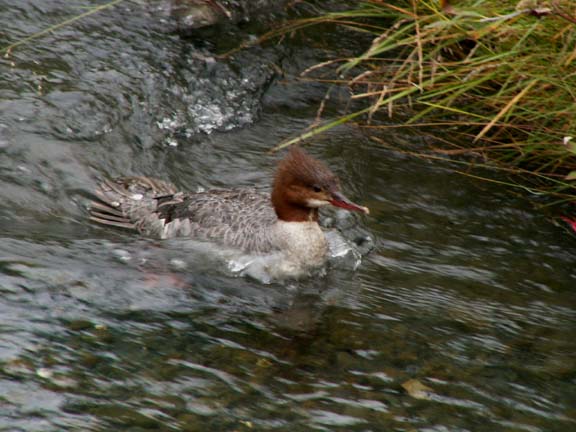
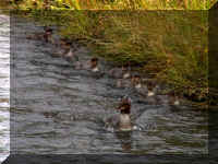
This is what you call, getting your ducks in order. Mom was in
charge on this trip and you could tell. One quack from her and the line was
straight.
At the end of the road on the way back to the fifth wheel,
another glacier.
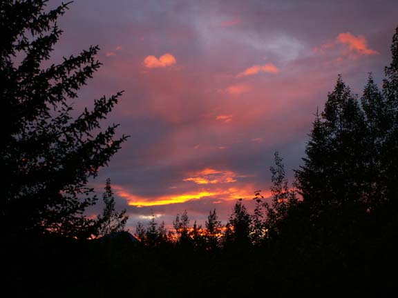
We had to share one more photograph with you . . . we just saw
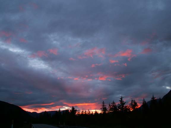
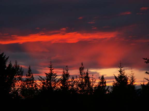
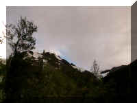
some blue sky for the first time in eight days.
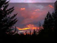
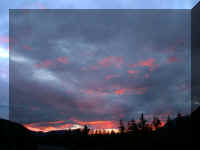
Okay . . . there was a colorful sunset tonight - what an end to
our day, blue sky and a colorful sunset.
Our next stop is Anchorage. We spent more time in the Kenai
Peninsula than expected because it is so beautiful and relaxing.
Go back to Alaska Photo Album
.
Top of Page

 We
had an interesting experience when we got up in the morning to go to the Kenai
Peninsula. Fred parked the truck behind the HHII when we returned from dinner so
we could keep our eye on it during the night. Early in the morning, someone
parked in front of the HHII so we could not hitch up to leave. With the help of
a very cooperative police officer, the owner was located and the vehicle moved.
We were on our way.
We
had an interesting experience when we got up in the morning to go to the Kenai
Peninsula. Fred parked the truck behind the HHII when we returned from dinner so
we could keep our eye on it during the night. Early in the morning, someone
parked in front of the HHII so we could not hitch up to leave. With the help of
a very cooperative police officer, the owner was located and the vehicle moved.
We were on our way.